|
Current Intensity Estimates
|
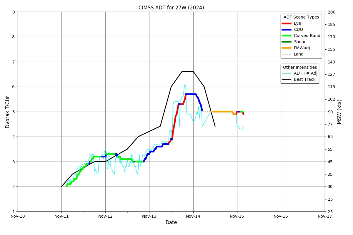
ADT
|
| Date |
Time |
Vmax |
MSLP |
| 17Nov2024 |
0500UTC |
25 kts |
1010 hPa |
| Scene |
CI# |
FT# |
AdjT# |
RawT# |
Eye T |
Cloud T |
| SHEAR |
1.5 |
1.5 |
1.5 |
1.5 |
20.68C |
17.92C |
|
|
|
|
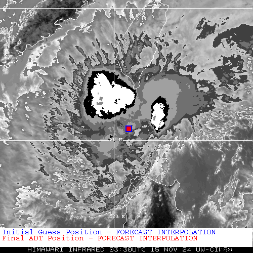
AiDT
|
| Date |
Time |
Vmax |
|
| 17Nov2024 |
0500UTC |
29 kts |
|
|
|
|
|
DPRINT
|
| Date |
Time |
Vmax |
MSLP |
| 17Nov2024 |
0500UTC |
23 kts |
NaN hPa |
| Vmax 25% |
Vmax 75% |
|
|
| 22 kts |
25 kts |
|
|
|
|
|
|
DMINT
|
| Date |
Time |
Vmax |
MSLP |
| 16Nov2024 |
1752UTC |
25 kts |
NaN hPa |
| Vmax 25% |
Vmax 75% |
MW Instr. |
|
| 22 kts |
27 kts |
AMSR2 |
|
|
|
|
|
MW Sounders
|
| Date |
Time |
Vmax |
MSLP |
| 16Nov2024 |
1252UTC |
38 kts |
1005 hPa |
|
|
|
|
SATCON
|
| Date |
Time |
Vmax |
MSLP |
| 17Nov2024 |
0400UTC |
30 kts |
1009 hPa |
| Consensus Members |
| 2 (ADT+Sounders) |
|
|
|