|
Current Intensity Estimates
|
ADT
|
| Date |
Time |
Vmax |
MSLP |
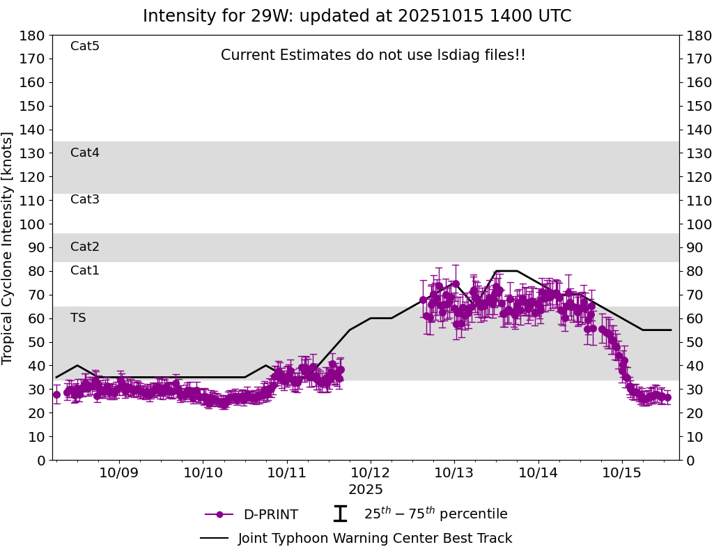
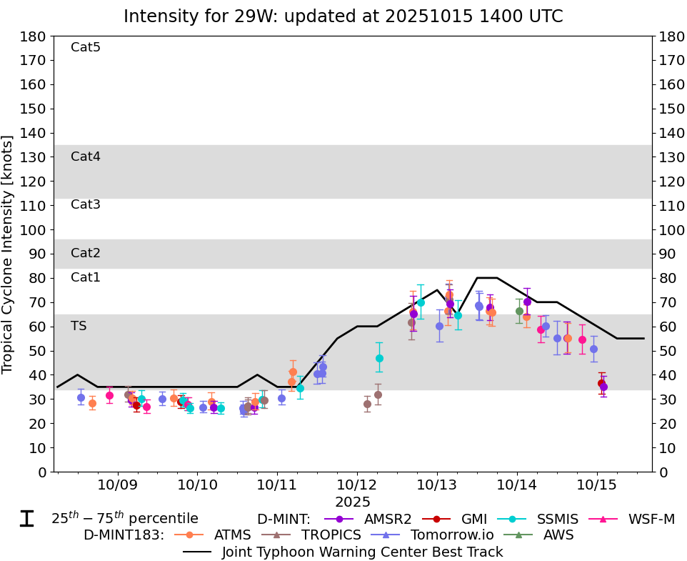
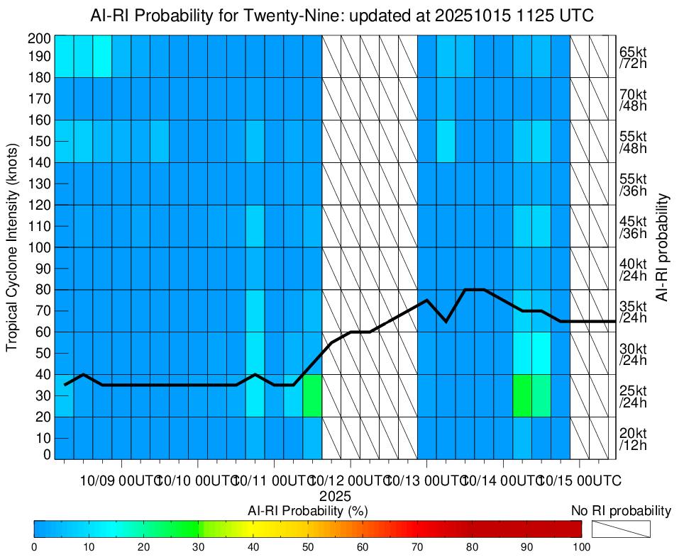
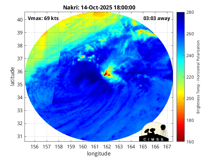
| 15Oct2025 |
1120UTC |
30 kts |
996 hPa |
| Scene |
CI# |
FT# |
AdjT# |
RawT# |
Eye T |
Cloud T |
| SHEAR |
2.0 |
1.5 |
1.5 |
1.5 |
12.60C |
1.60C |
|
|
|
|
AiDT
|
| Date |
Time |
Vmax |
|
| 15Oct2025 |
1120UTC |
38 kts |
|
|
|
|
|
DPRINT
|
| Date |
Time |
Vmax |
MSLP |
| 15Oct2025 |
1120UTC |
27 kts |
NaN hPa |
| Vmax 25% |
Vmax 75% |
|
|
| 24 kts |
31 kts |
|
|
|
|
|
|
DMINT
|
| Date |
Time |
Vmax |
MSLP |
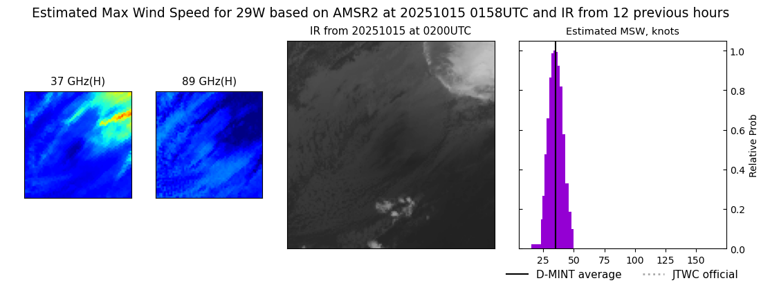
| 15Oct2025 |
0158UTC |
35 kts |
1007 hPa |
| Vmax 25% |
Vmax 75% |
MW Instr. |
|
| 31 kts |
39 kts |
AMSR2 |
|
|
|
|
|
MW Sounders
|
| Date |
Time |
Vmax |
MSLP |
| 14Oct2025 |
1513UTC |
49 kts |
989 hPa |
|
|
|
|
SATCON
|
| Date |
Time |
Vmax |
MSLP |
| 14Oct2025 |
1540UTC |
68 kts |
978 hPa |
| Consensus Members |
| 2 (ADT+Sounders) |
|
|
|