|
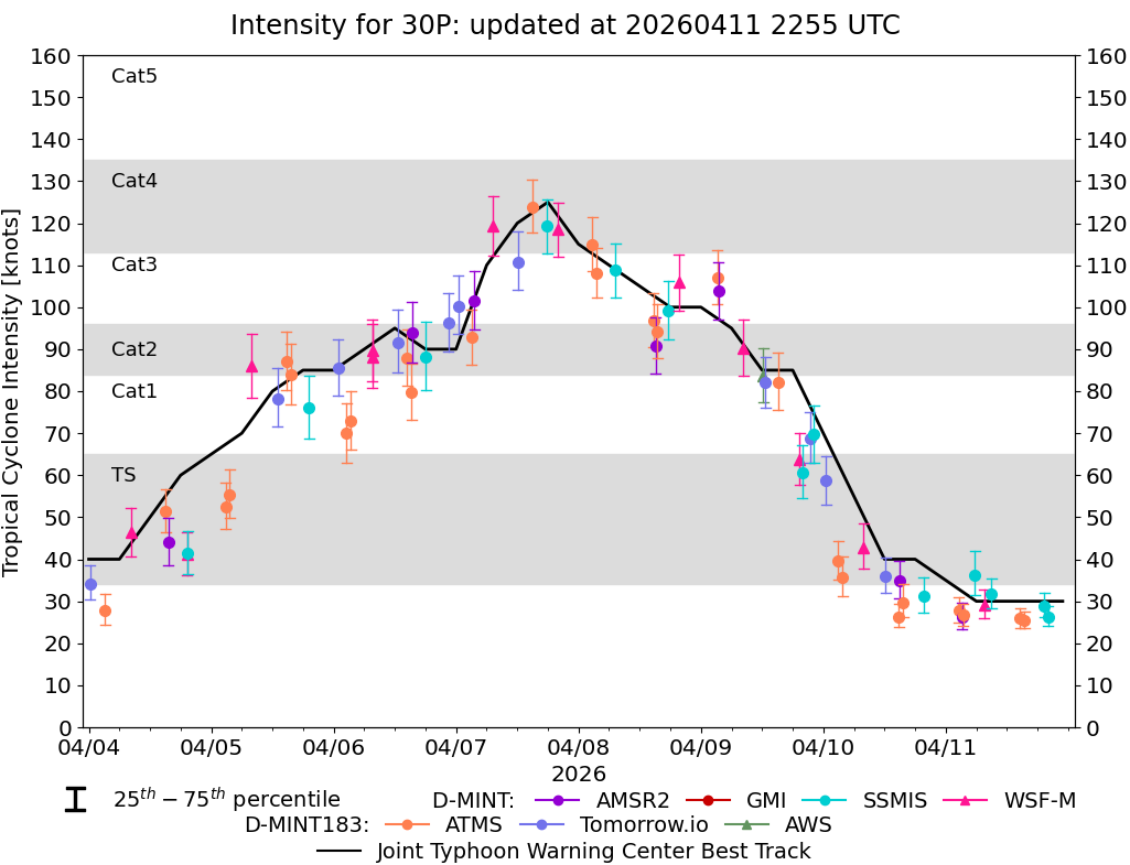
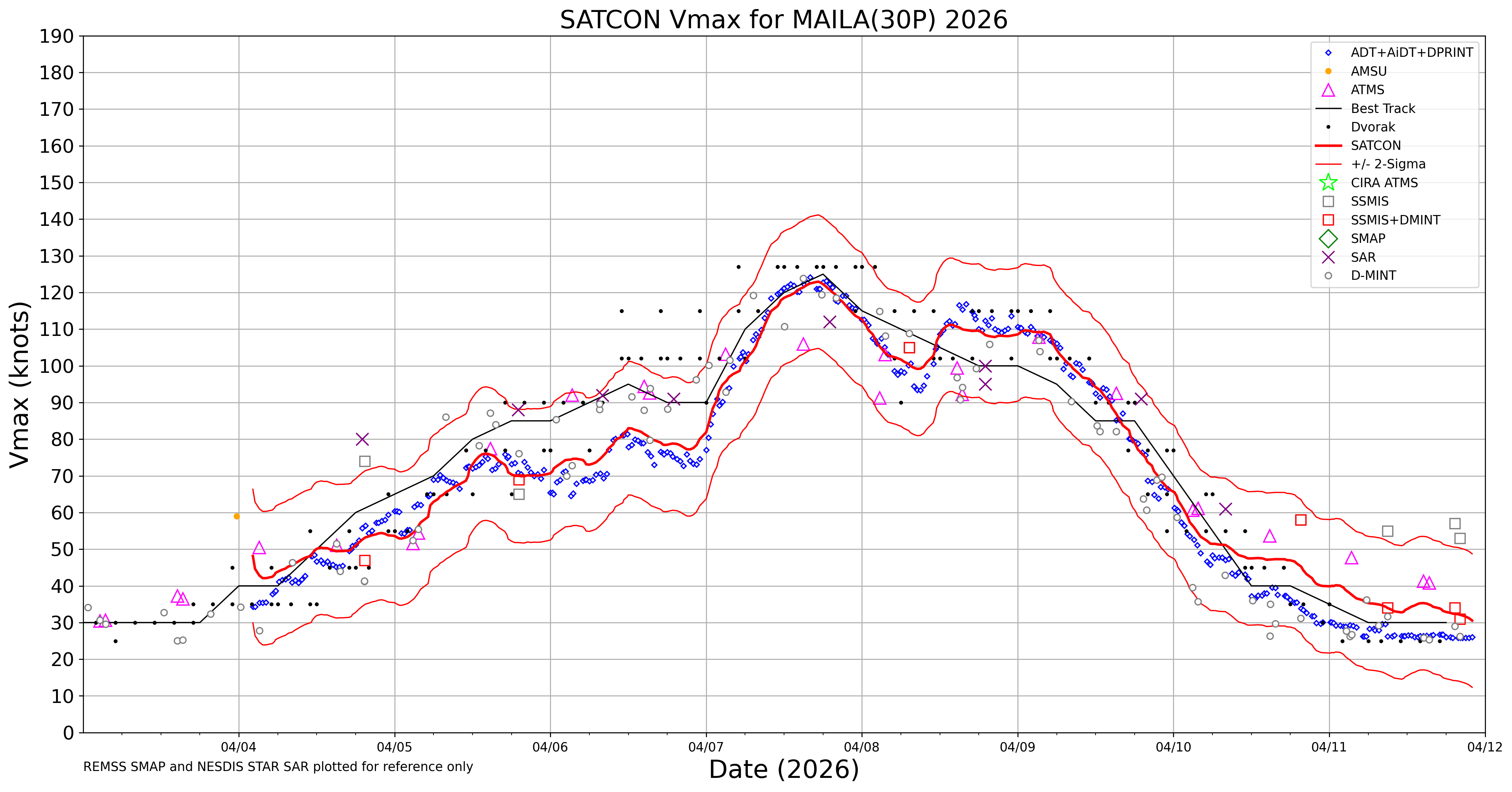
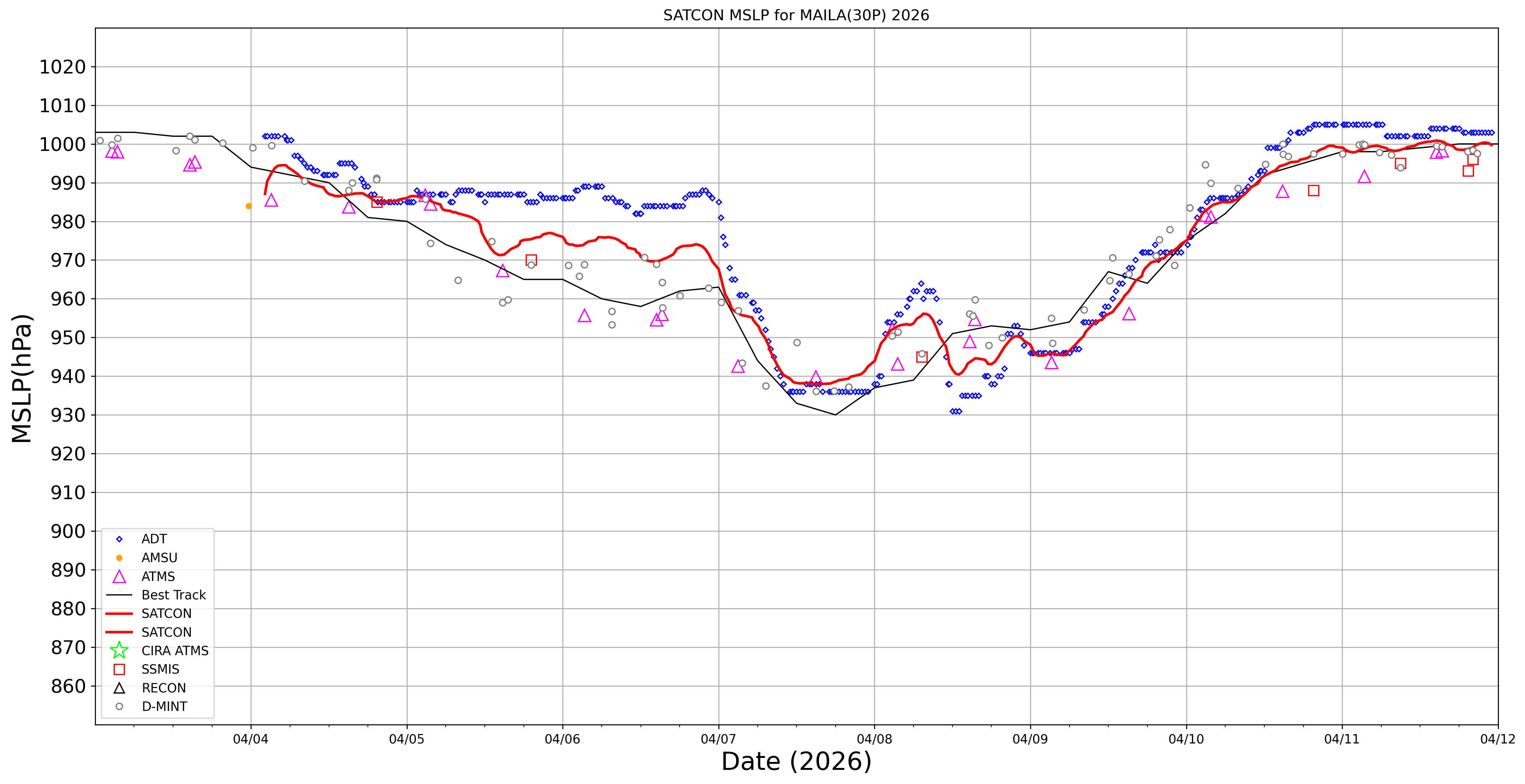
Current Intensity Estimates
|
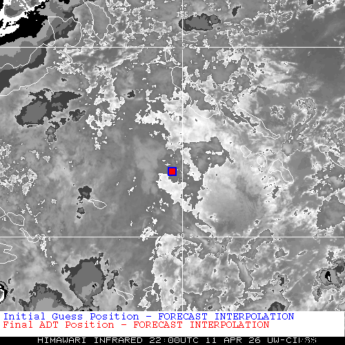
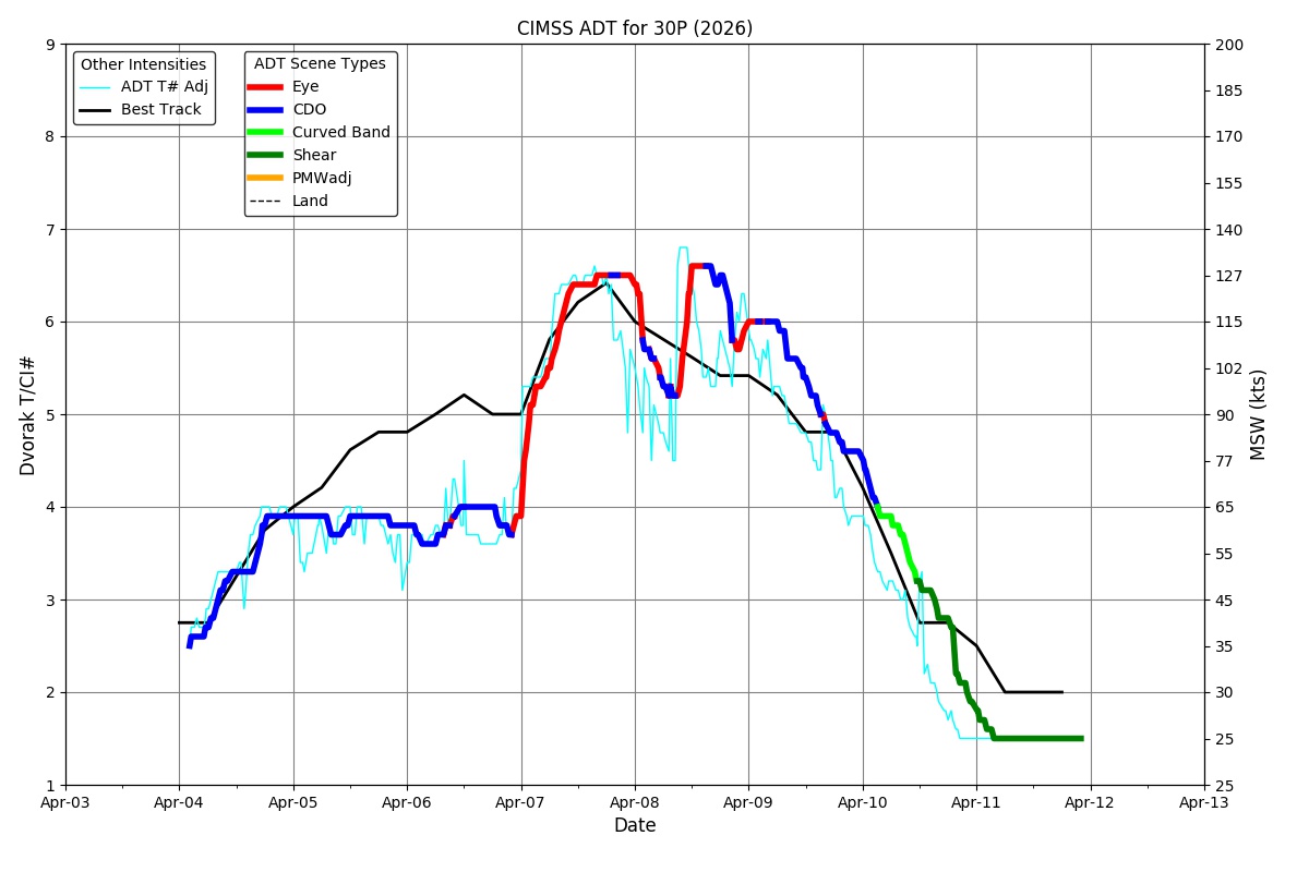
ADT
|
| Date |
Time |
Vmax |
MSLP |
| 11Apr2026 |
2030UTC |
25 kts |
1003 hPa |
| Scene |
CI# |
FT# |
AdjT# |
RawT# |
Eye T |
Cloud T |
| SHEAR |
1.5 |
1.5 |
1.5 |
1.5 |
10.58C |
0.58C |
|
|
|
|
AiDT
|
| Date |
Time |
Vmax |
|
| 11Apr2026 |
2030UTC |
30 kts |
|
|
|
|
|
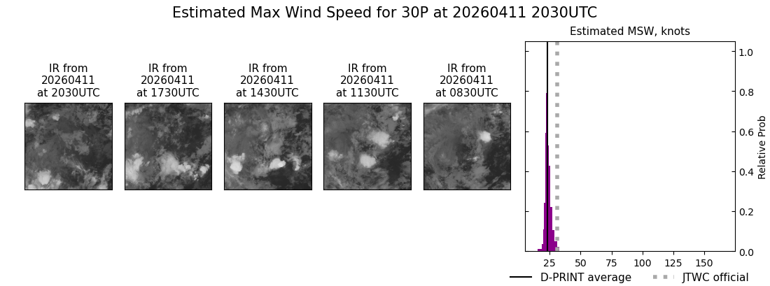
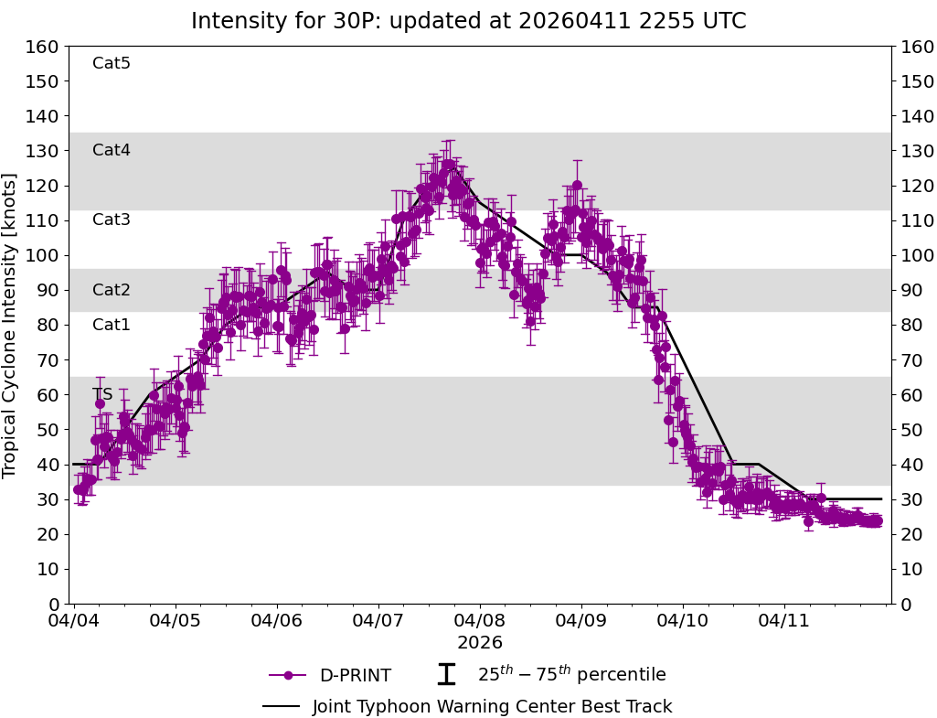
DPRINT
|
| Date |
Time |
Vmax |
MSLP |
| 11Apr2026 |
2030UTC |
23 kts |
1000 hPa |
| Vmax 25% |
Vmax 75% |
|
|
| 22 kts |
25 kts |
|
|
|
|
|
|
DMINT
|
| Date |
Time |
Vmax |
MSLP |
| 11Apr2026 |
1921UTC |
29 kts |
998 hPa |
| Vmax 25% |
Vmax 75% |
MW Instr. |
|
| 26 kts |
32 kts |
SSMISF17 |
|
|
|
|
|
MW Sounders
|
| Date |
Time |
Vmax |
MSLP |
| 11Apr2026 |
1522UTC |
41 kts |
998 hPa |
|
|
|
|
SATCON
|
| Date |
Time |
Vmax |
MSLP |
| 11Apr2026 |
2010UTC |
34 kts |
997 hPa |
| Consensus Members |
| 2 (ADT+Sounders) |
|
|
|