|
Current Intensity Estimates
|
ADT
|
| Date |
Time |
Vmax |
MSLP |
| 23Oct2025 |
2300UTC |
N/A kts |
N/A hPa |
| Scene |
CI# |
FT# |
AdjT# |
RawT# |
Eye T |
Cloud T |
| LAND |
N/A |
N/A |
N/A |
N/A |
N/AC |
N/AC |
|
|
|
|
AiDT
|
| Date |
Time |
Vmax |
|
| 23Oct2025 |
0040UTC |
27 kts |
|
|
|
|
|
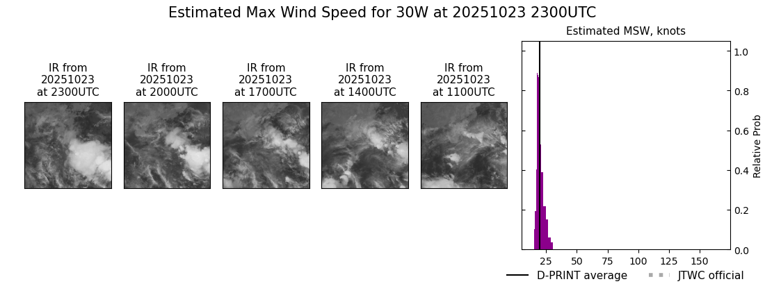
DPRINT
|
| Date |
Time |
Vmax |
MSLP |
| 23Oct2025 |
2300UTC |
20 kts |
1005 hPa |
| Vmax 25% |
Vmax 75% |
|
|
| 18 kts |
22 kts |
|
|
|
|
|
|
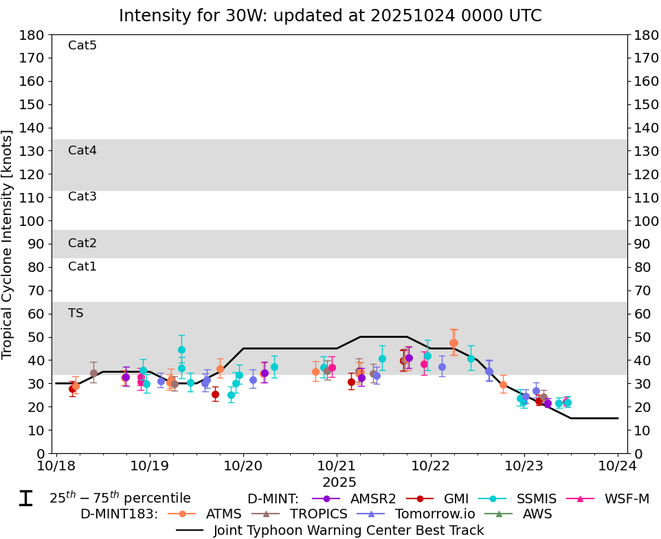
DMINT
|
| Date |
Time |
Vmax |
MSLP |
| 23Oct2025 |
1108UTC |
22 kts |
1002 hPa |
| Vmax 25% |
Vmax 75% |
MW Instr. |
|
| 20 kts |
24 kts |
SSMISF16 |
|
|
|
|
|
MW Sounders
|
| Date |
Time |
Vmax |
MSLP |
| 22Oct2025 |
2257UTC |
30 kts |
999 hPa |
|
|
|
|
SATCON
|
| Date |
Time |
Vmax |
MSLP |
| 23Oct2025 |
0040UTC |
34 kts |
998 hPa |
| Consensus Members |
| 2 (ADT+Sounders) |
|
|
|