|
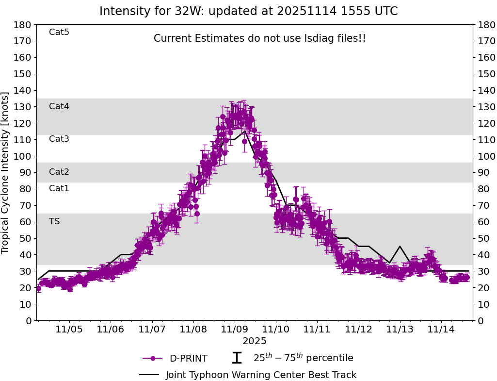
Current Intensity Estimates
|
ADT
|
| Date |
Time |
Vmax |
MSLP |
| 14Nov2025 |
1100UTC |
25 kts |
1006 hPa |
| Scene |
CI# |
FT# |
AdjT# |
RawT# |
Eye T |
Cloud T |
| SHEAR |
1.5 |
1.5 |
1.5 |
1.5 |
21.51C |
17.66C |
|
|
|
|
AiDT
|
| Date |
Time |
Vmax |
|
| 14Nov2025 |
1100UTC |
30 kts |
|
|
|
|
|
DPRINT
|
| Date |
Time |
Vmax |
MSLP |
| 14Nov2025 |
1100UTC |
26 kts |
NaN hPa |
| Vmax 25% |
Vmax 75% |
|
|
| 24 kts |
29 kts |
|
|
|
|
|
|
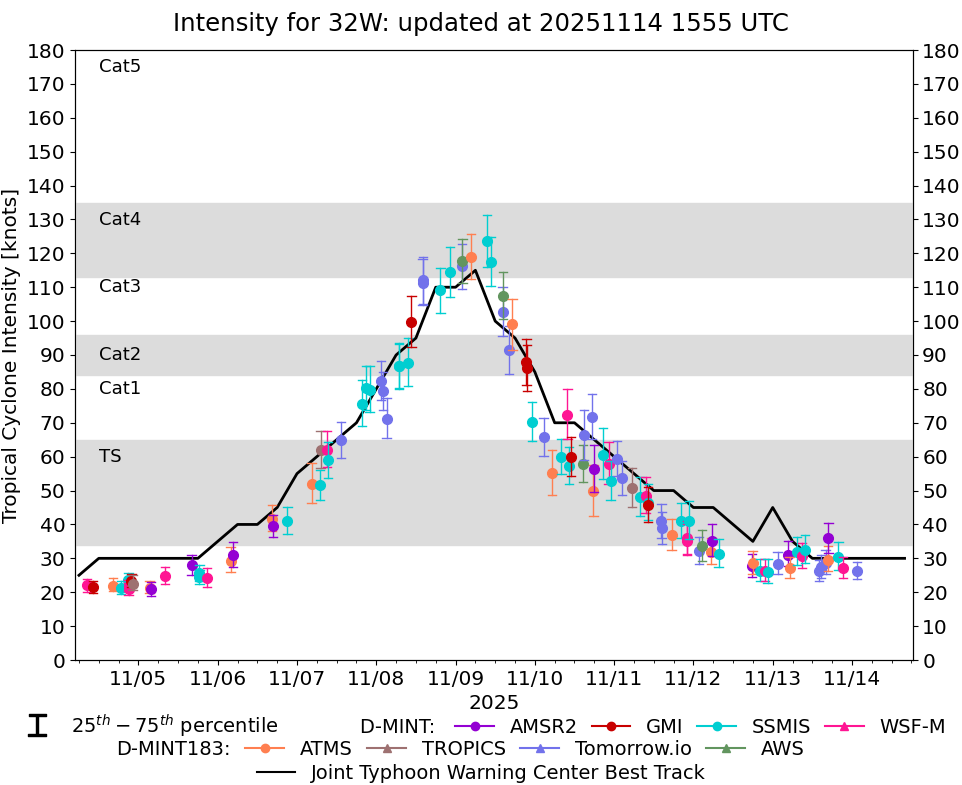
DMINT
|
| Date |
Time |
Vmax |
MSLP |
| 13Nov2025 |
2118UTC |
27 kts |
1005 hPa |
| Vmax 25% |
Vmax 75% |
MW Instr. |
|
| 24 kts |
30 kts |
WSFM01 |
|
|
|
|
|
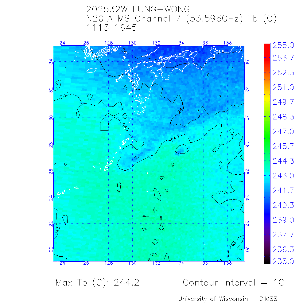
MW Sounders
|
| Date |
Time |
Vmax |
MSLP |
| 13Nov2025 |
1645UTC |
40 kts |
1000 hPa |
|
|
|
|
SATCON
|
| Date |
Time |
Vmax |
MSLP |
| 13Nov2025 |
1830UTC |
40 kts |
1001 hPa |
| Consensus Members |
| 2 (ADT+Sounders) |
|
|
|