|
Current Intensity Estimates
|
ADT
|
| Date |
Time |
Vmax |
MSLP |
| 30Nov2025 |
2300UTC |
25 kts |
1008 hPa |
| Scene |
CI# |
FT# |
AdjT# |
RawT# |
Eye T |
Cloud T |
| SHEAR |
1.5 |
1.5 |
1.5 |
1.5 |
20.39C |
13.20C |
|
|
|
|
AiDT
|
| Date |
Time |
Vmax |
|
| 30Nov2025 |
2300UTC |
26 kts |
|
|
|
|
|
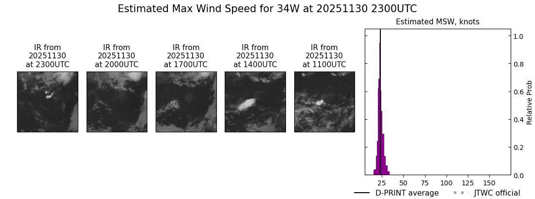
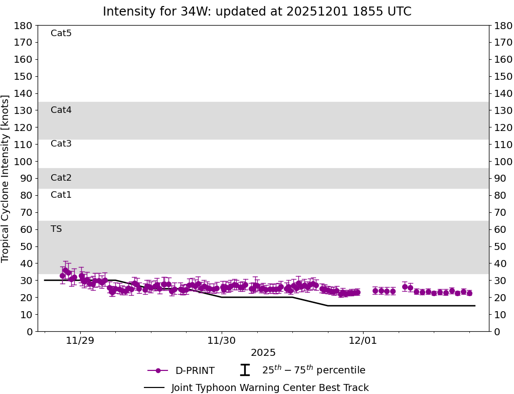
DPRINT
|
| Date |
Time |
Vmax |
MSLP |
| 30Nov2025 |
2300UTC |
23 kts |
1007 hPa |
| Vmax 25% |
Vmax 75% |
|
|
| 21 kts |
25 kts |
|
|
|
|
|
|
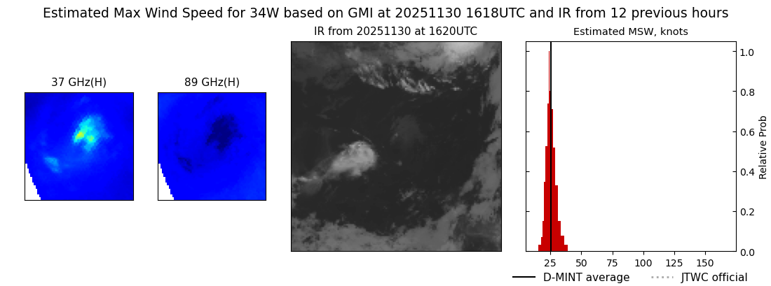
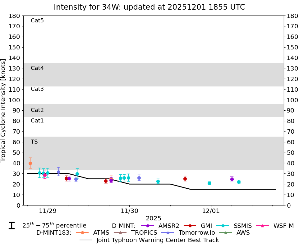
DMINT
|
| Date |
Time |
Vmax |
MSLP |
| 30Nov2025 |
1618UTC |
25 kts |
1005 hPa |
| Vmax 25% |
Vmax 75% |
MW Instr. |
|
| 23 kts |
28 kts |
GMI |
|
|
|
|
|
MW Sounders
|
| Date |
Time |
Vmax |
MSLP |
| 30Nov2025 |
0626UTC |
42 kts |
1004 hPa |
|
|
|
|
SATCON
|
| Date |
Time |
Vmax |
MSLP |
| 30Nov2025 |
0700UTC |
38 kts |
1006 hPa |
| Consensus Members |
| 2 (ADT+Sounders) |
|
|
|