|
Current Intensity Estimates
|
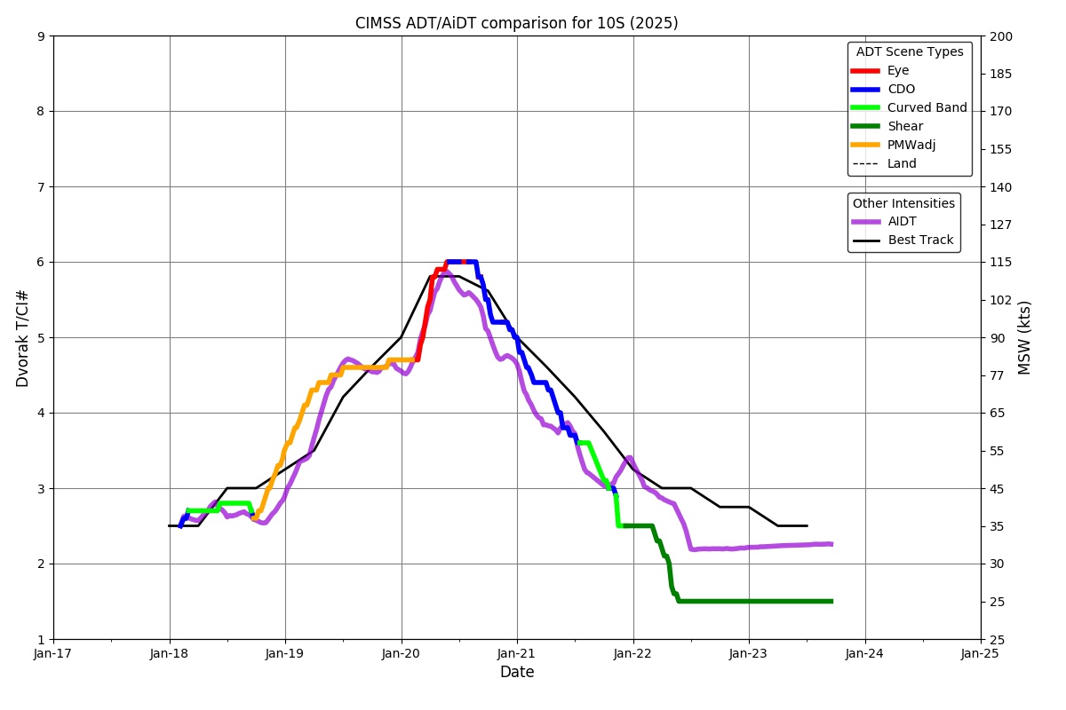
ADT
|
| Date |
Time |
Vmax |
MSLP |
| 20Jan2025 |
0700UTC |
109 kts |
945 hPa |
| Scene |
CI# |
FT# |
AdjT# |
RawT# |
Eye T |
Cloud T |
| EYE |
5.8 |
5.8 |
6.0 |
6.4 |
4.75C |
-74.03C |
|
|
|
|
AiDT
|
| Date |
Time |
Vmax |
|
| 20Jan2025 |
0700UTC |
104 kts |
|
|
|
|
|
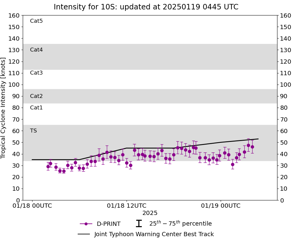
DPRINT
|
| Date |
Time |
Vmax |
MSLP |
| 20Jan2025 |
0700UTC |
89 kts |
948 hPa |
| Vmax 25% |
Vmax 75% |
|
|
| 82 kts |
97 kts |
|
|
|
|
|
|
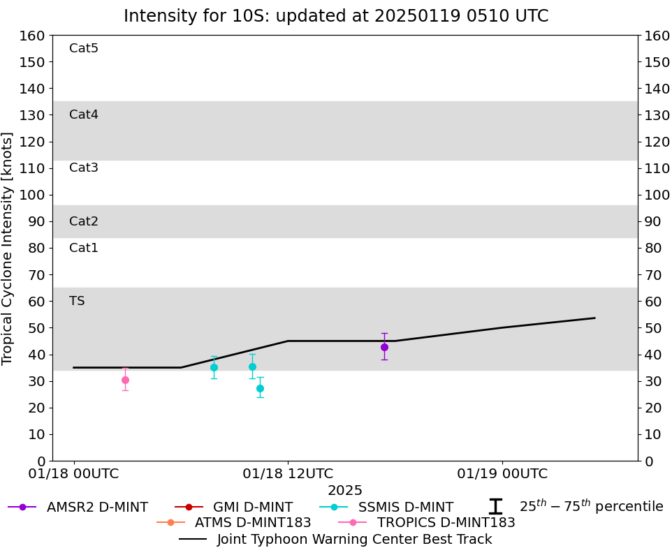
DMINT
|
| Date |
Time |
Vmax |
MSLP |
| 20Jan2025 |
0606UTC |
86 kts |
955 hPa |
| Vmax 25% |
Vmax 75% |
MW Instr. |
|
| 79 kts |
93 kts |
ATMS-N20 |
|
|
|
|
|
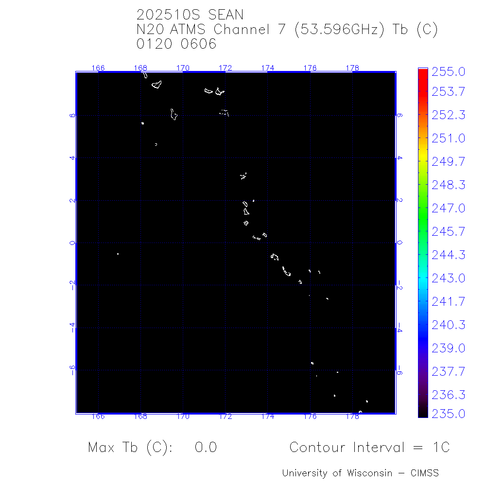
MW Sounders
|
| Date |
Time |
Vmax |
MSLP |
| 20Jan2025 |
0606UTC |
100 kts |
929 hPa |
|
|
|
|
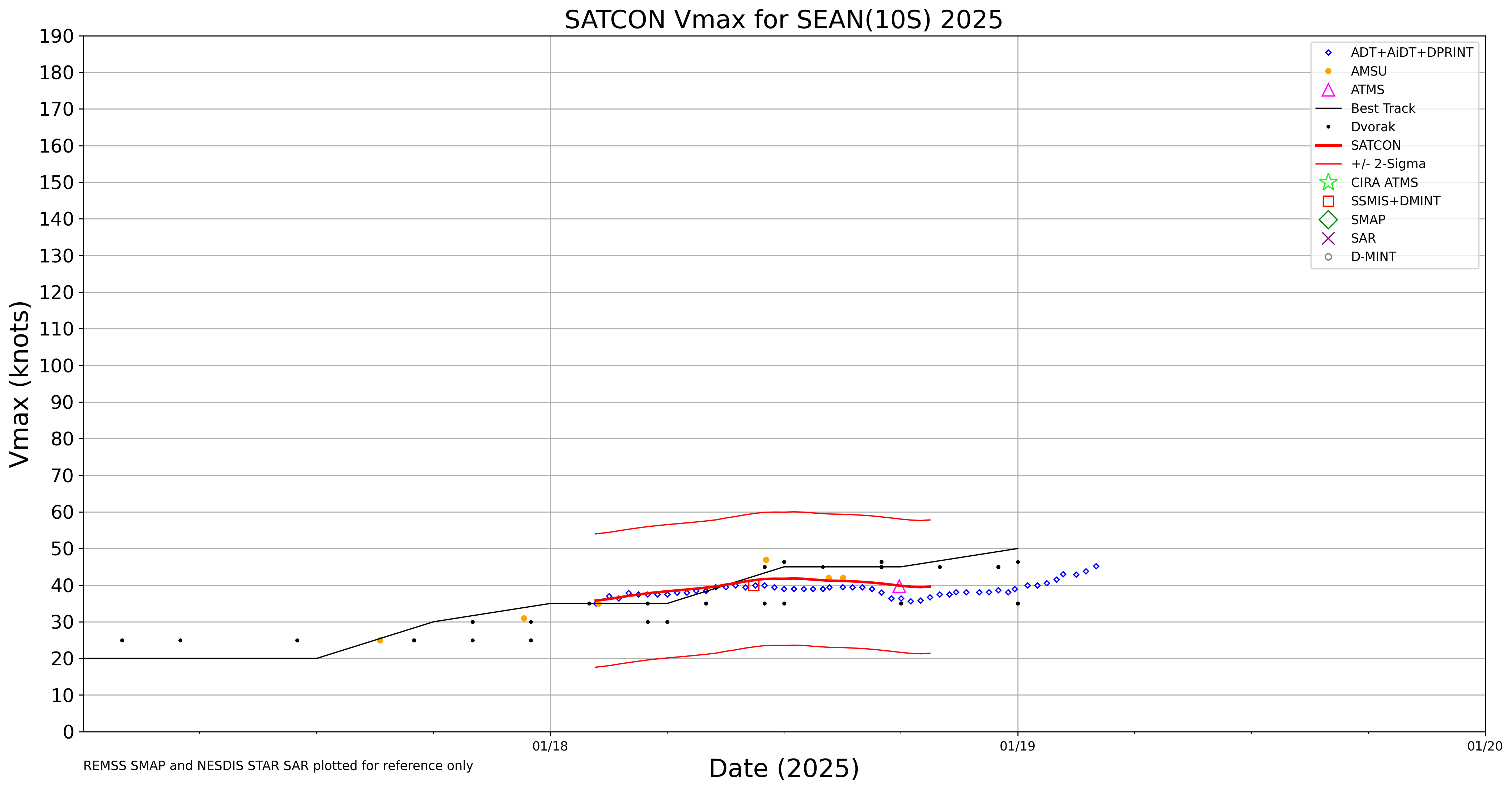
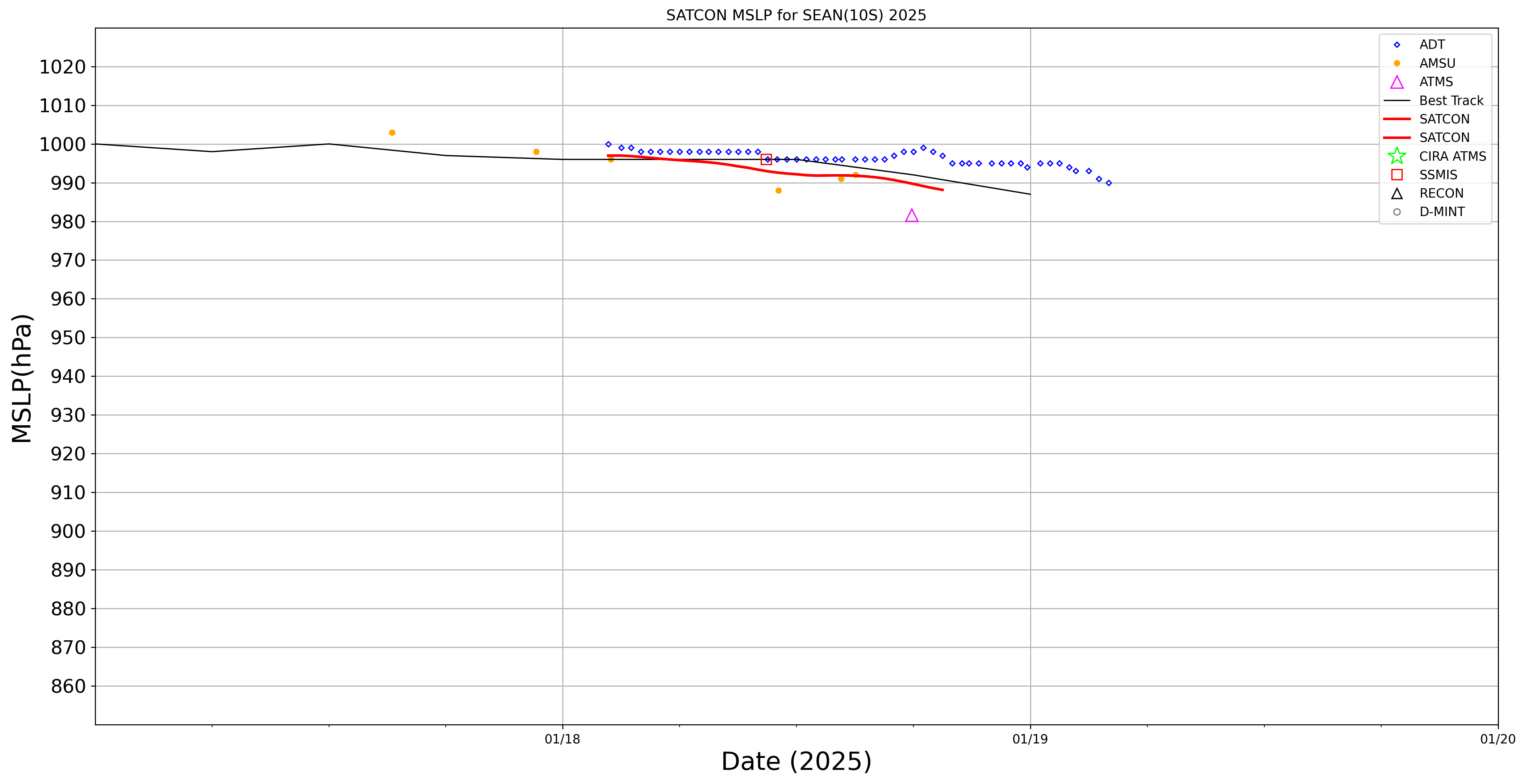
SATCON
|
| Date |
Time |
Vmax |
MSLP |
| 20Jan2025 |
0700UTC |
109 kts |
937 hPa |
| Consensus Members |
| 2 (ADT+Sounders) |
|
|
|