|
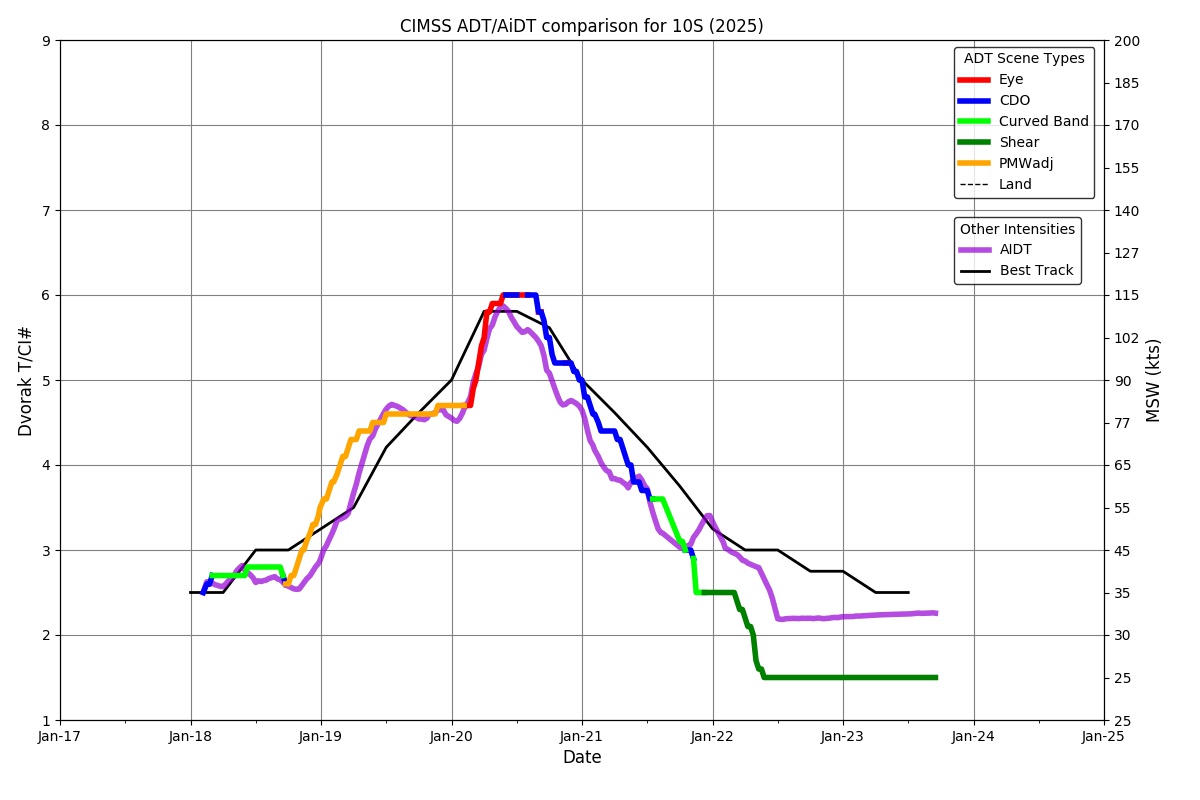
Current Intensity Estimates
|
ADT
|
| Date |
Time |
Vmax |
MSLP |
| 20Jan2025 |
0800UTC |
112 kts |
943 hPa |
| Scene |
CI# |
FT# |
AdjT# |
RawT# |
Eye T |
Cloud T |
| EYE |
5.9 |
5.9 |
6.0 |
6.5 |
-0.62C |
-75.40C |
|
|
|
|
AiDT
|
| Date |
Time |
Vmax |
|
| 20Jan2025 |
0800UTC |
108 kts |
|
|
|
|
|
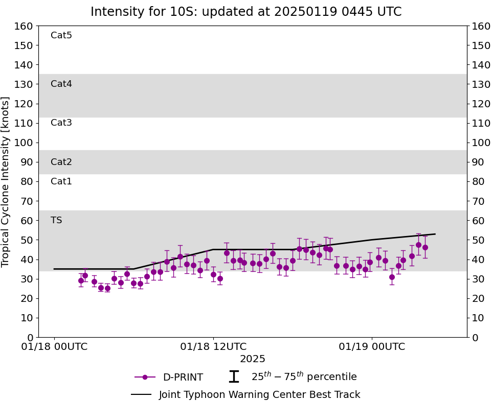
DPRINT
|
| Date |
Time |
Vmax |
MSLP |
| 20Jan2025 |
0800UTC |
97 kts |
947 hPa |
| Vmax 25% |
Vmax 75% |
|
|
| 90 kts |
104 kts |
|
|
|
|
|
|
DMINT
|
| Date |
Time |
Vmax |
MSLP |
| 20Jan2025 |
0631UTC |
83 kts |
955 hPa |
| Vmax 25% |
Vmax 75% |
MW Instr. |
|
| 77 kts |
90 kts |
ATMS-N20 |
|
|
|
|
|
MW Sounders
|
| Date |
Time |
Vmax |
MSLP |
| 20Jan2025 |
0606UTC |
100 kts |
929 hPa |
|
|
|
|
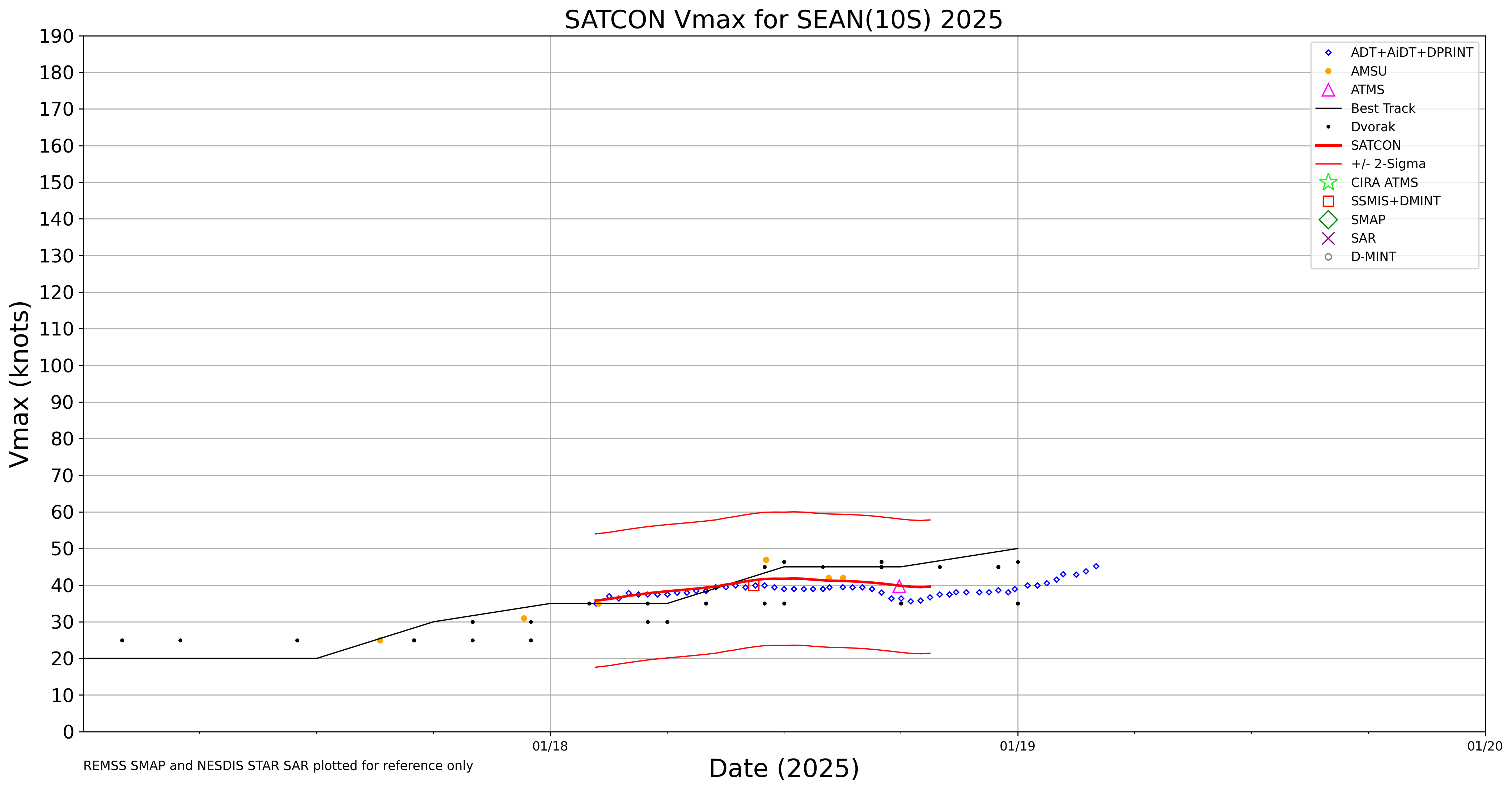
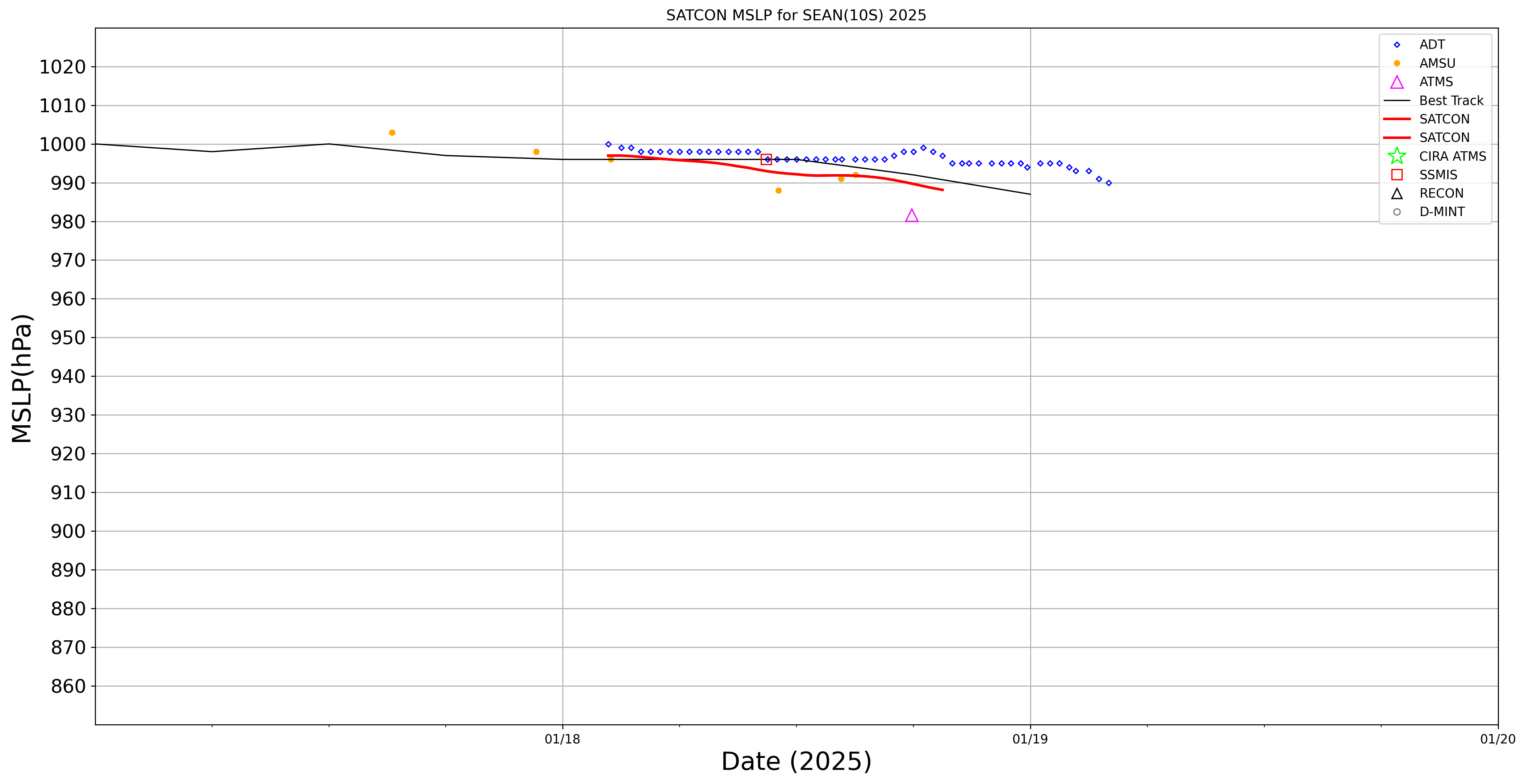
SATCON
|
| Date |
Time |
Vmax |
MSLP |
| 20Jan2025 |
0730UTC |
107 kts |
936 hPa |
| Consensus Members |
| 2 (ADT+Sounders) |
|
|
|