|
Current Intensity Estimates
|
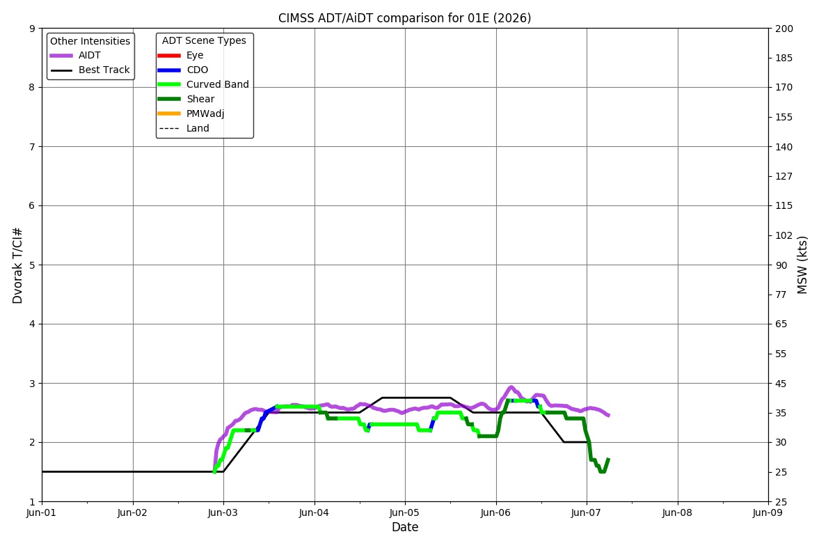
ADT
|
| Date |
Time |
Vmax |
MSLP |
| 07Jun2026 |
0410UTC |
25 kts |
1011 hPa |
| Scene |
CI# |
FT# |
AdjT# |
RawT# |
Eye T |
Cloud T |
| SHEAR |
1.5 |
1.5 |
1.5 |
1.5 |
20.49C |
-13.93C |
|
|
|
|
AiDT
|
| Date |
Time |
Vmax |
|
| 07Jun2026 |
0410UTC |
35 kts |
|
|
|
|
|
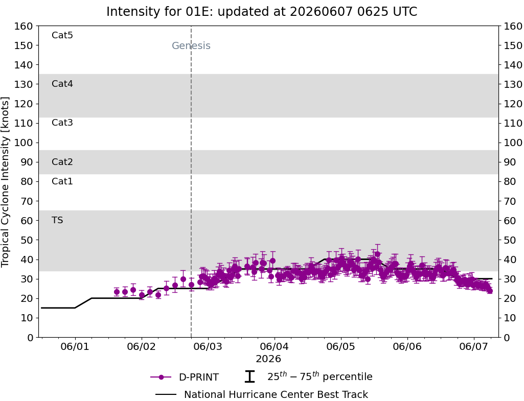
DPRINT
|
| Date |
Time |
Vmax |
MSLP |
| 07Jun2026 |
0410UTC |
27 kts |
1010 hPa |
| Vmax 25% |
Vmax 75% |
|
|
| 25 kts |
30 kts |
|
|
|
|
|
|
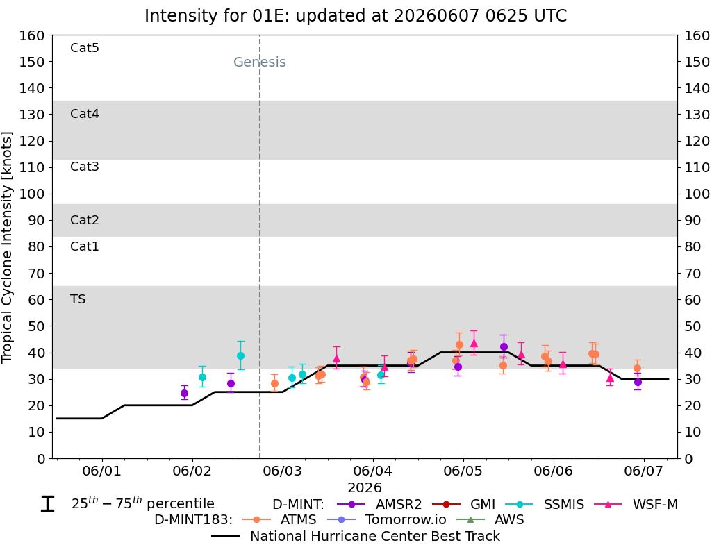
DMINT
|
| Date |
Time |
Vmax |
MSLP |
| 06Jun2026 |
2216UTC |
29 kts |
1010 hPa |
| Vmax 25% |
Vmax 75% |
MW Instr. |
|
| 26 kts |
32 kts |
AMSR2 |
|
|
|
|
|
MW Sounders
|
| Date |
Time |
Vmax |
MSLP |
| 06Jun2026 |
2211UTC |
40 kts |
1005 hPa |
|
|
|
|
SATCON
|
| Date |
Time |
Vmax |
MSLP |
| 07Jun2026 |
0010UTC |
37 kts |
1008 hPa |
| Consensus Members |
| 2 (ADT+Sounders) |
|
|
|