|
Current Intensity Estimates
|
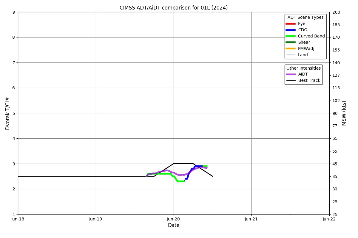
ADT
|
| Date |
Time |
Vmax |
MSLP |
| 20Jun2024 |
1740UTC |
N/A kts |
N/A hPa |
| Scene |
CI# |
FT# |
AdjT# |
RawT# |
Eye T |
Cloud T |
| LAND |
N/A |
N/A |
N/A |
N/A |
N/AC |
N/AC |
|
|
|
|
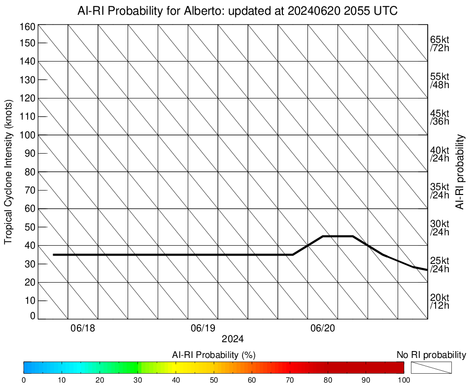
AiDT
|
| Date |
Time |
Vmax |
|
| 20Jun2024 |
1010UTC |
41 kts |
|
|
|
|
|
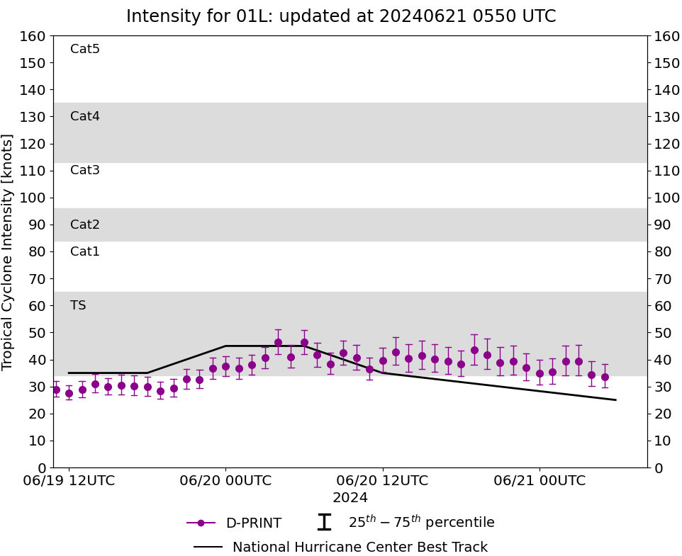
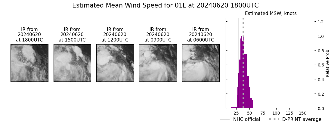
DPRINT
|
| Date |
Time |
Vmax |
MSLP |
| 20Jun2024 |
1800UTC |
38 kts |
1004 hPa |
| Vmax 25% |
Vmax 75% |
|
|
| 34 kts |
43 kts |
|
|
|
|
|
|
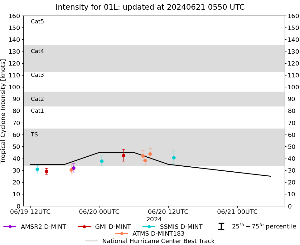
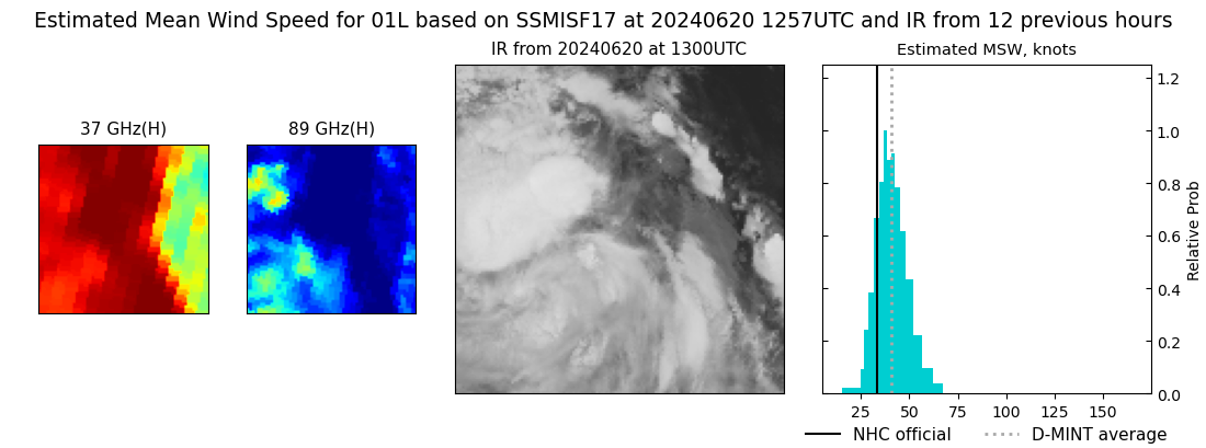
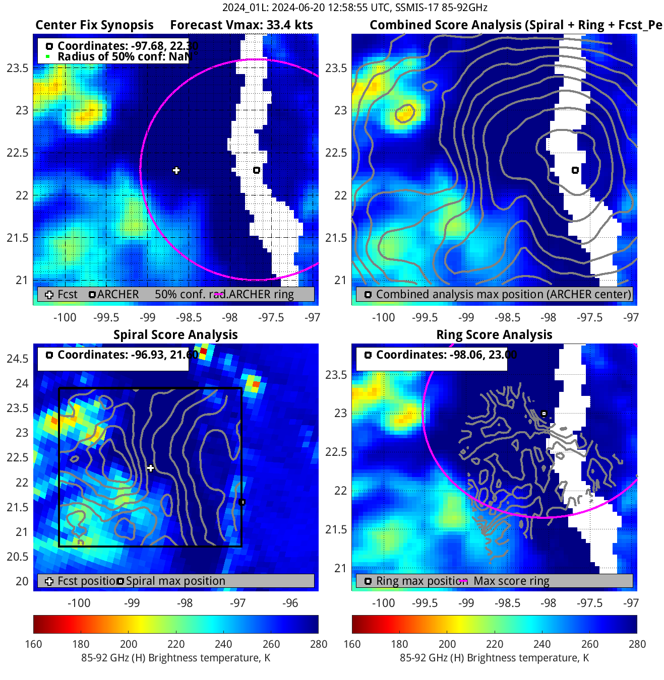
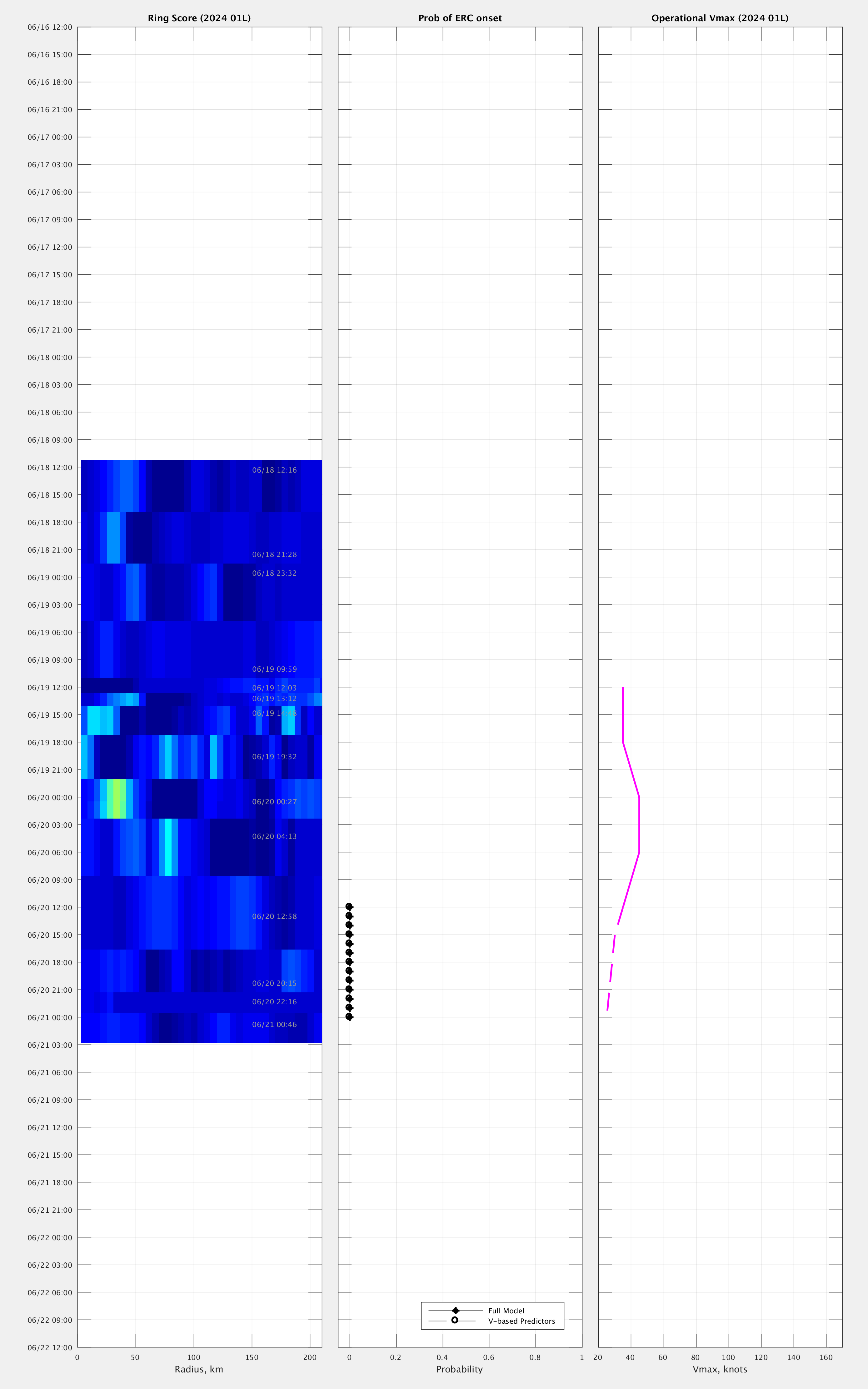
DMINT
|
| Date |
Time |
Vmax |
MSLP |
| 20Jun2024 |
1257UTC |
41 kts |
999 hPa |
| Vmax 25% |
Vmax 75% |
MW Instr. |
|
| 35 kts |
46 kts |
SSMISF17 |
|
|
|
|
|
MW Sounders
|
| Date |
Time |
Vmax |
MSLP |
| 20Jun2024 |
0734UTC |
34 kts |
992 hPa |
|
|
|
|
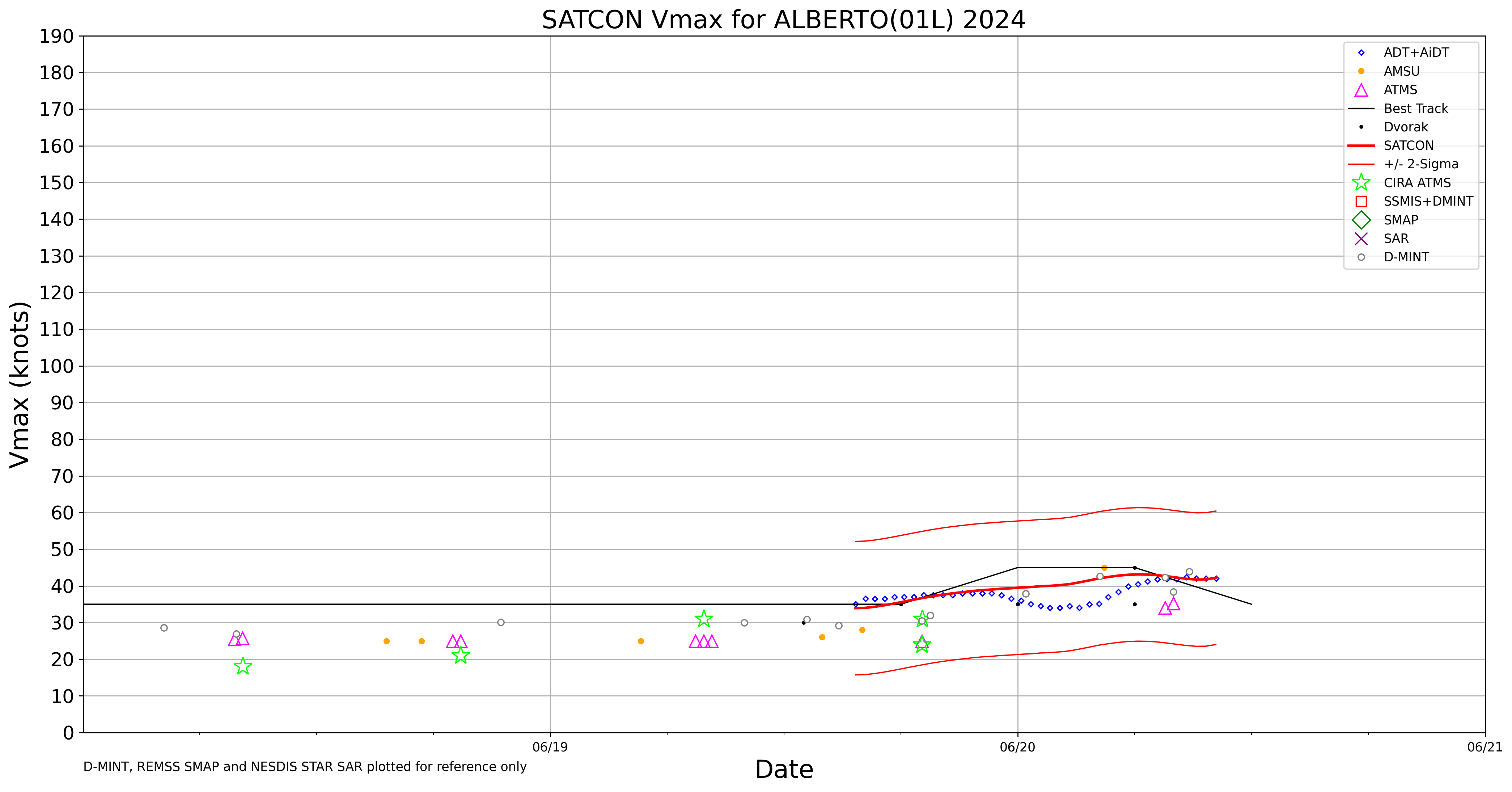
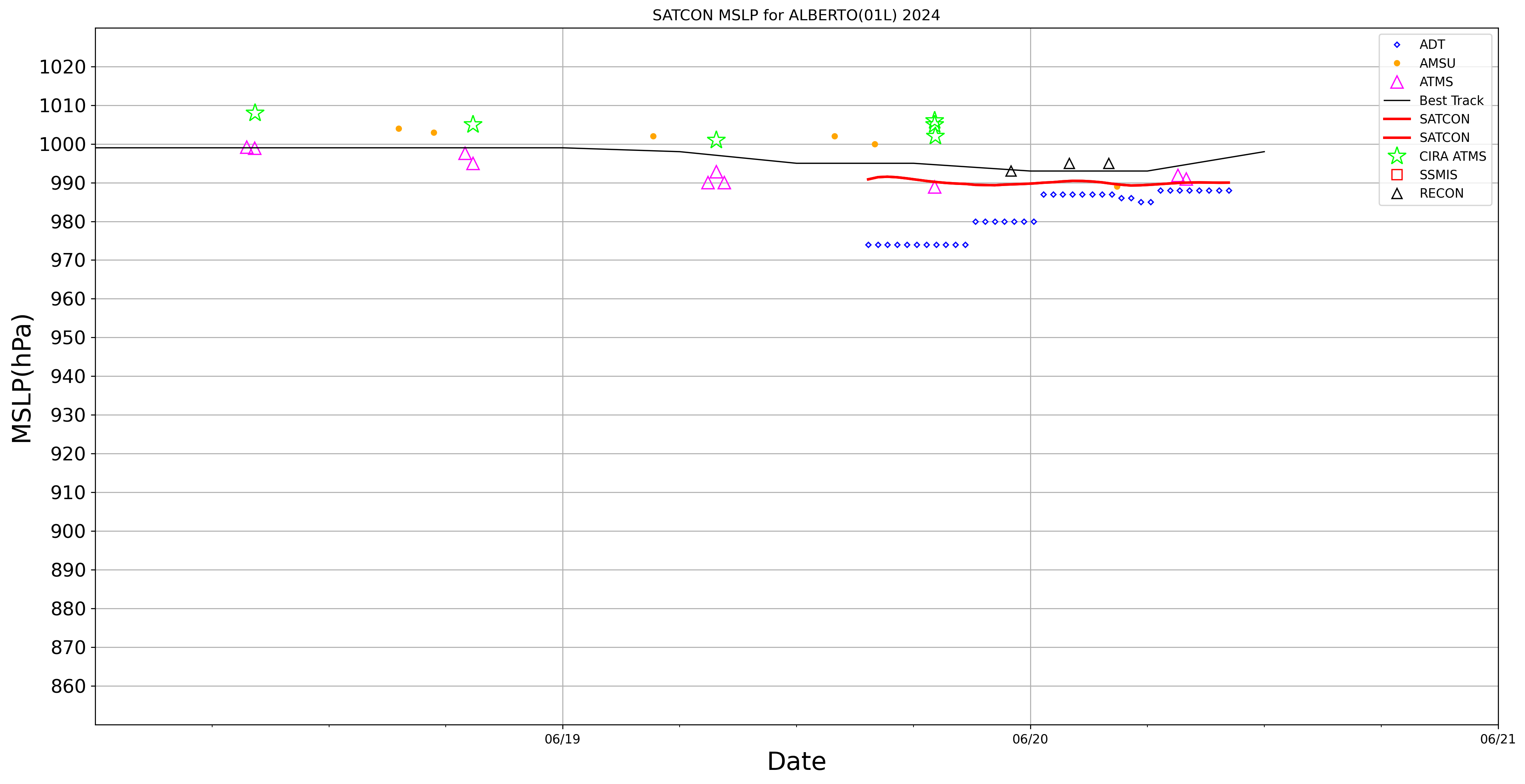
SATCON
|
| Date |
Time |
Vmax |
MSLP |
| 20Jun2024 |
1010UTC |
42 kts |
990 hPa |
| Consensus Members |
| 2 (ADT+Sounders) |
|
|
|