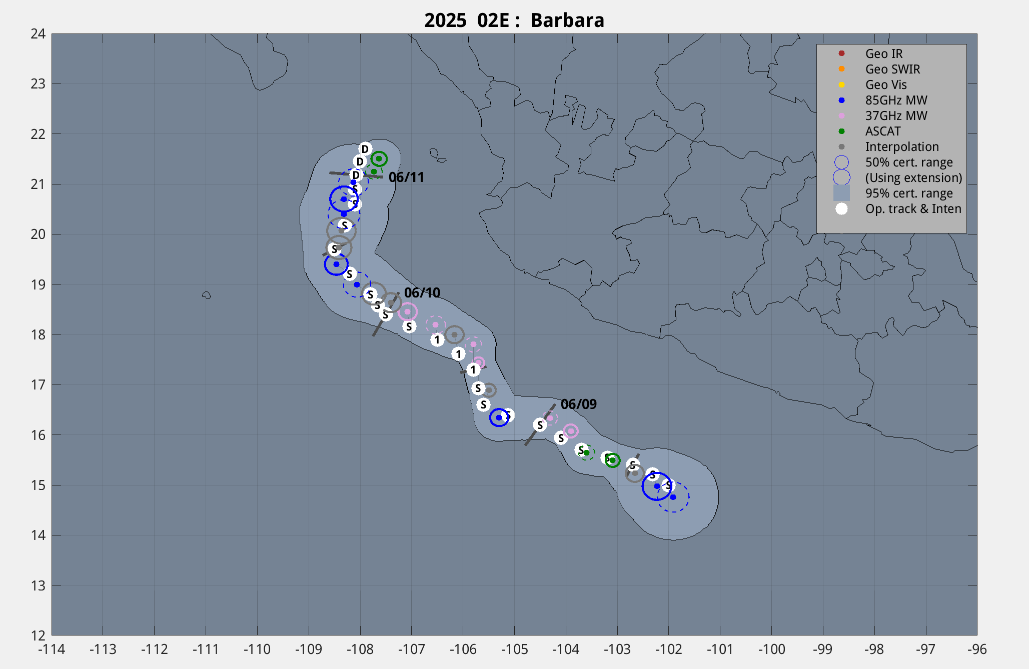
|
Current Intensity Estimates
|
ADT
|
| Date |
Time |
Vmax |
MSLP |
| 11Jun2025 |
0040UTC |
30 kts |
1005 hPa |
| Scene |
CI# |
FT# |
AdjT# |
RawT# |
Eye T |
Cloud T |
| SHEAR |
2.0 |
1.5 |
1.5 |
1.5 |
16.70C |
0.10C |
|
|
|
|
AiDT
|
| Date |
Time |
Vmax |
|
| 11Jun2025 |
0040UTC |
31 kts |
|
|
|
|
|
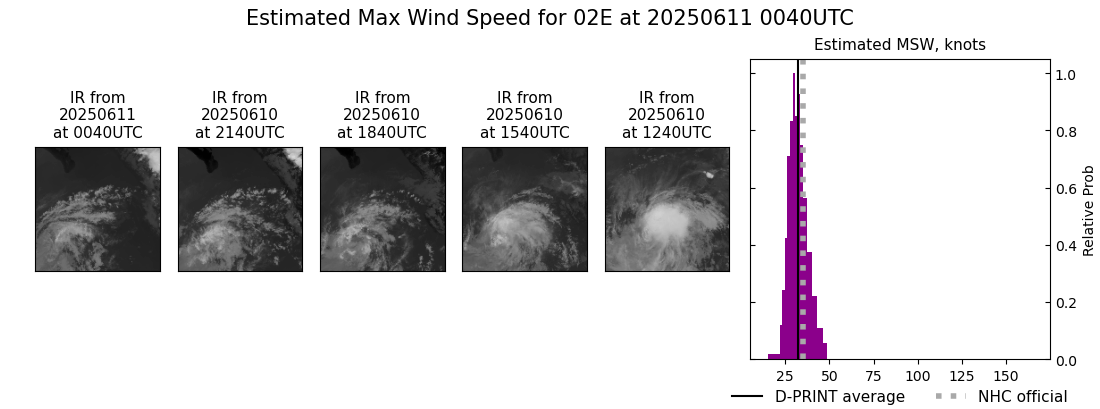
DPRINT
|
| Date |
Time |
Vmax |
MSLP |
| 11Jun2025 |
0040UTC |
32 kts |
1006 hPa |
| Vmax 25% |
Vmax 75% |
|
|
| 28 kts |
36 kts |
|
|
|
|
|
|
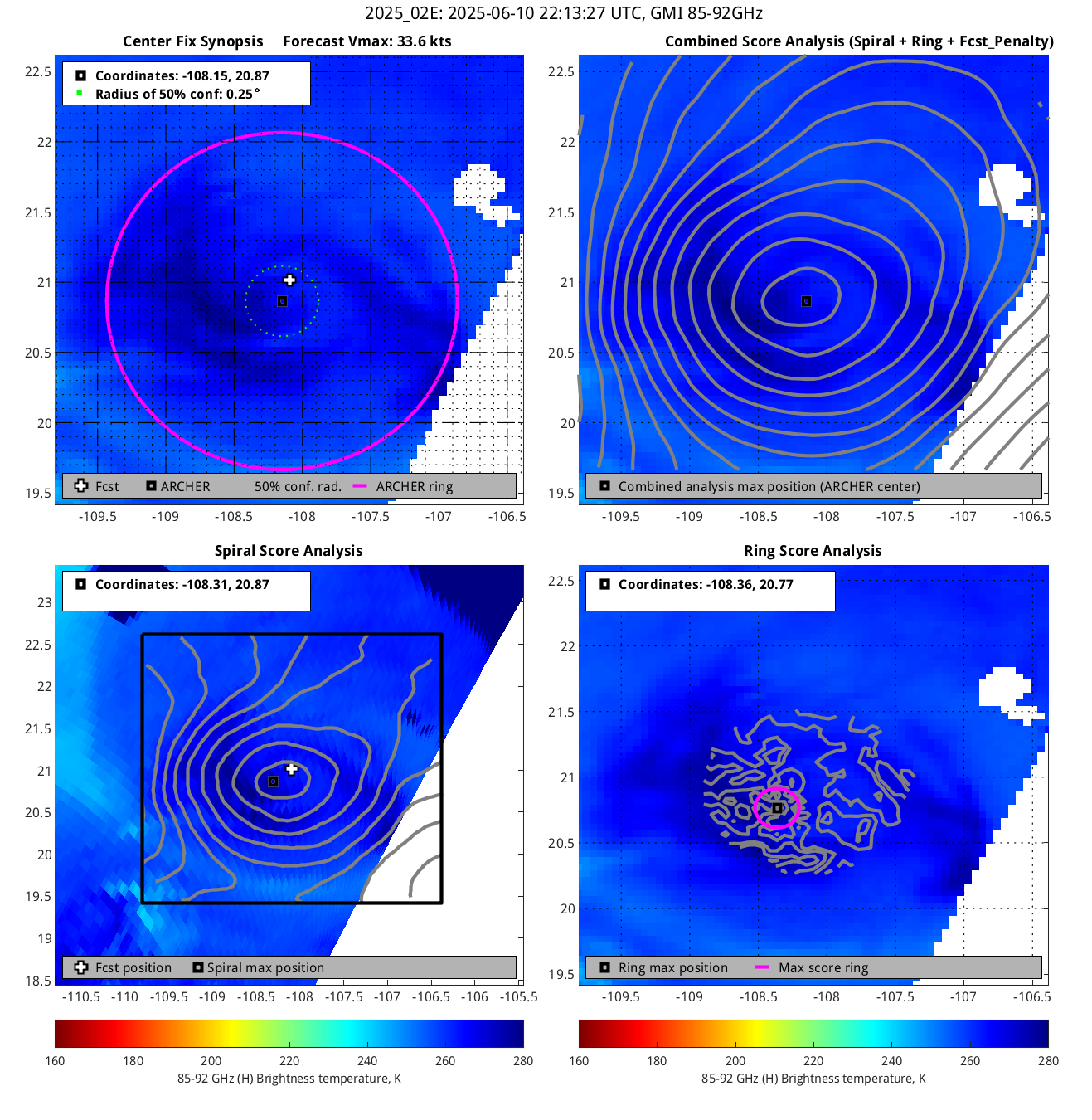
DMINT
|
| Date |
Time |
Vmax |
MSLP |
| 10Jun2025 |
2213UTC |
30 kts |
1006 hPa |
| Vmax 25% |
Vmax 75% |
MW Instr. |
|
| 28 kts |
34 kts |
GMI |
|
|
|
|
|
MW Sounders
|
| Date |
Time |
Vmax |
MSLP |
| 10Jun2025 |
1442UTC |
39 kts |
1005 hPa |
|
|
|
|
SATCON
|
| Date |
Time |
Vmax |
MSLP |
| 10Jun2025 |
1730UTC |
42 kts |
1000 hPa |
| Consensus Members |
| 2 (ADT+Sounders) |
|
|
|