|
Current Intensity Estimates
|
ADT
|
| Date |
Time |
Vmax |
MSLP |
| 09Jun2026 |
2310UTC |
N/A kts |
N/A hPa |
| Scene |
CI# |
FT# |
AdjT# |
RawT# |
Eye T |
Cloud T |
| LAND |
N/A |
N/A |
N/A |
N/A |
N/AC |
N/AC |
|
|
|
|
AiDT
|
| Date |
Time |
Vmax |
|
| 09Jun2026 |
0740UTC |
34 kts |
|
|
|
|
|
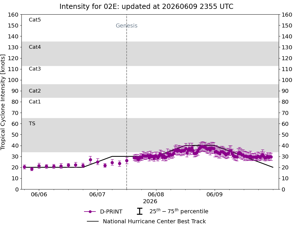
DPRINT
|
| Date |
Time |
Vmax |
MSLP |
| 09Jun2026 |
2310UTC |
30 kts |
1005 hPa |
| Vmax 25% |
Vmax 75% |
|
|
| 27 kts |
33 kts |
|
|
|
|
|
|
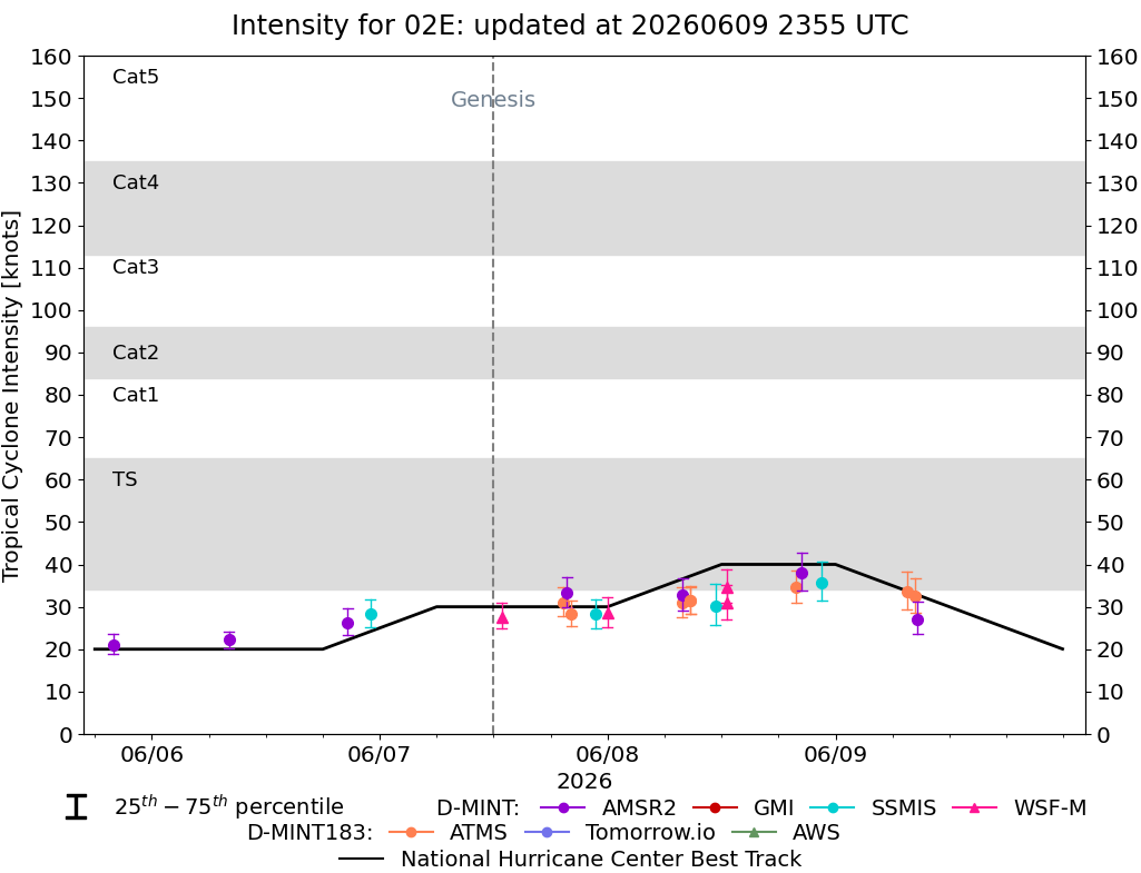
DMINT
|
| Date |
Time |
Vmax |
MSLP |
| 09Jun2026 |
0838UTC |
27 kts |
1005 hPa |
| Vmax 25% |
Vmax 75% |
MW Instr. |
|
| 24 kts |
31 kts |
AMSR2 |
|
|
|
|
|
MW Sounders
|
| Date |
Time |
Vmax |
MSLP |
| 09Jun2026 |
2020UTC |
39 kts |
1001 hPa |
|
|
|
|
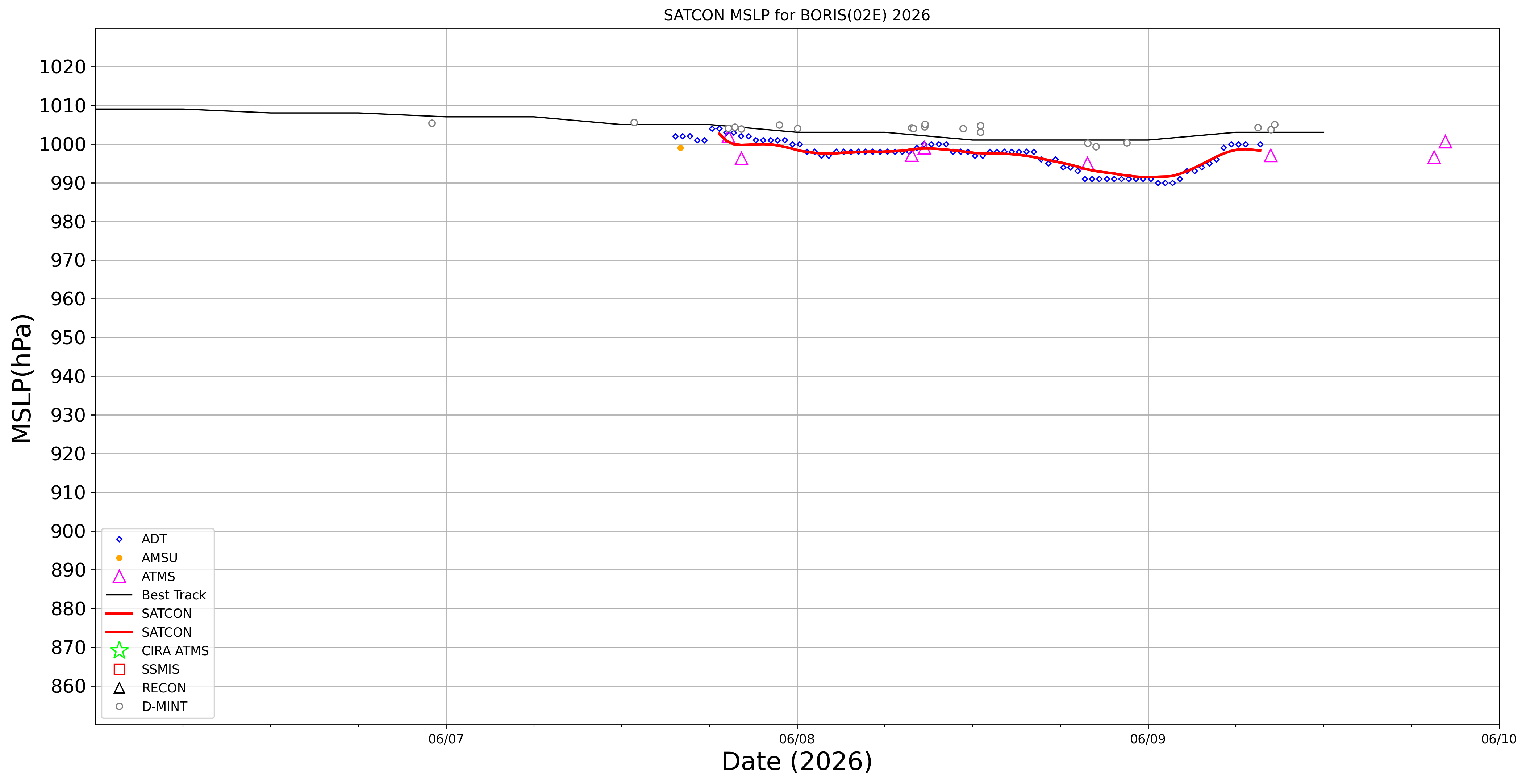
SATCON
|
| Date |
Time |
Vmax |
MSLP |
| 09Jun2026 |
0740UTC |
40 kts |
999 hPa |
| Consensus Members |
| 2 (ADT+Sounders) |
|
|
|