|
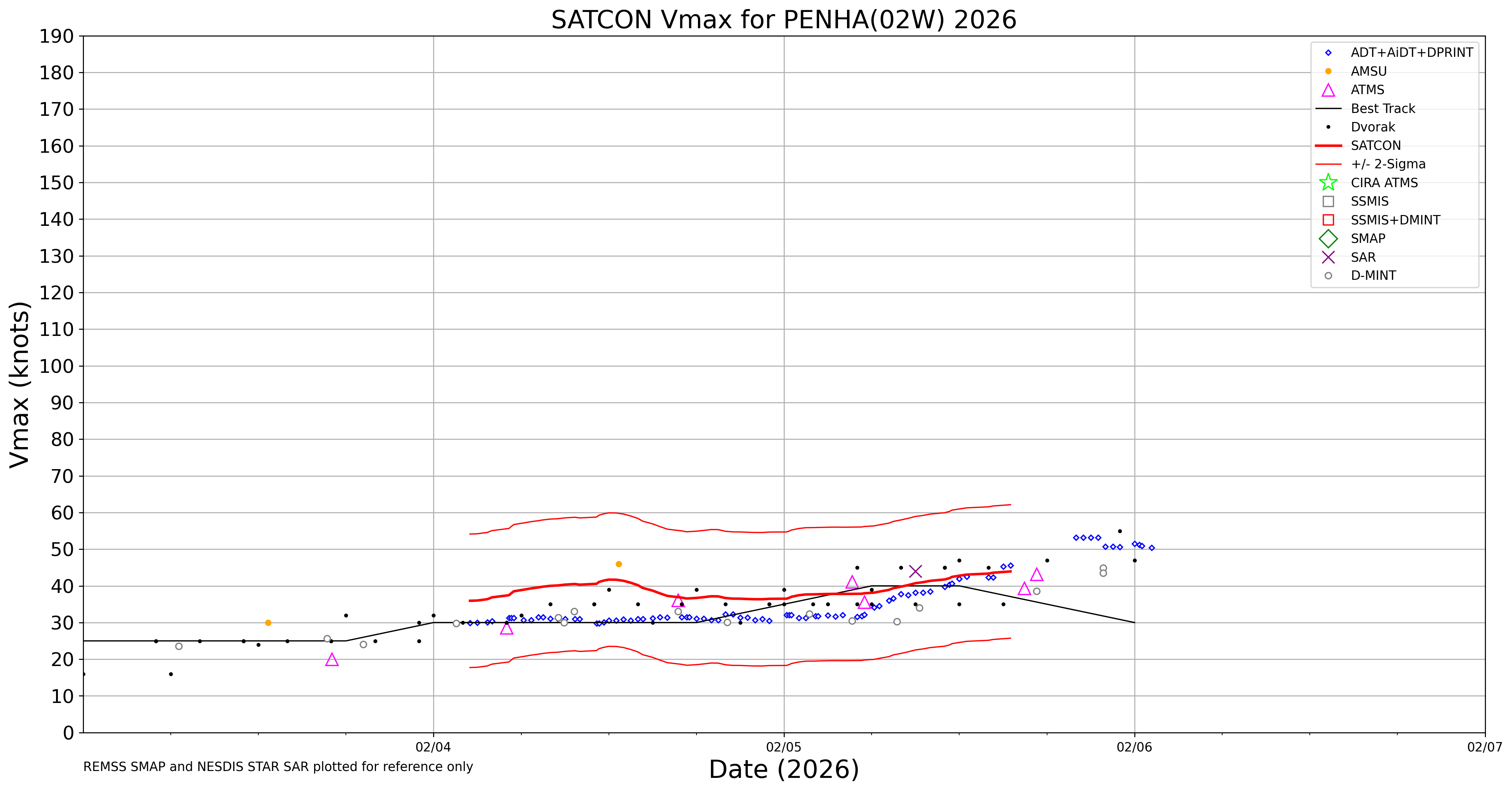
Current Intensity Estimates
|
ADT
|
| Date |
Time |
Vmax |
MSLP |
| 07Feb2026 |
1110UTC |
33 kts |
1008 hPa |
| Scene |
CI# |
FT# |
AdjT# |
RawT# |
Eye T |
Cloud T |
| SHEAR |
2.3 |
2.3 |
2.5 |
3.1 |
15.03C |
-15.63C |
|
|
|
|
AiDT
|
| Date |
Time |
Vmax |
|
| 07Feb2026 |
1110UTC |
32 kts |
|
|
|
|
|
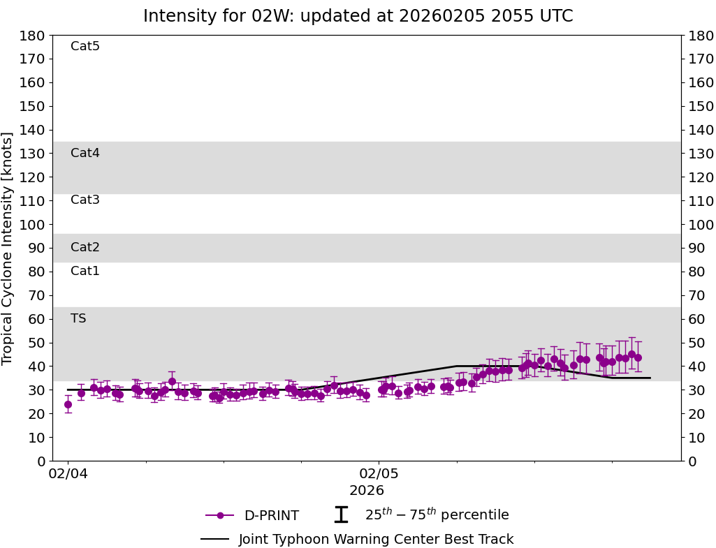
DPRINT
|
| Date |
Time |
Vmax |
MSLP |
| 07Feb2026 |
1110UTC |
25 kts |
1004 hPa |
| Vmax 25% |
Vmax 75% |
|
|
| 22 kts |
27 kts |
|
|
|
|
|
|
DMINT
|
| Date |
Time |
Vmax |
MSLP |
| 07Feb2026 |
0540UTC |
25 kts |
1004 hPa |
| Vmax 25% |
Vmax 75% |
MW Instr. |
|
| 22 kts |
28 kts |
AMSR2 |
|
|
|
|
|
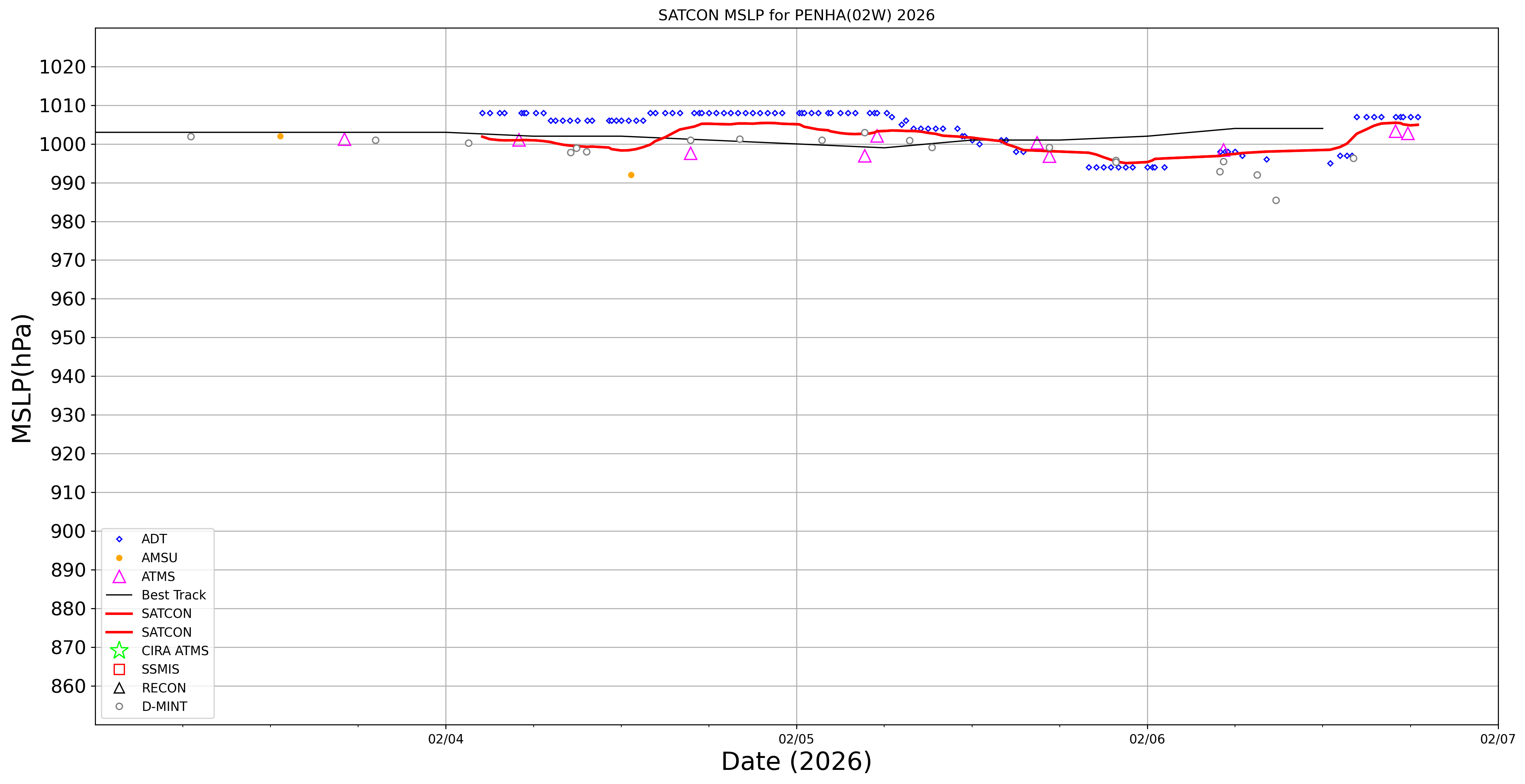
MW Sounders
|
| Date |
Time |
Vmax |
MSLP |
| 06Feb2026 |
1748UTC |
40 kts |
1003 hPa |
|
|
|
|
SATCON
|
| Date |
Time |
Vmax |
MSLP |
| 06Feb2026 |
1830UTC |
40 kts |
1005 hPa |
| Consensus Members |
| 2 (ADT+Sounders) |
|
|
|