|
Current Intensity Estimates
|
ADT
|
| Date |
Time |
Vmax |
MSLP |
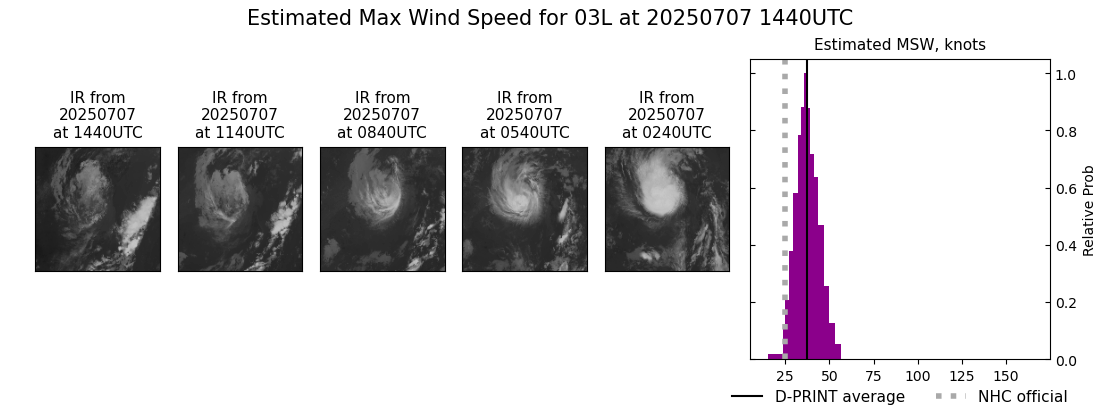
| 07Jul2025 |
1440UTC |
25 kts |
1005 hPa |
| Scene |
CI# |
FT# |
AdjT# |
RawT# |
Eye T |
Cloud T |
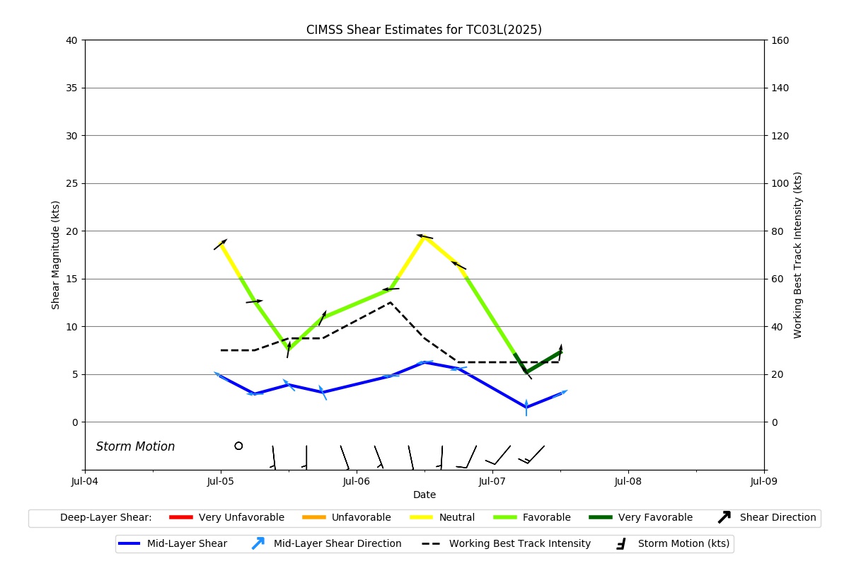
| SHEAR |
1.5 |
1.5 |
1.5 |
1.5 |
11.29C |
3.98C |
|
|
|
|
AiDT
|
| Date |
Time |
Vmax |
|
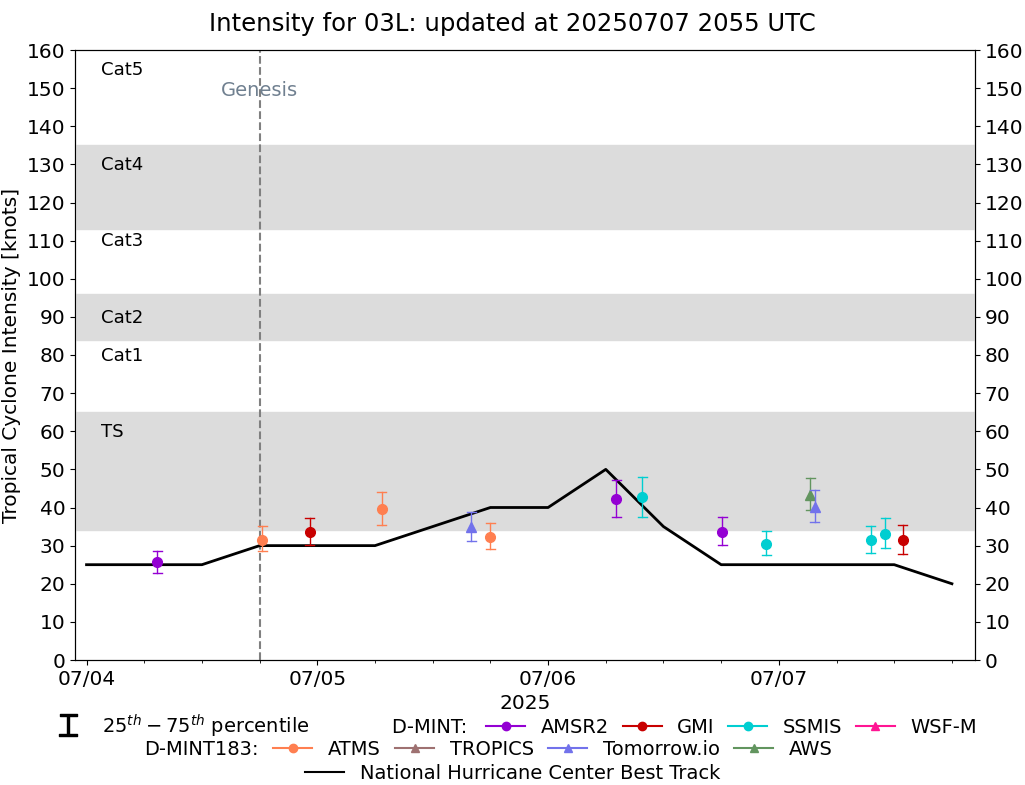
| 07Jul2025 |
1440UTC |
36 kts |
|
|
|
|
|
DPRINT
|
| Date |
Time |
Vmax |
MSLP |
| 07Jul2025 |
1440UTC |
37 kts |
1007 hPa |
| Vmax 25% |
Vmax 75% |
|
|
| 33 kts |
42 kts |
|
|
|
|
|
|
DMINT
|
| Date |
Time |
Vmax |
MSLP |
| 07Jul2025 |
1253UTC |
31 kts |
1007 hPa |
| Vmax 25% |
Vmax 75% |
MW Instr. |
|
| 28 kts |
35 kts |
GMI |
|
|
|
|
|
MW Sounders
|
| Date |
Time |
Vmax |
MSLP |
| 07Jul2025 |
0743UTC |
37 kts |
1009 hPa |
|
|
|
|
SATCON
|
| Date |
Time |
Vmax |
MSLP |
| 06Jul2025 |
0810UTC |
42 kts |
1002 hPa |
| Consensus Members |
| 3 (ADT+Sounders) |
|
|
|