|
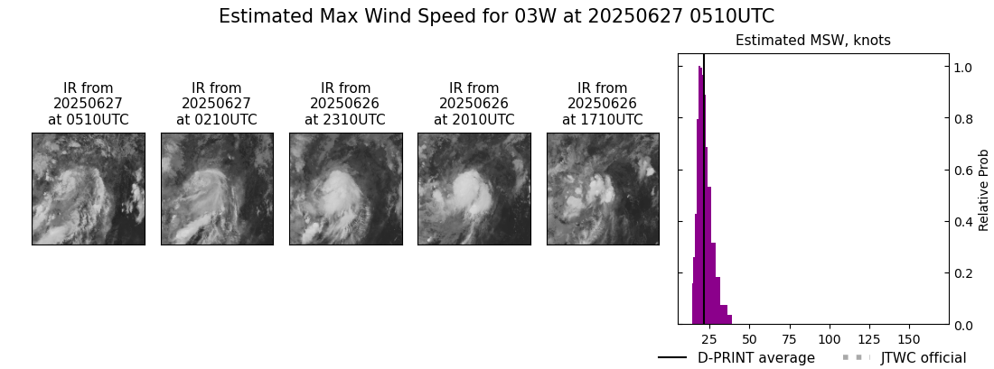
Current Intensity Estimates
|
ADT
|
| Date |
Time |
Vmax |
MSLP |
| 27Jun2025 |
0510UTC |
N/A kts |
N/A hPa |
| Scene |
CI# |
FT# |
AdjT# |
RawT# |
Eye T |
Cloud T |
| LAND |
N/A |
N/A |
N/A |
N/A |
N/AC |
N/AC |
|
|
|
|
AiDT
|
| Date |
Time |
Vmax |
|
| 26Jun2025 |
0300UTC |
36 kts |
|
|
|
|
|
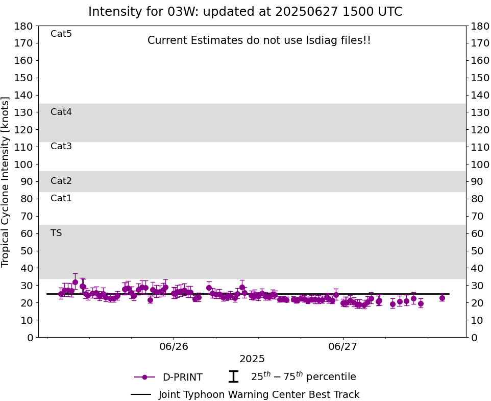
DPRINT
|
| Date |
Time |
Vmax |
MSLP |
| 27Jun2025 |
0510UTC |
21 kts |
1005 hPa |
| Vmax 25% |
Vmax 75% |
|
|
| 19 kts |
25 kts |
|
|
|
|
|
|
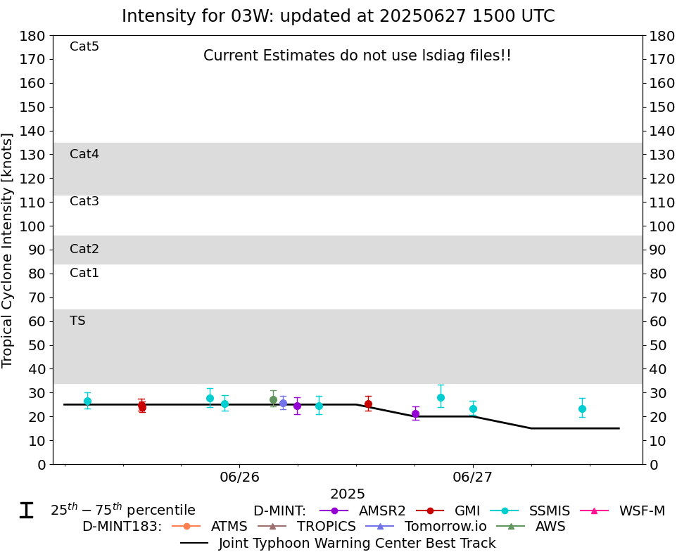
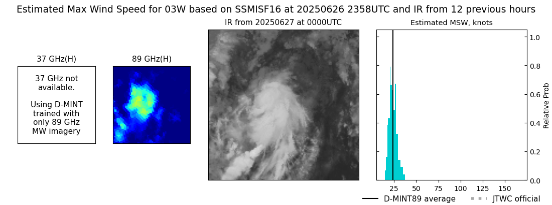
DMINT
|
| Date |
Time |
Vmax |
MSLP |
| 26Jun2025 |
2358UTC |
23 kts |
1008 hPa |
| Vmax 25% |
Vmax 75% |
MW Instr. |
|
| 21 kts |
27 kts |
SSMISF16 |
|
|
|
|
|
MW Sounders
|
| Date |
Time |
Vmax |
MSLP |
| 27Jun2025 |
0028UTC |
41 kts |
997 hPa |
|
|
|
|
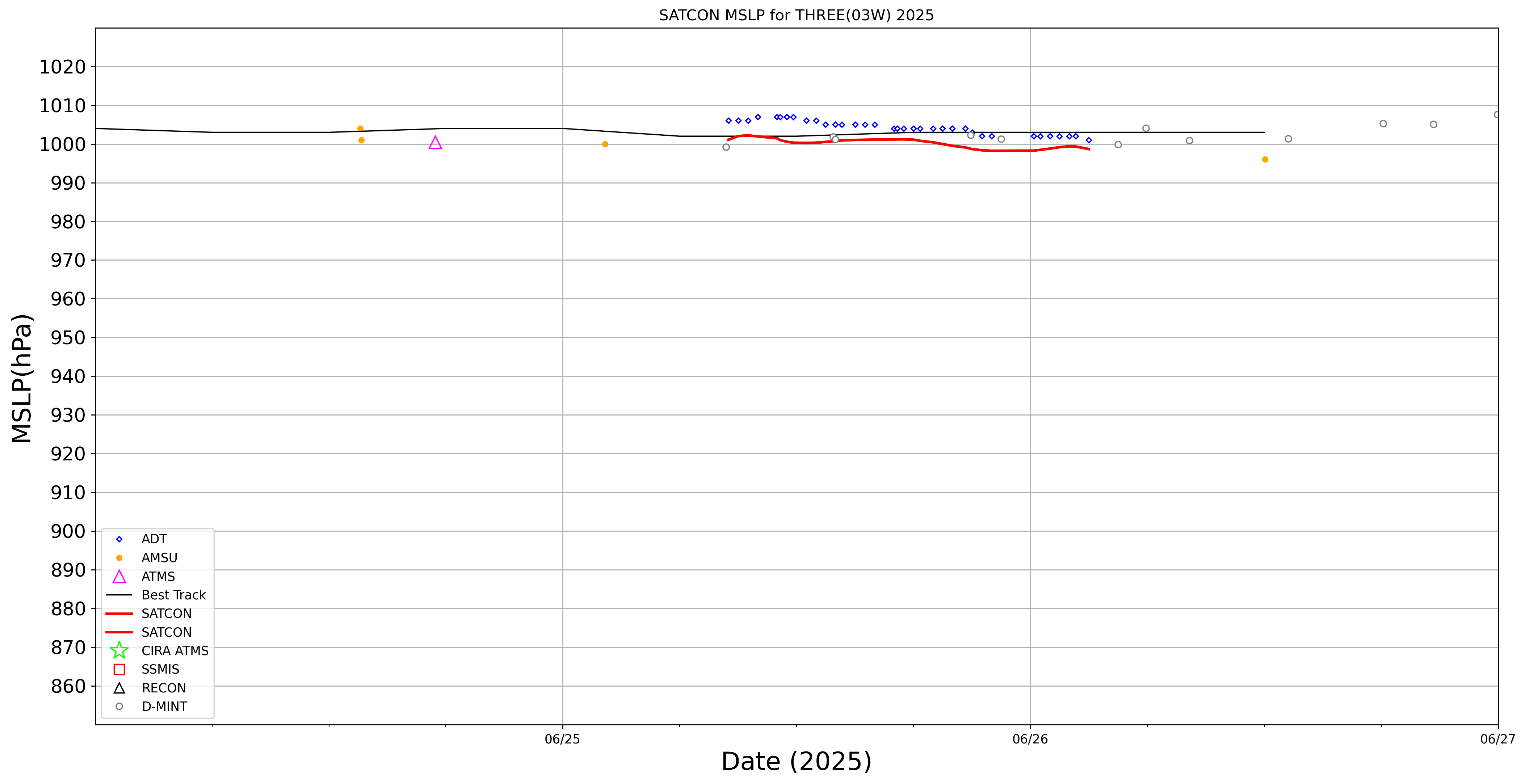
SATCON
|
| Date |
Time |
Vmax |
MSLP |
| 26Jun2025 |
0300UTC |
37 kts |
999 hPa |
| Consensus Members |
| 2 (ADT+Sounders) |
|
|
|