|
Current Intensity Estimates
|
ADT
|
| Date |
Time |
Vmax |
MSLP |
| 16Jun2025 |
0010UTC |
25 kts |
1008 hPa |
| Scene |
CI# |
FT# |
AdjT# |
RawT# |
Eye T |
Cloud T |
| SHEAR |
1.5 |
1.5 |
1.5 |
1.5 |
17.24C |
9.51C |
|
|
|
|
AiDT
|
| Date |
Time |
Vmax |
|
| 16Jun2025 |
0010UTC |
30 kts |
|
|
|
|
|
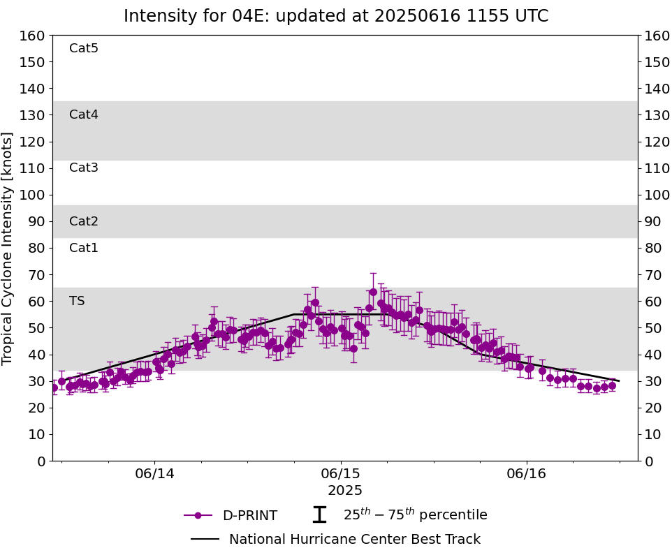
DPRINT
|
| Date |
Time |
Vmax |
MSLP |
| 16Jun2025 |
0010UTC |
35 kts |
1006 hPa |
| Vmax 25% |
Vmax 75% |
|
|
| 31 kts |
39 kts |
|
|
|
|
|
|
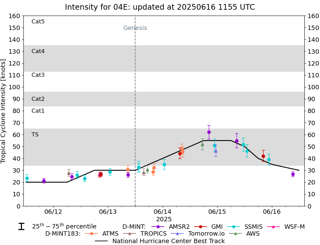
DMINT
|
| Date |
Time |
Vmax |
MSLP |
| 15Jun2025 |
2237UTC |
39 kts |
1005 hPa |
| Vmax 25% |
Vmax 75% |
MW Instr. |
|
| 35 kts |
44 kts |
SSMISF18 |
|
|
|
|
|
MW Sounders
|
| Date |
Time |
Vmax |
MSLP |
| 14Jun2025 |
0847UTC |
39 kts |
992 hPa |
|
|
|
|
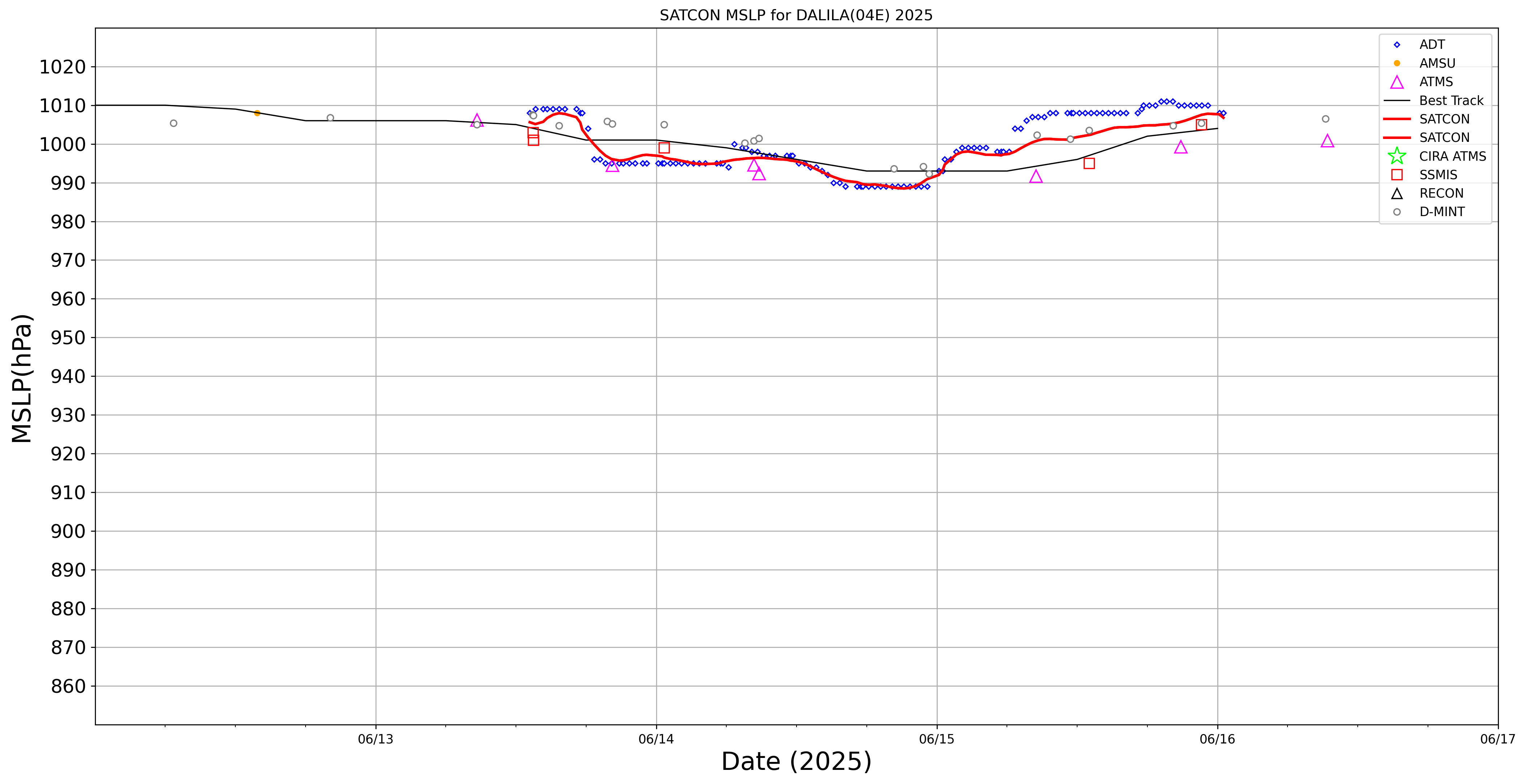
SATCON
|
| Date |
Time |
Vmax |
MSLP |
| 14Jun2025 |
1140UTC |
44 kts |
995 hPa |
| Consensus Members |
| 2 (ADT+Sounders) |
|
|
|