|
Current Intensity Estimates
|
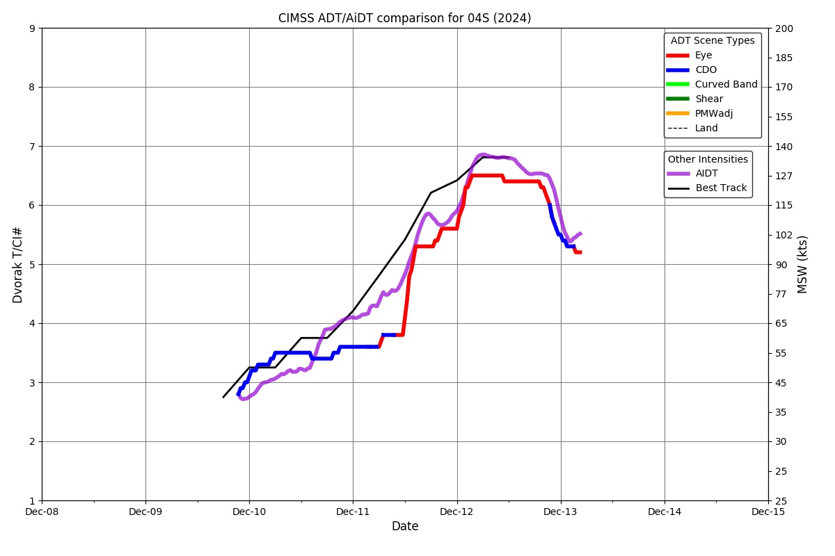
ADT
|
| Date |
Time |
Vmax |
MSLP |
| 26Oct2025 |
0430UTC |
25 kts |
1012 hPa |
| Scene |
CI# |
FT# |
AdjT# |
RawT# |
Eye T |
Cloud T |
| SHEAR |
1.5 |
1.5 |
1.5 |
1.5 |
18.11C |
12.30C |
|
|
|
|
AiDT
|
| Date |
Time |
Vmax |
|
| 26Oct2025 |
0430UTC |
30 kts |
|
|
|
|
|
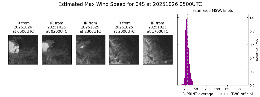
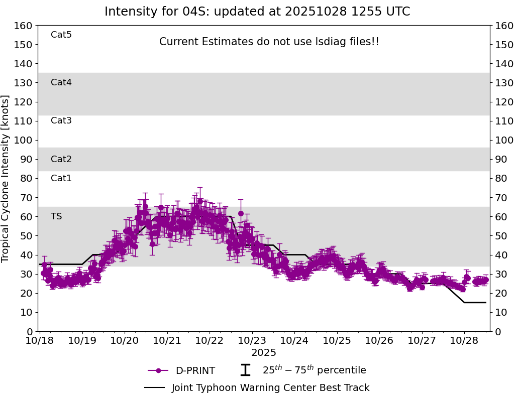
DPRINT
|
| Date |
Time |
Vmax |
MSLP |
| 26Oct2025 |
0500UTC |
28 kts |
1004 hPa |
| Vmax 25% |
Vmax 75% |
|
|
| 26 kts |
31 kts |
|
|
|
|
|
|
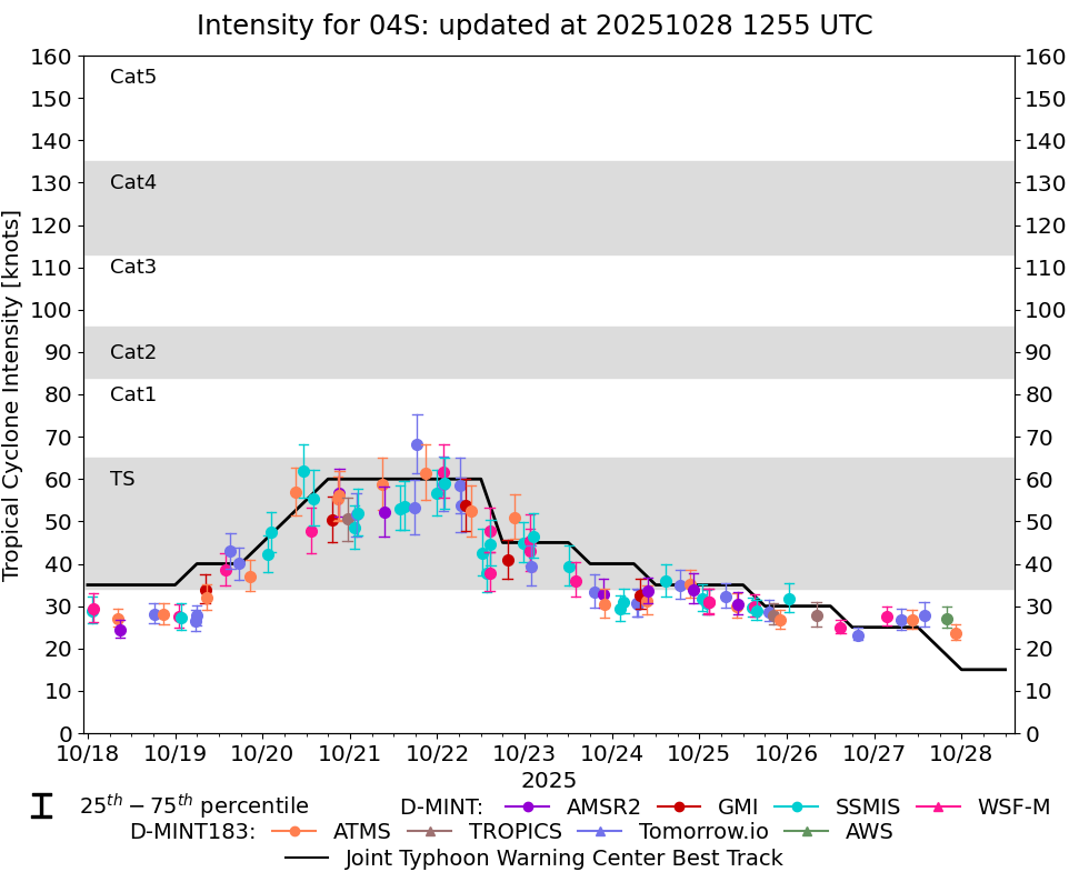
DMINT
|
| Date |
Time |
Vmax |
MSLP |
| 26Oct2025 |
0033UTC |
32 kts |
1004 hPa |
| Vmax 25% |
Vmax 75% |
MW Instr. |
|
| 29 kts |
35 kts |
SSMISF18 |
|
|
|
|
|
MW Sounders
|
| Date |
Time |
Vmax |
MSLP |
| 25Oct2025 |
2205UTC |
35 kts |
1002 hPa |
|
|
|
|
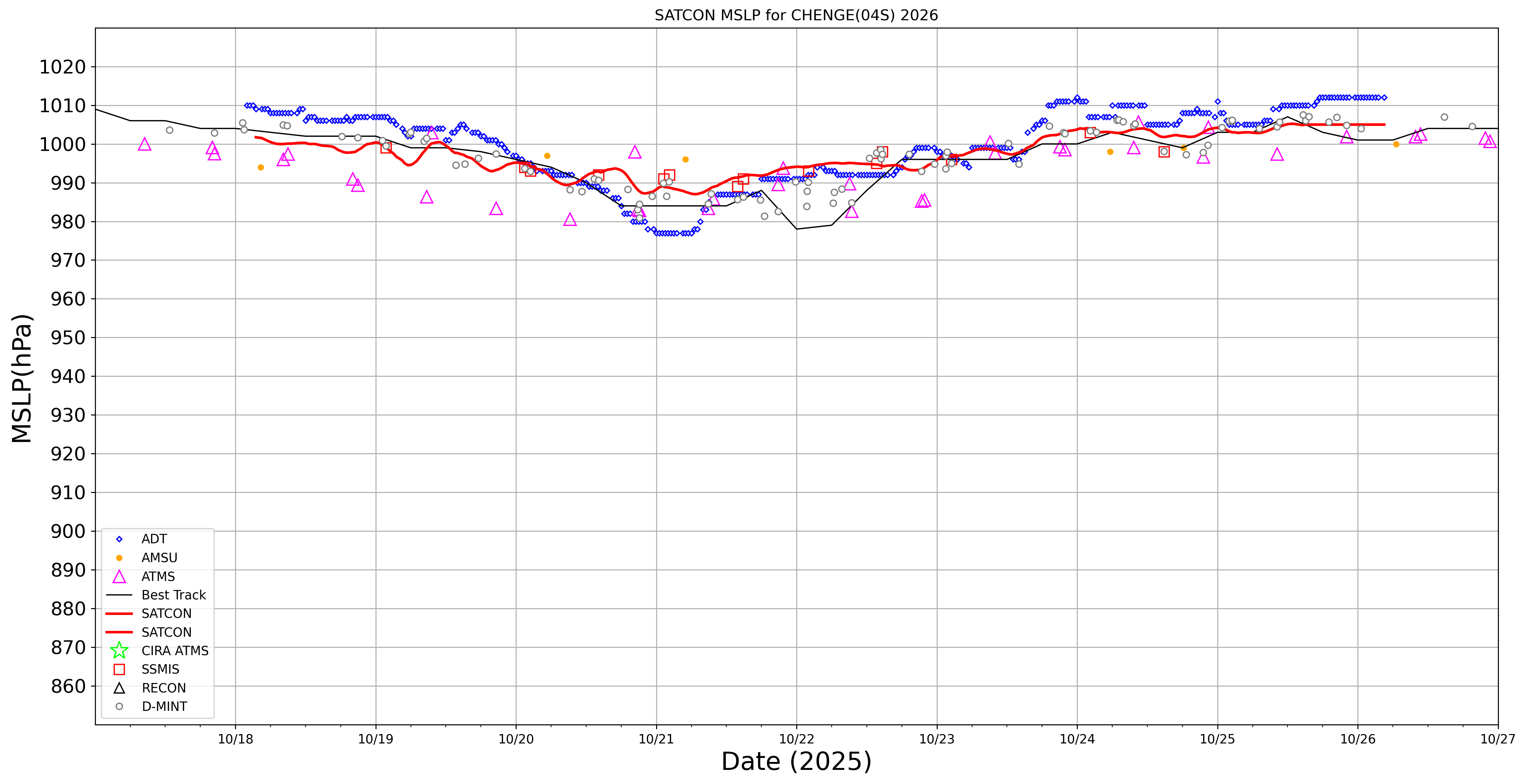
SATCON
|
| Date |
Time |
Vmax |
MSLP |
| 25Oct2025 |
2330UTC |
36 kts |
1007 hPa |
| Consensus Members |
| 2 (ADT+Sounders) |
|
|
|