|
Current Intensity Estimates
|
ADT
|
| Date |
Time |
Vmax |
MSLP |
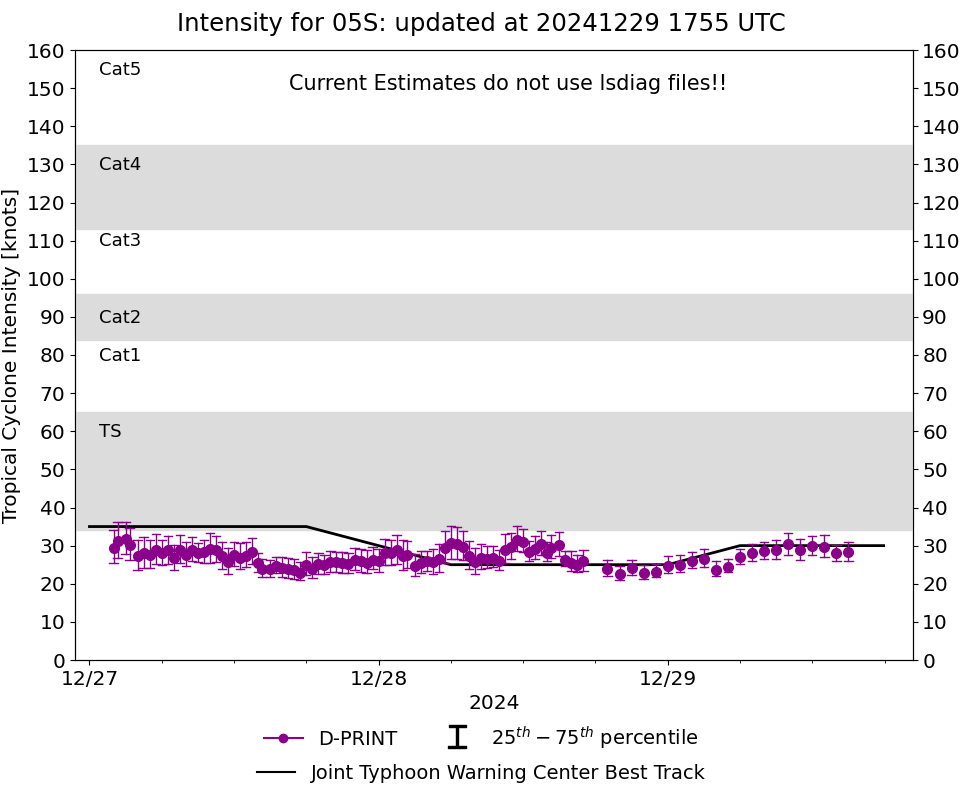
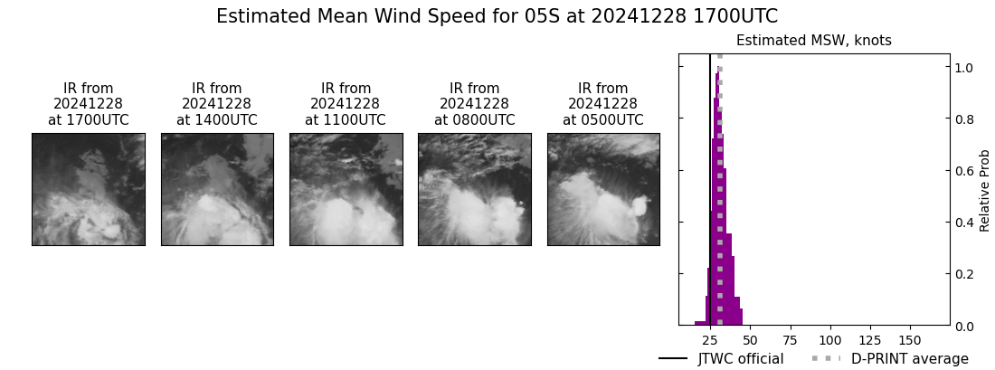
| 28Dec2024 |
1700UTC |
34 kts |
1004 hPa |
| Scene |
CI# |
FT# |
AdjT# |
RawT# |
Eye T |
Cloud T |
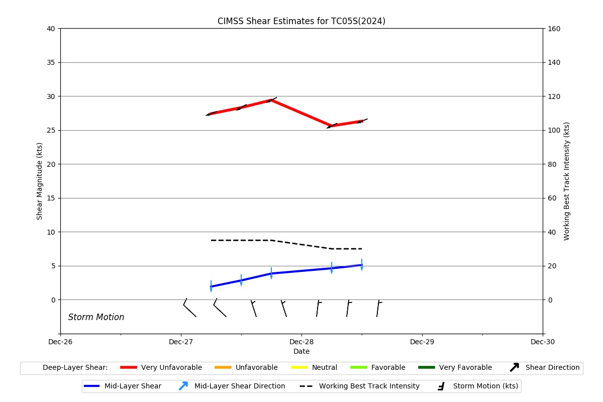
| SHEAR |
2.4 |
2.3 |
2.5 |
2.5 |
0.03C |
-22.76C |
|
|
|
|
AiDT
|
| Date |
Time |
Vmax |
|
| 28Dec2024 |
1700UTC |
32 kts |
|
|
|
|
|
DPRINT
|
| Date |
Time |
Vmax |
MSLP |
| 28Dec2024 |
1700UTC |
25 kts |
NaN hPa |
| Vmax 25% |
Vmax 75% |
|
|
| 23 kts |
28 kts |
|
|
|
|
|
|
DMINT
|
| Date |
Time |
Vmax |
MSLP |
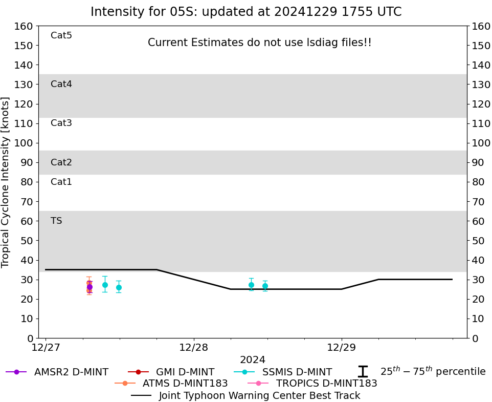
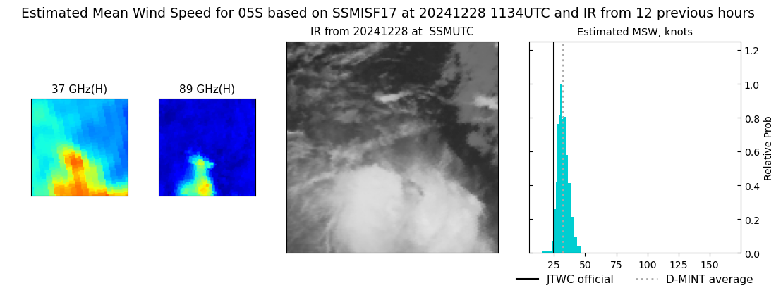
| 28Dec2024 |
1134UTC |
27 kts |
NaN hPa |
| Vmax 25% |
Vmax 75% |
MW Instr. |
|
| 24 kts |
29 kts |
SSMISF17 |
|
|
|
|
|
MW Sounders
|
| Date |
Time |
Vmax |
MSLP |
| 28Dec2024 |
1455UTC |
48 kts |
996 hPa |
|
|
|
|
SATCON
|
| Date |
Time |
Vmax |
MSLP |
| 28Dec2024 |
1700UTC |
41 kts |
1000 hPa |
| Consensus Members |
| 3 (ADT+Sounders) |
|
|
|