|
Current Intensity Estimates
|
ADT
|
| Date |
Time |
Vmax |
MSLP |
| 09Jul2025 |
1710UTC |
N/A kts |
N/A hPa |
| Scene |
CI# |
FT# |
AdjT# |
RawT# |
Eye T |
Cloud T |
| LAND |
N/A |
N/A |
N/A |
N/A |
N/AC |
N/AC |
|
|
|
|
AiDT
|
| Date |
Time |
Vmax |
|
| 08Jul2025 |
1450UTC |
38 kts |
|
|
|
|
|
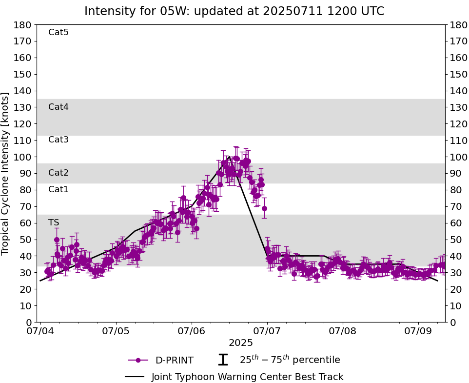
DPRINT
|
| Date |
Time |
Vmax |
MSLP |
| 09Jul2025 |
1710UTC |
31 kts |
NaN hPa |
| Vmax 25% |
Vmax 75% |
|
|
| 27 kts |
35 kts |
|
|
|
|
|
|
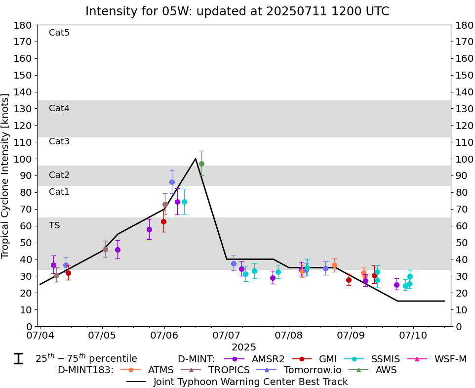
DMINT
|
| Date |
Time |
Vmax |
MSLP |
| 09Jul2025 |
1010UTC |
32 kts |
NaN hPa |
| Vmax 25% |
Vmax 75% |
MW Instr. |
|
| 28 kts |
36 kts |
SSMISF16 |
|
|
|
|
|
MW Sounders
|
| Date |
Time |
Vmax |
MSLP |
| 09Jul2025 |
1331UTC |
41 kts |
984 hPa |
|
|
|
|
SATCON
|
| Date |
Time |
Vmax |
MSLP |
| 08Jul2025 |
1450UTC |
43 kts |
985 hPa |
| Consensus Members |
| 3 (ADT+Sounders) |
|
|
|