|
Current Intensity Estimates
|
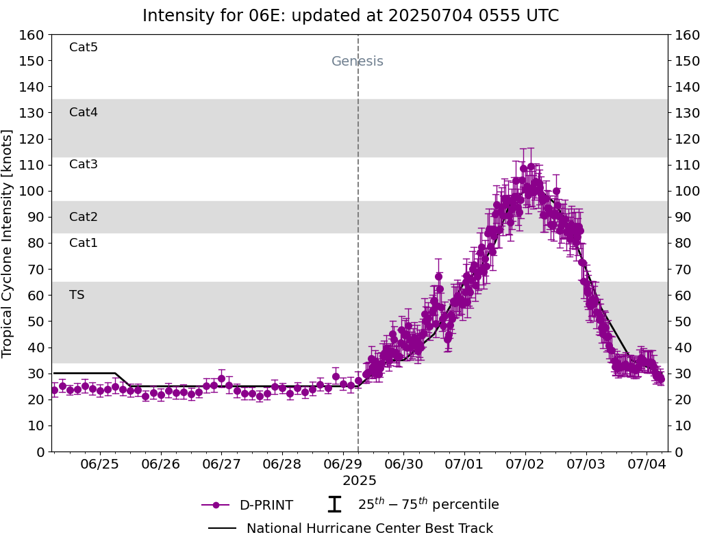
ADT
|
| Date |
Time |
Vmax |
MSLP |
| 04Jul2025 |
0540UTC |
25 kts |
1008 hPa |
| Scene |
CI# |
FT# |
AdjT# |
RawT# |
Eye T |
Cloud T |
| SHEAR |
1.5 |
1.5 |
1.5 |
1.5 |
15.62C |
8.47C |
|
|
|
|
AiDT
|
| Date |
Time |
Vmax |
|
| 04Jul2025 |
0540UTC |
30 kts |
|
|
|
|
|
DPRINT
|
| Date |
Time |
Vmax |
MSLP |
| 04Jul2025 |
0530UTC |
28 kts |
1005 hPa |
| Vmax 25% |
Vmax 75% |
|
|
| 25 kts |
31 kts |
|
|
|
|
|
|
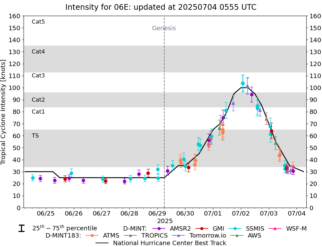
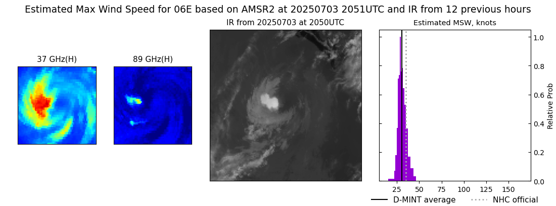
DMINT
|
| Date |
Time |
Vmax |
MSLP |
| 03Jul2025 |
2051UTC |
31 kts |
1005 hPa |
| Vmax 25% |
Vmax 75% |
MW Instr. |
|
| 28 kts |
34 kts |
AMSR2 |
|
|
|
|
|
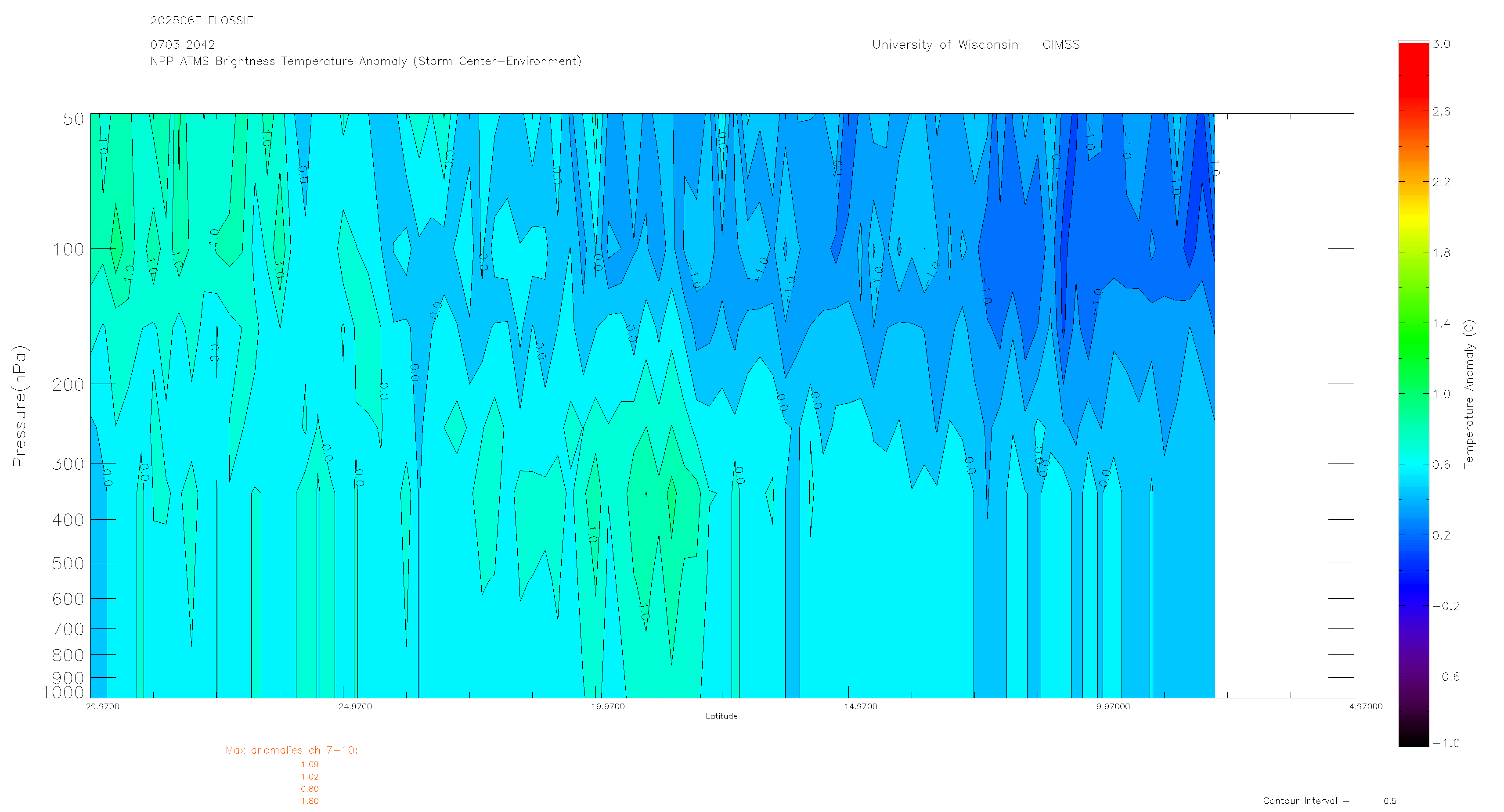
MW Sounders
|
| Date |
Time |
Vmax |
MSLP |
| 03Jul2025 |
2042UTC |
45 kts |
994 hPa |
|
|
|
|
SATCON
|
| Date |
Time |
Vmax |
MSLP |
| 03Jul2025 |
2310UTC |
42 kts |
1001 hPa |
| Consensus Members |
| 2 (ADT+Sounders) |
|
|
|