|
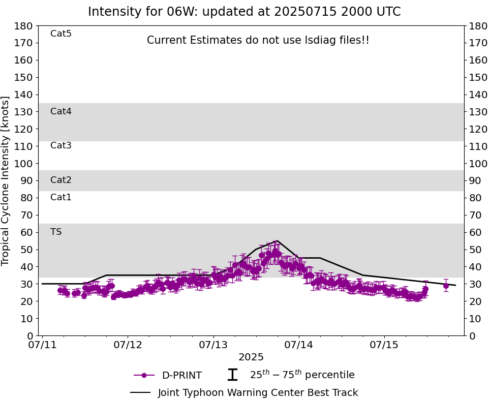
Current Intensity Estimates
|
ADT
|
| Date |
Time |
Vmax |
MSLP |
| 15Jul2025 |
1720UTC |
25 kts |
982 hPa |
| Scene |
CI# |
FT# |
AdjT# |
RawT# |
Eye T |
Cloud T |
| SHEAR |
1.5 |
1.5 |
1.5 |
1.5 |
9.24C |
-3.58C |
|
|
|
|
AiDT
|
| Date |
Time |
Vmax |
|
| 15Jul2025 |
1720UTC |
40 kts |
|
|
|
|
|
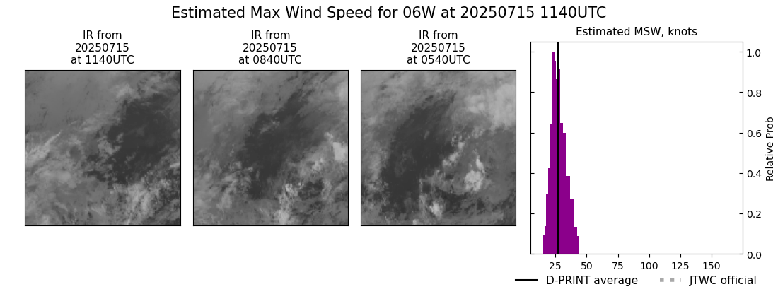
DPRINT
|
| Date |
Time |
Vmax |
MSLP |
| 15Jul2025 |
1140UTC |
27 kts |
998 hPa |
| Vmax 25% |
Vmax 75% |
|
|
| 23 kts |
32 kts |
|
|
|
|
|
|
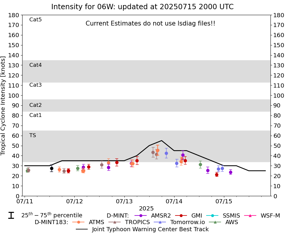
DMINT
|
| Date |
Time |
Vmax |
MSLP |
| 15Jul2025 |
0314UTC |
24 kts |
996 hPa |
| Vmax 25% |
Vmax 75% |
MW Instr. |
|
| 21 kts |
26 kts |
AMSR2 |
|
|
|
|
|
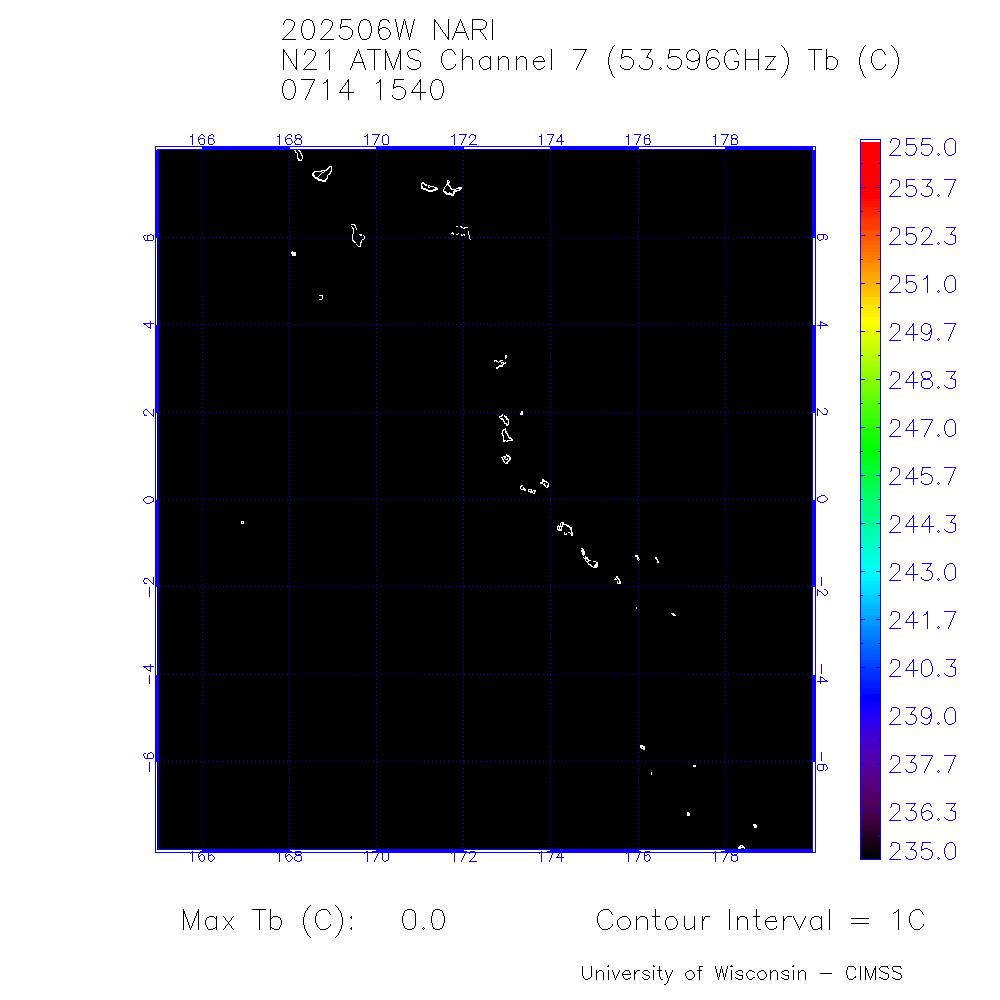
MW Sounders
|
| Date |
Time |
Vmax |
MSLP |
| 14Jul2025 |
1540UTC |
31 kts |
1001 hPa |
|
|
|
|
SATCON
|
| Date |
Time |
Vmax |
MSLP |
| 15Jul2025 |
1000UTC |
48 kts |
983 hPa |
| Consensus Members |
| 2 (ADT+Sounders) |
|
|
|