|
Current Intensity Estimates
|
ADT
|
| Date |
Time |
Vmax |
MSLP |
| 14Jul2025 |
2250UTC |
25 kts |
993 hPa |
| Scene |
CI# |
FT# |
AdjT# |
RawT# |
Eye T |
Cloud T |
| SHEAR |
1.5 |
1.5 |
1.5 |
1.5 |
21.54C |
18.84C |
|
|
|
|
AiDT
|
| Date |
Time |
Vmax |
|
| 14Jul2025 |
2250UTC |
34 kts |
|
|
|
|
|
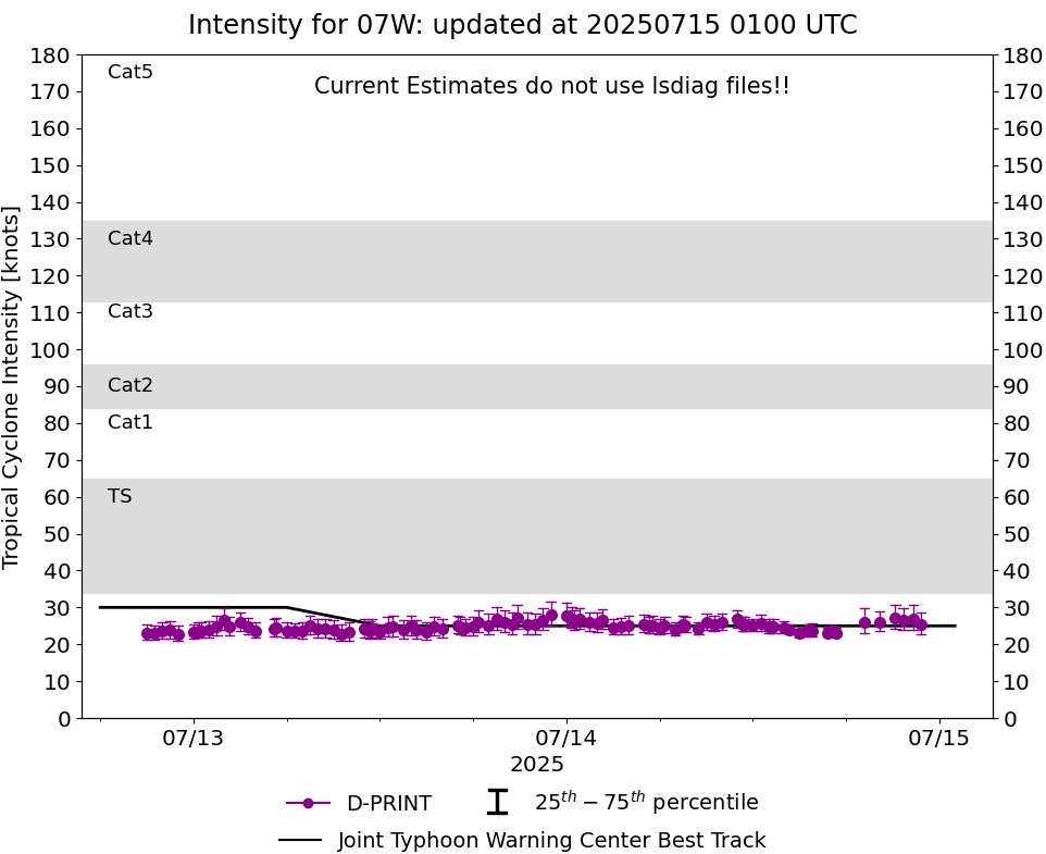
DPRINT
|
| Date |
Time |
Vmax |
MSLP |
| 14Jul2025 |
2250UTC |
25 kts |
NaN hPa |
| Vmax 25% |
Vmax 75% |
|
|
| 23 kts |
29 kts |
|
|
|
|
|
|
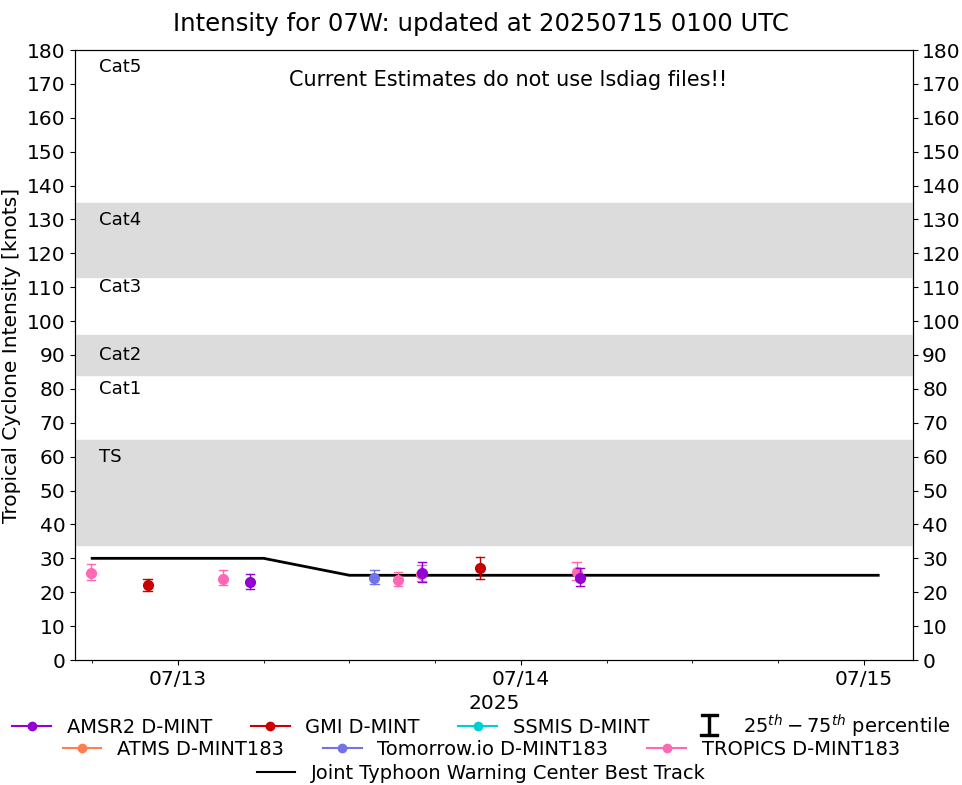
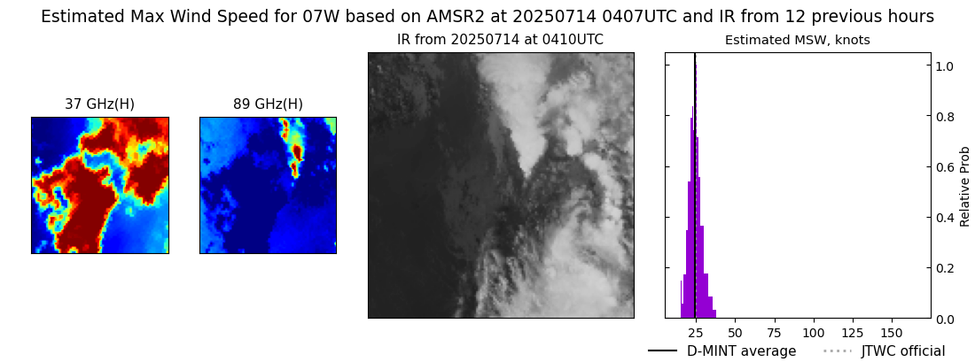
DMINT
|
| Date |
Time |
Vmax |
MSLP |
| 14Jul2025 |
0407UTC |
24 kts |
995 hPa |
| Vmax 25% |
Vmax 75% |
MW Instr. |
|
| 22 kts |
27 kts |
AMSR2 |
|
|
|
|
|
MW Sounders
|
| Date |
Time |
Vmax |
MSLP |
| 14Jul2025 |
0345UTC |
43 kts |
988 hPa |
|
|
|
|
SATCON
|
| Date |
Time |
Vmax |
MSLP |
| 14Jul2025 |
1100UTC |
56 kts |
977 hPa |
| Consensus Members |
| 2 (ADT+Sounders) |
|
|
|