|
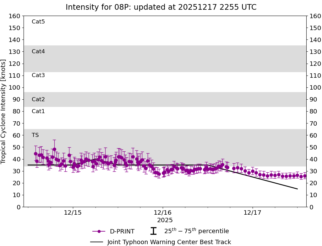
Current Intensity Estimates
|
ADT
|
| Date |
Time |
Vmax |
MSLP |
| 16Dec2025 |
1700UTC |
35 kts |
1006 hPa |
| Scene |
CI# |
FT# |
AdjT# |
RawT# |
Eye T |
Cloud T |
| SHEAR |
2.5 |
2.2 |
2.4 |
2.4 |
14.14C |
5.00C |
|
|
|
|
AiDT
|
| Date |
Time |
Vmax |
|
| 16Dec2025 |
1700UTC |
34 kts |
|
|
|
|
|
DPRINT
|
| Date |
Time |
Vmax |
MSLP |
| 16Dec2025 |
1700UTC |
33 kts |
1001 hPa |
| Vmax 25% |
Vmax 75% |
|
|
| 30 kts |
38 kts |
|
|
|
|
|
|
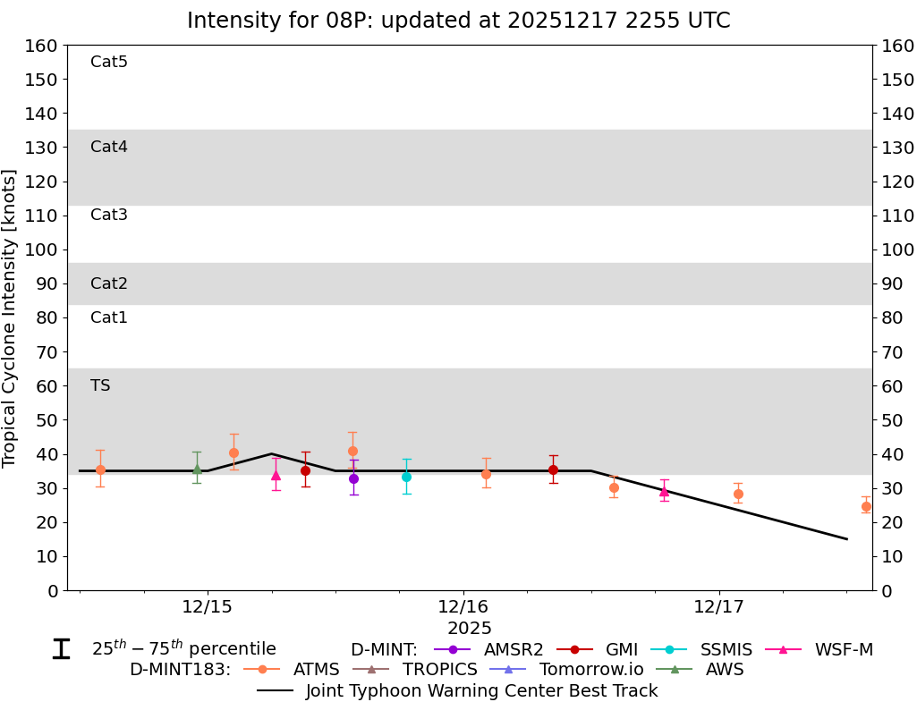
DMINT
|
| Date |
Time |
Vmax |
MSLP |
| 16Dec2025 |
1406UTC |
30 kts |
1003 hPa |
| Vmax 25% |
Vmax 75% |
MW Instr. |
|
| 27 kts |
34 kts |
ATMS-N21 |
|
|
|
|
|
MW Sounders
|
| Date |
Time |
Vmax |
MSLP |
| 16Dec2025 |
1406UTC |
39 kts |
1000 hPa |
|
|
|
|
SATCON
|
| Date |
Time |
Vmax |
MSLP |
| 16Dec2025 |
1600UTC |
39 kts |
1003 hPa |
| Consensus Members |
| 2 (ADT+Sounders) |
|
|
|