|
Current Intensity Estimates
|
ADT
|
| Date |
Time |
Vmax |
MSLP |
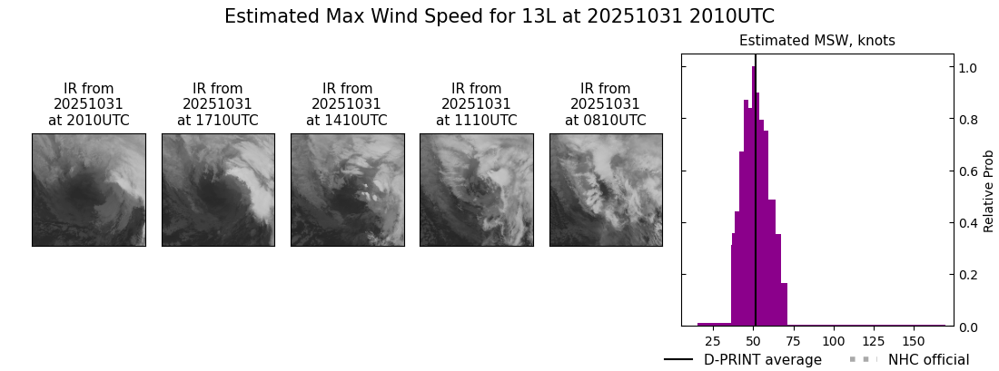
| 31Oct2025 |
2010UTC |
43 kts |
965 hPa |
| Scene |
CI# |
FT# |
AdjT# |
RawT# |
Eye T |
Cloud T |
| SHEAR |
2.9 |
2.4 |
2.2 |
1.5 |
17.97C |
12.82C |
|
|
|
|
AiDT
|
| Date |
Time |
Vmax |
|
| 31Oct2025 |
2010UTC |
39 kts |
|
|
|
|
|
DPRINT
|
| Date |
Time |
Vmax |
MSLP |
| 31Oct2025 |
2010UTC |
52 kts |
969 hPa |
| Vmax 25% |
Vmax 75% |
|
|
| 45 kts |
58 kts |
|
|
|
|
|
|
DMINT
|
| Date |
Time |
Vmax |
MSLP |
| 31Oct2025 |
1902UTC |
63 kts |
970 hPa |
| Vmax 25% |
Vmax 75% |
MW Instr. |
|
| 56 kts |
71 kts |
SSMISF18 |
|
|
|
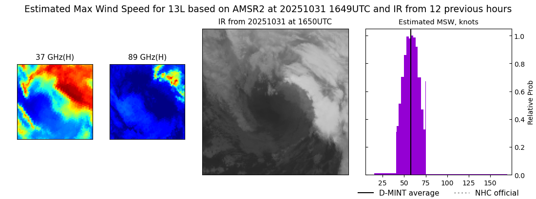
| Date |
Time |
Vmax |
MSLP |
| 31Oct2025 |
1649UTC |
58 kts |
972 hPa |
| Vmax 25% |
Vmax 75% |
MW Instr. |
|
| 51 kts |
65 kts |
AMSR2 |
|
|
|
|
|
|
MW Sounders
|
| Date |
Time |
Vmax |
MSLP |
| 31Oct2025 |
1656UTC |
56 kts |
962 hPa |
|
|
|
|
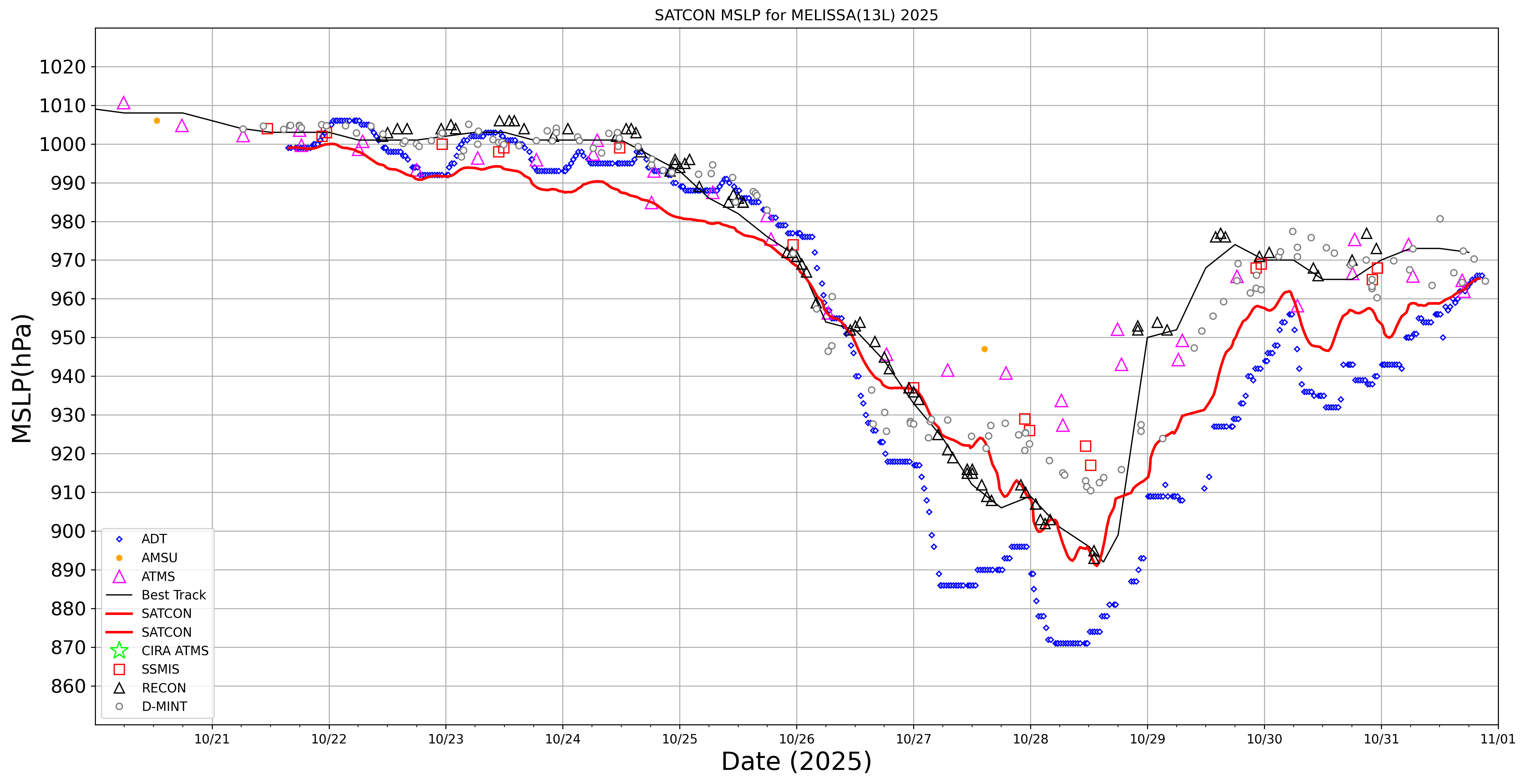
SATCON
|
| Date |
Time |
Vmax |
MSLP |
| 31Oct2025 |
2010UTC |
52 kts |
965 hPa |
| Consensus Members |
| 2 (ADT+Sounders) |
|
|
|