|
Current Intensity Estimates
|
ADT
|
| Date |
Time |
Vmax |
MSLP |
| 11Jan2026 |
1110UTC |
N/A kts |
N/A hPa |
| Scene |
CI# |
FT# |
AdjT# |
RawT# |
Eye T |
Cloud T |
| LAND |
N/A |
N/A |
N/A |
N/A |
N/AC |
N/AC |
|
|
|
|
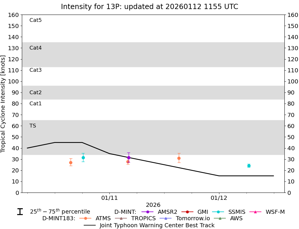
AiDT
|
| Date |
Time |
Vmax |
|
| 10Jan2026 |
2130UTC |
32 kts |
|
|
|
|
|
DPRINT
|
| Date |
Time |
Vmax |
MSLP |
| 11Jan2026 |
1110UTC |
36 kts |
990 hPa |
| Vmax 25% |
Vmax 75% |
|
|
| 32 kts |
41 kts |
|
|
|
|
|
|
DMINT
|
| Date |
Time |
Vmax |
MSLP |
| 11Jan2026 |
0411UTC |
31 kts |
994 hPa |
| Vmax 25% |
Vmax 75% |
MW Instr. |
|
| 27 kts |
36 kts |
AMSR2 |
|
|
|
|
|
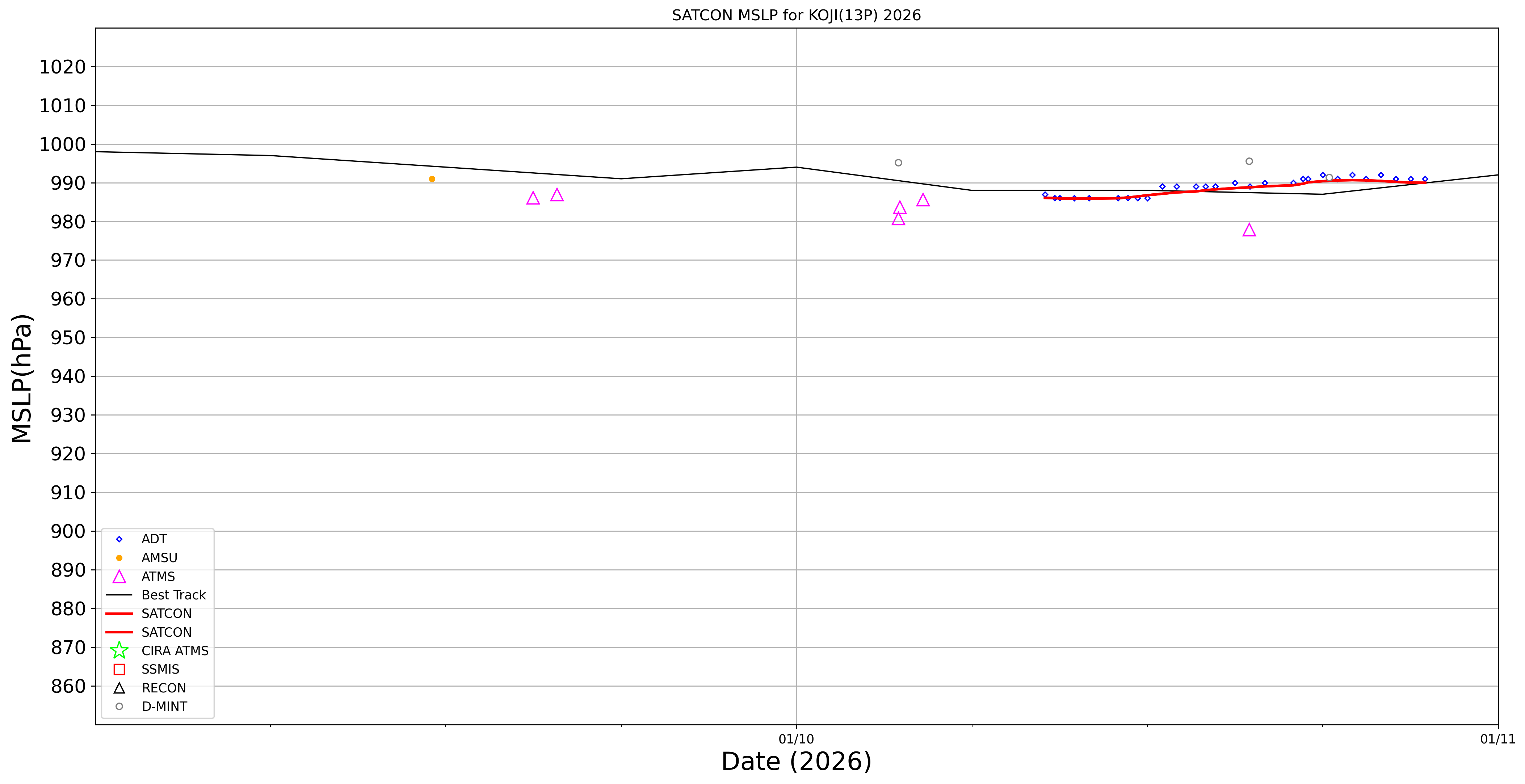
MW Sounders
|
| Date |
Time |
Vmax |
MSLP |
| 11Jan2026 |
0400UTC |
51 kts |
978 hPa |
|
|
|
|
SATCON
|
| Date |
Time |
Vmax |
MSLP |
| 10Jan2026 |
2130UTC |
42 kts |
986 hPa |
| Consensus Members |
| 2 (ADT+Sounders) |
|
|
|