|
Current Intensity Estimates
|
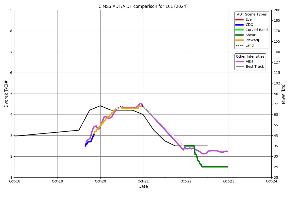
ADT
|
| Date |
Time |
Vmax |
MSLP |
| 22Oct2024 |
2310UTC |
25 kts |
1005 hPa |
| Scene |
CI# |
FT# |
AdjT# |
RawT# |
Eye T |
Cloud T |
| SHEAR |
1.5 |
1.5 |
1.5 |
1.5 |
16.61C |
12.17C |
|
|
|
|
AiDT
|
| Date |
Time |
Vmax |
|
| 22Oct2024 |
2310UTC |
32 kts |
|
|
|
|
|
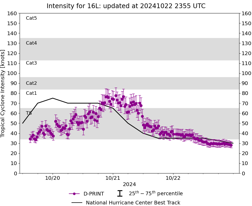
DPRINT
|
| Date |
Time |
Vmax |
MSLP |
| 22Oct2024 |
2310UTC |
28 kts |
1006 hPa |
| Vmax 25% |
Vmax 75% |
|
|
| 25 kts |
31 kts |
|
|
|
|
|
|
DMINT
|
| Date |
Time |
Vmax |
MSLP |
| 22Oct2024 |
1110UTC |
37 kts |
1005 hPa |
| Vmax 25% |
Vmax 75% |
MW Instr. |
|
| 33 kts |
41 kts |
SSMISF17 |
|
|
|
|
|
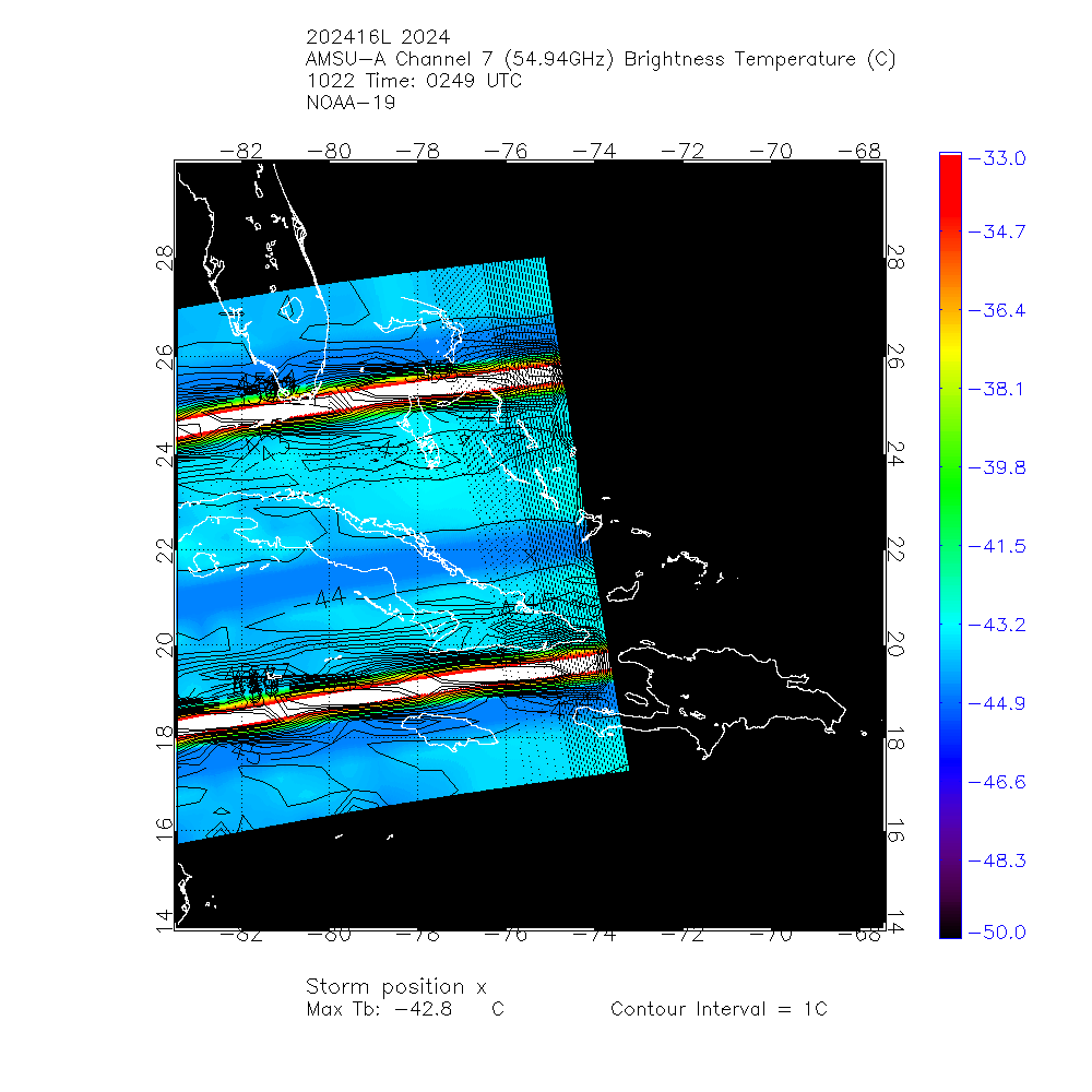
MW Sounders
|
| Date |
Time |
Vmax |
MSLP |
| 22Oct2024 |
2227UTC |
57 kts |
990 hPa |
|
|
|
|
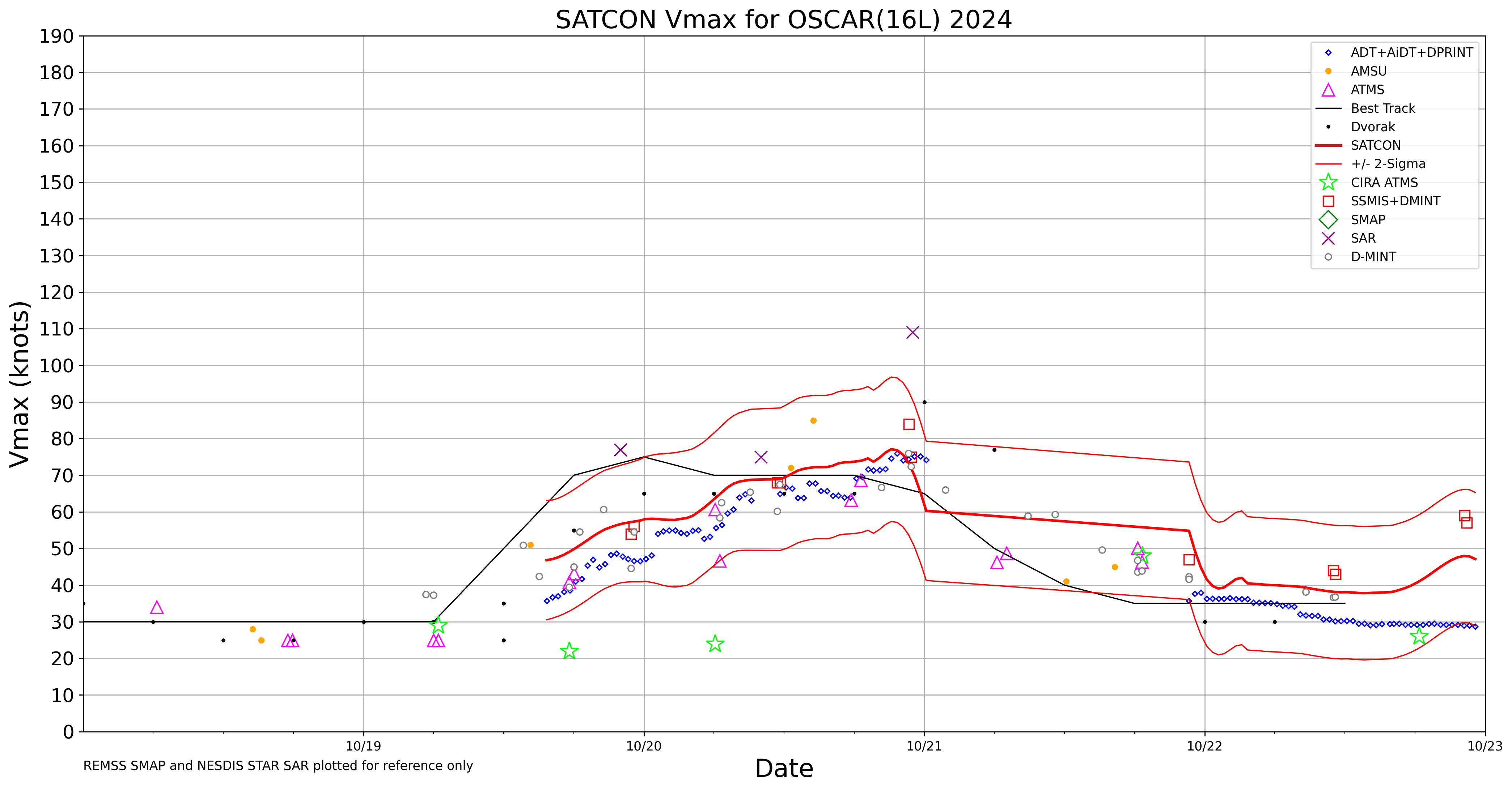
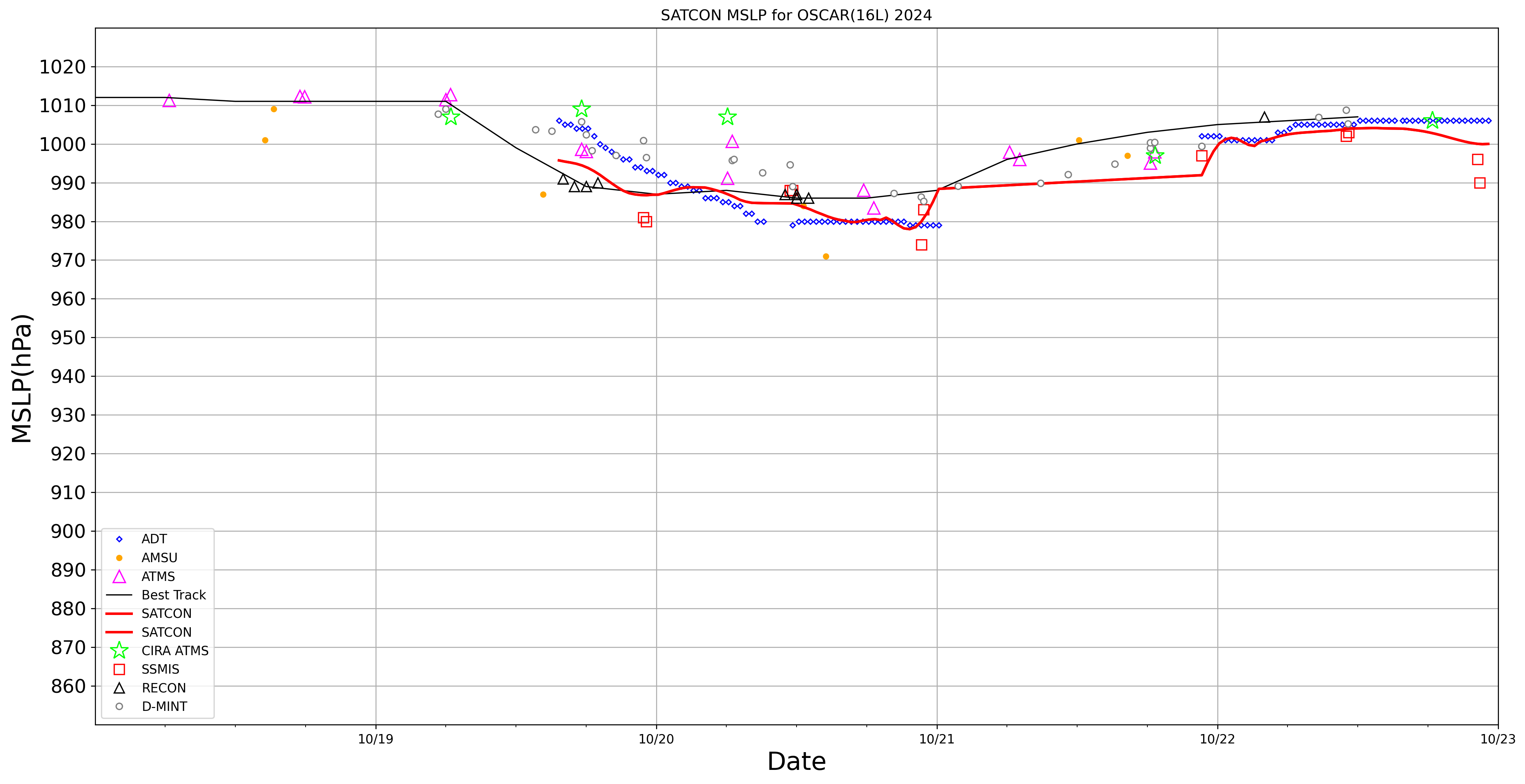
SATCON
|
| Date |
Time |
Vmax |
MSLP |
| 22Oct2024 |
2240UTC |
48 kts |
1000 hPa |
| Consensus Members |
| 2 (ADT+Sounders) |
|
|
|