|
Current Intensity Estimates
|
ADT
|
| Date |
Time |
Vmax |
MSLP |
| 23Jan2026 |
2310UTC |
31 kts |
996 hPa |
| Scene |
CI# |
FT# |
AdjT# |
RawT# |
Eye T |
Cloud T |
| CRVBND |
2.1 |
2.1 |
2.1 |
2.1 |
19.48C |
16.02C |
|
|
|
|
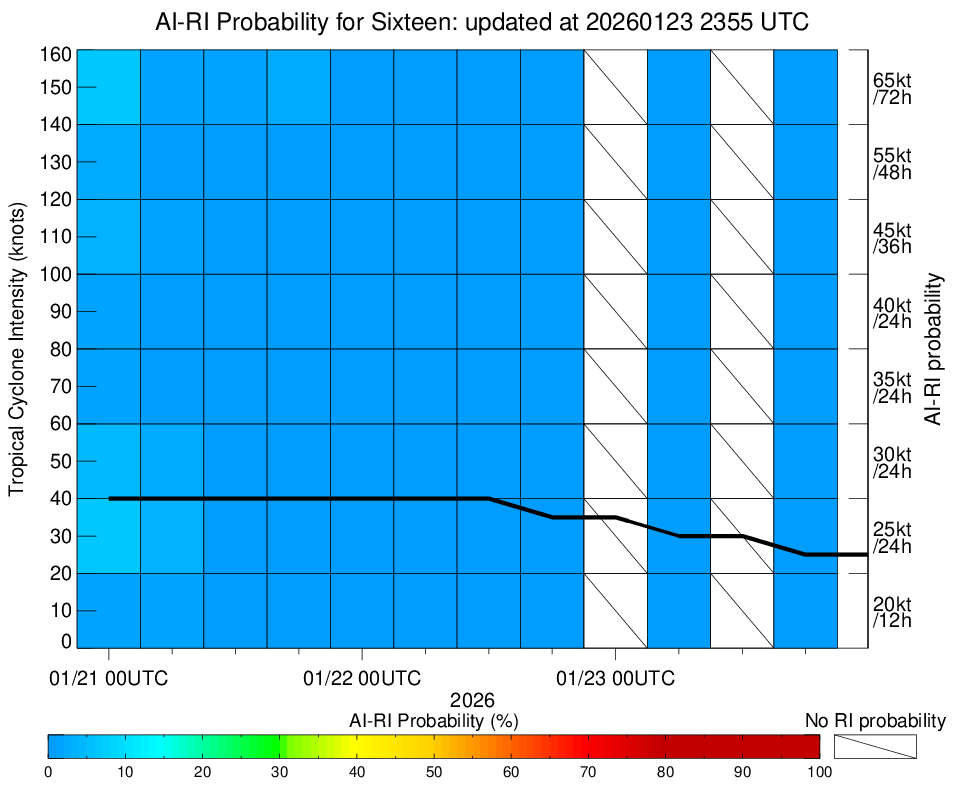
AiDT
|
| Date |
Time |
Vmax |
|
| 23Jan2026 |
2310UTC |
35 kts |
|
|
|
|
|
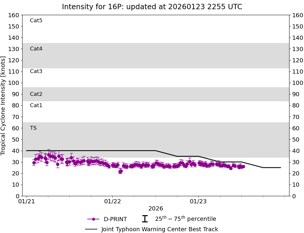
DPRINT
|
| Date |
Time |
Vmax |
MSLP |
| 23Jan2026 |
1230UTC |
26 kts |
994 hPa |
| Vmax 25% |
Vmax 75% |
|
|
| 25 kts |
27 kts |
|
|
|
|
|
|
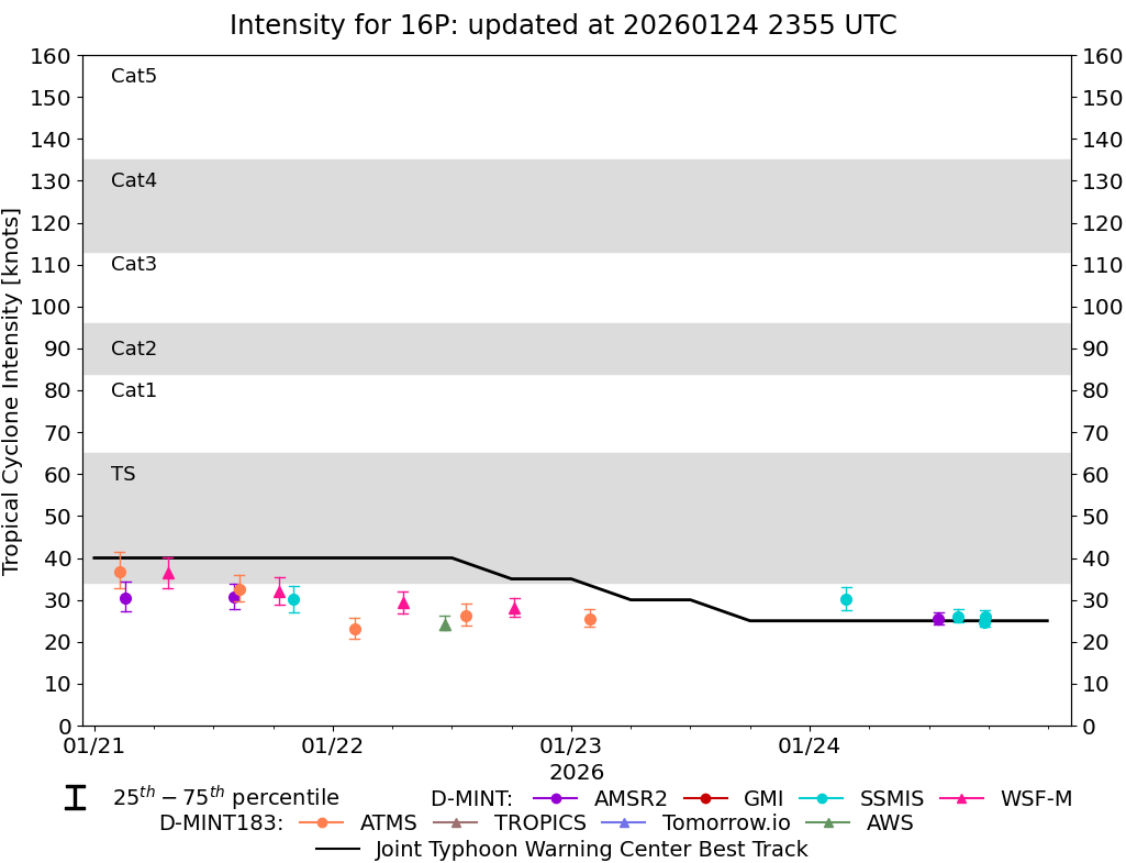
DMINT
|
| Date |
Time |
Vmax |
MSLP |
| 23Jan2026 |
0151UTC |
25 kts |
1000 hPa |
| Vmax 25% |
Vmax 75% |
MW Instr. |
|
| 24 kts |
28 kts |
ATMS-N20 |
|
|
|
|
|
MW Sounders
|
| Date |
Time |
Vmax |
MSLP |
| 23Jan2026 |
0151UTC |
41 kts |
997 hPa |
|
|
|
|
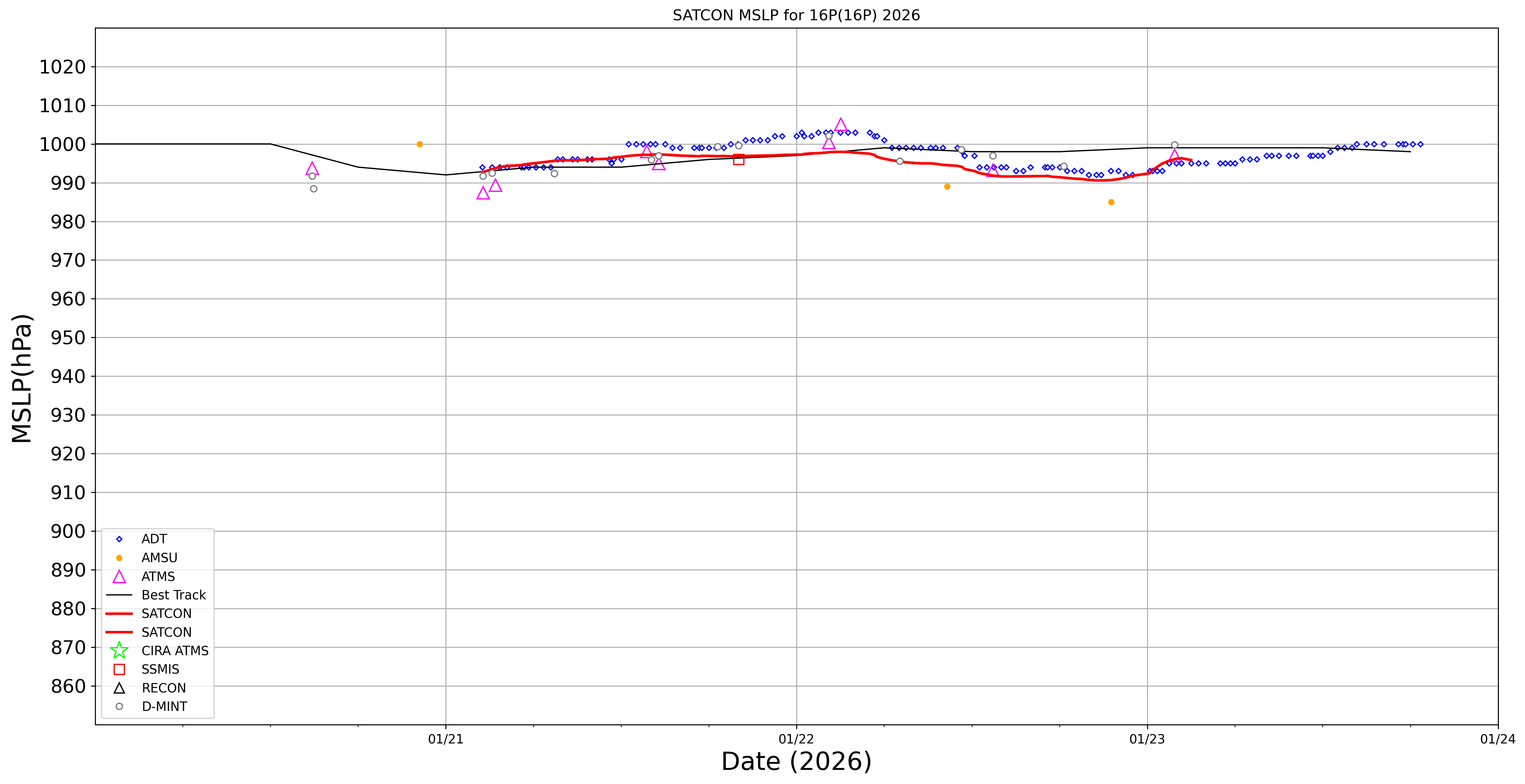
SATCON
|
| Date |
Time |
Vmax |
MSLP |
| 23Jan2026 |
0300UTC |
41 kts |
996 hPa |
| Consensus Members |
| 2 (ADT+Sounders) |
|
|
|