|
Current Intensity Estimates
|
ADT
|
| Date |
Time |
Vmax |
MSLP |
| 04Feb2026 |
1630UTC |
25 kts |
1005 hPa |
| Scene |
CI# |
FT# |
AdjT# |
RawT# |
Eye T |
Cloud T |
| SHEAR |
1.5 |
1.5 |
1.5 |
1.5 |
19.02C |
12.23C |
|
|
|
|
AiDT
|
| Date |
Time |
Vmax |
|
| 04Feb2026 |
1630UTC |
36 kts |
|
|
|
|
|
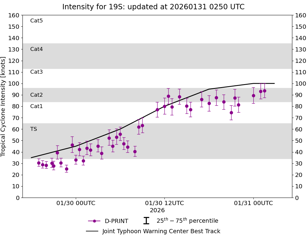
DPRINT
|
| Date |
Time |
Vmax |
MSLP |
| 04Feb2026 |
1700UTC |
29 kts |
998 hPa |
| Vmax 25% |
Vmax 75% |
|
|
| 26 kts |
32 kts |
|
|
|
|
|
|
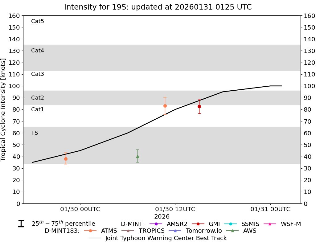
DMINT
|
| Date |
Time |
Vmax |
MSLP |
| 04Feb2026 |
1431UTC |
22 kts |
997 hPa |
| Vmax 25% |
Vmax 75% |
MW Instr. |
|
| 20 kts |
24 kts |
WSFM01 |
|
|
|
|
|
MW Sounders
|
| Date |
Time |
Vmax |
MSLP |
| 04Feb2026 |
0955UTC |
39 kts |
997 hPa |
|
|
|
|
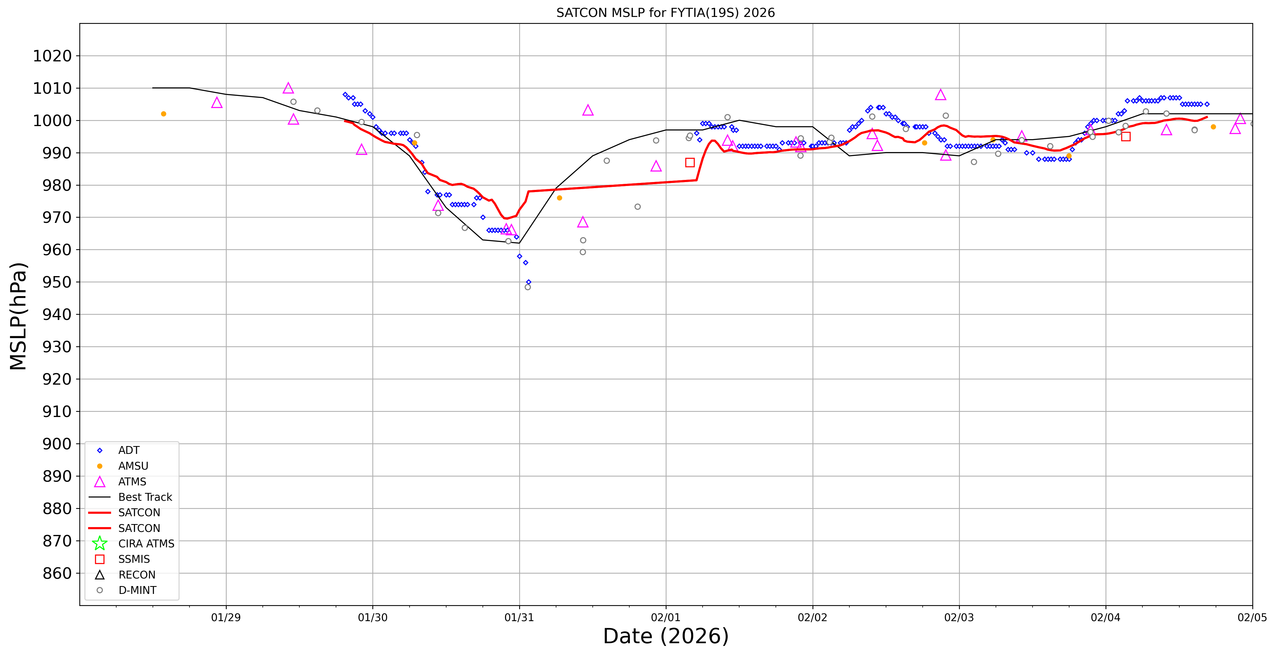
SATCON
|
| Date |
Time |
Vmax |
MSLP |
| 04Feb2026 |
1200UTC |
35 kts |
1001 hPa |
| Consensus Members |
| 2 (ADT+Sounders) |
|
|
|