|
Current Intensity Estimates
|
ADT
|
| Date |
Time |
Vmax |
MSLP |
| 29Mar2024 |
0430UTC |
N/A kts |
N/A hPa |
| Scene |
CI# |
FT# |
AdjT# |
RawT# |
Eye T |
Cloud T |
| LAND |
N/A |
N/A |
N/A |
N/A |
N/AC |
N/AC |
|
|
|
|
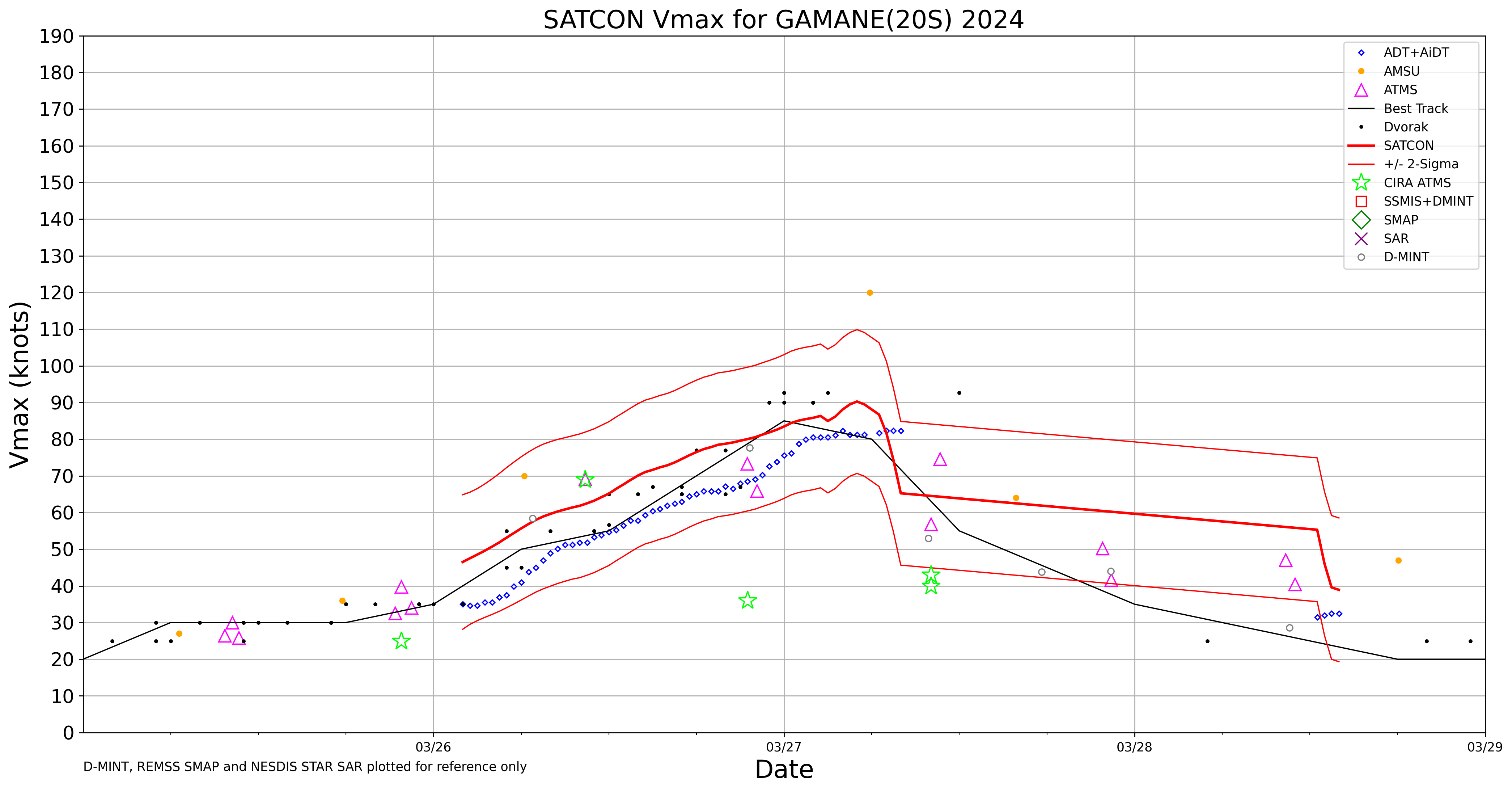
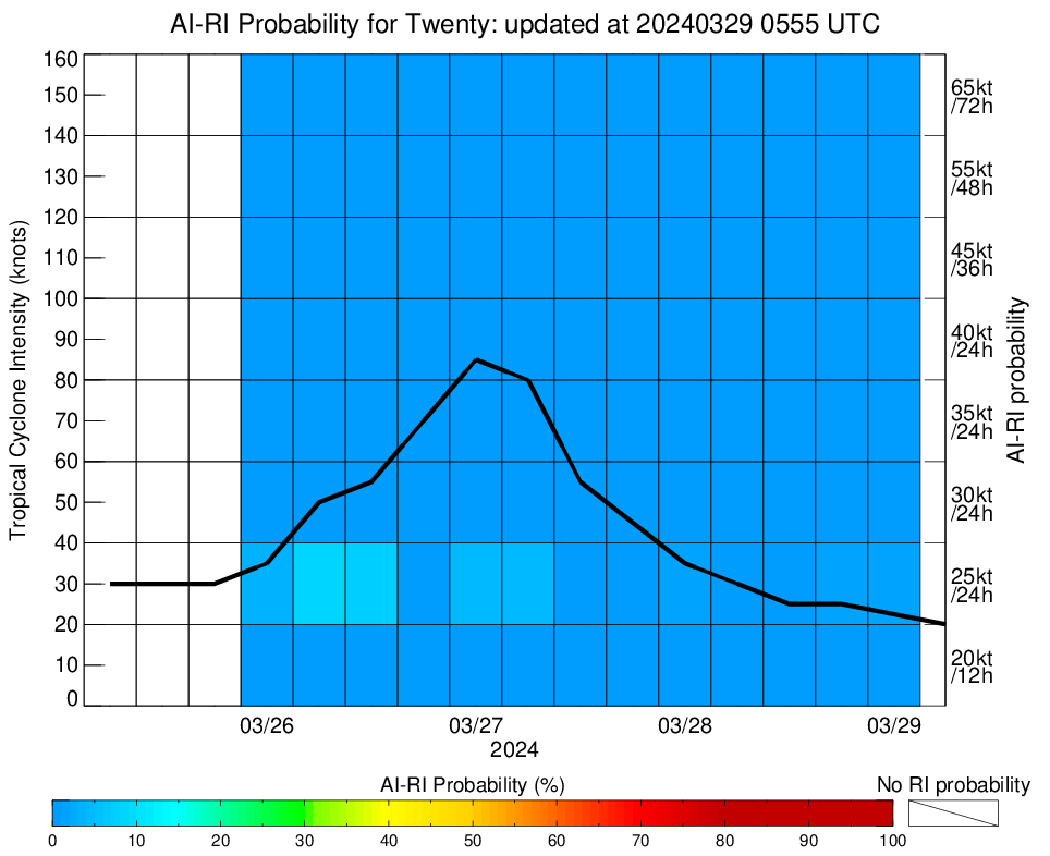
AiDT
|
| Date |
Time |
Vmax |
|
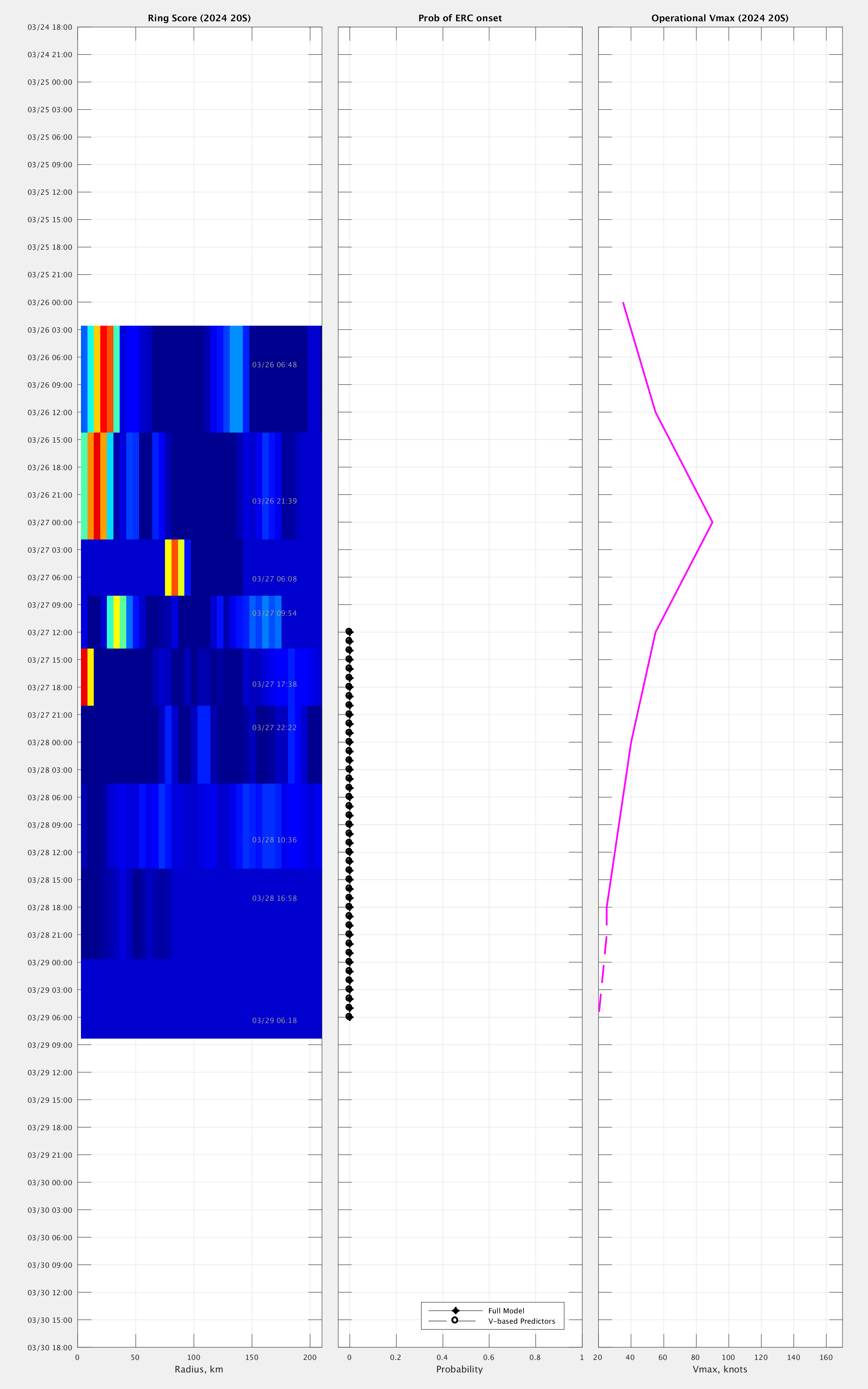
| 28Mar2024 |
1400UTC |
33 kts |
|
|
|
|
|
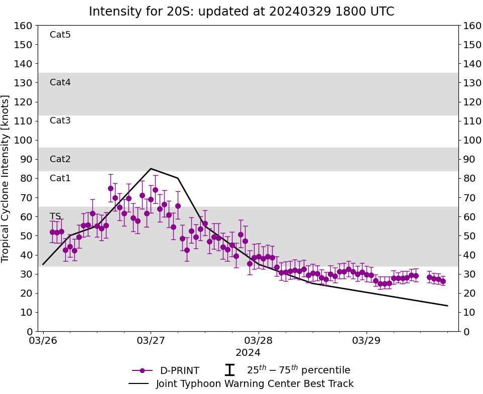
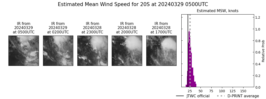
DPRINT
|
| Date |
Time |
Vmax |
MSLP |
| 29Mar2024 |
0500UTC |
25 kts |
1005 hPa |
| Vmax 25% |
Vmax 75% |
|
|
| 22 kts |
29 kts |
|
|
|
|
|
|
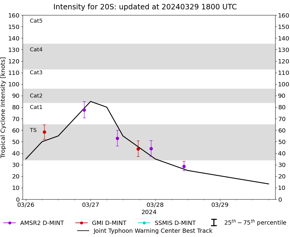
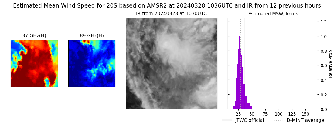
DMINT
|
| Date |
Time |
Vmax |
MSLP |
| 28Mar2024 |
1036UTC |
29 kts |
1001 hPa |
| Vmax 25% |
Vmax 75% |
MW Instr. |
|
| 25 kts |
33 kts |
AMSR2 |
|
|
|
|
|
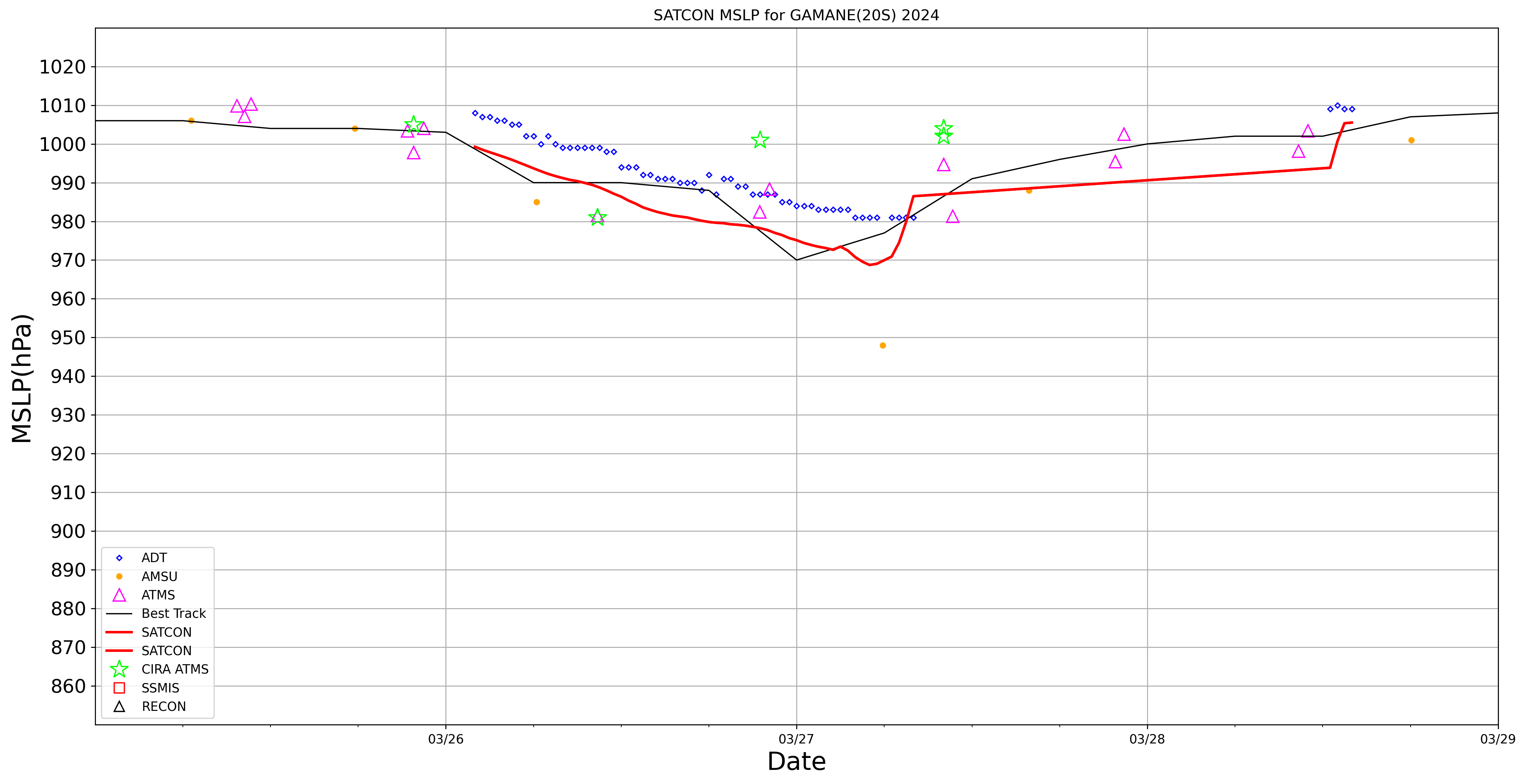
MW Sounders
|
| Date |
Time |
Vmax |
MSLP |
| 28Mar2024 |
1058UTC |
40 kts |
1003 hPa |
|
|
|
|
SATCON
|
| Date |
Time |
Vmax |
MSLP |
| 28Mar2024 |
1400UTC |
40 kts |
1005 hPa |
| Consensus Members |
| 2 (ADT+Sounders) |
|
|
|