|
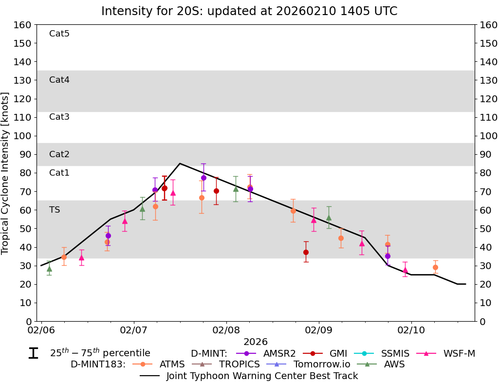
Current Intensity Estimates
|
ADT
|
| Date |
Time |
Vmax |
MSLP |
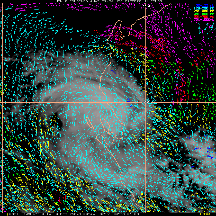
| 09Feb2026 |
2250UTC |
N/A kts |
N/A hPa |
| Scene |
CI# |
FT# |
AdjT# |
RawT# |
Eye T |
Cloud T |
| LAND |
N/A |
N/A |
N/A |
N/A |
N/AC |
N/AC |
|
|
|
|
AiDT
|
| Date |
Time |
Vmax |
|
| 09Feb2026 |
1420UTC |
45 kts |
|
|
|
|
|
DPRINT
|
| Date |
Time |
Vmax |
MSLP |
| 09Feb2026 |
2250UTC |
35 kts |
990 hPa |
| Vmax 25% |
Vmax 75% |
|
|
| 30 kts |
40 kts |
|
|
|
|
|
|
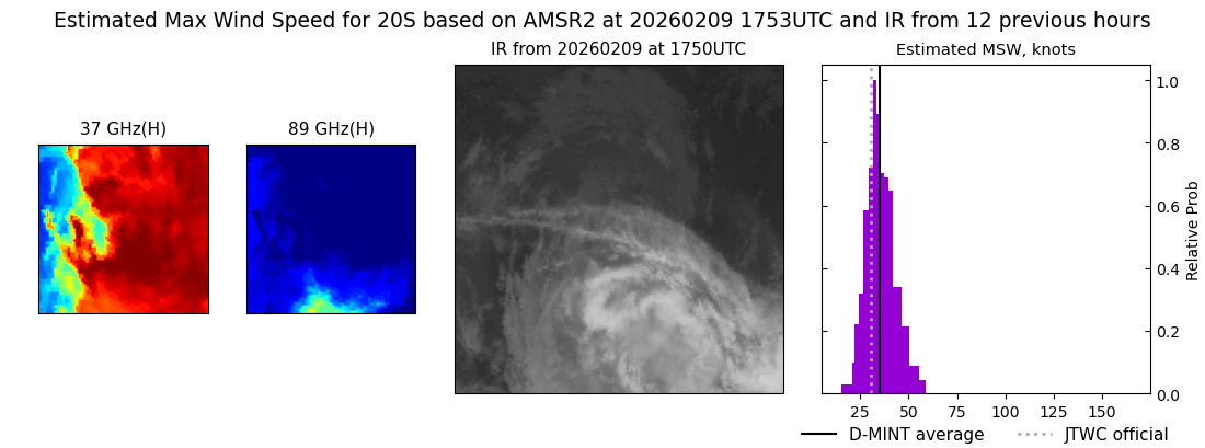
DMINT
|
| Date |
Time |
Vmax |
MSLP |
| 09Feb2026 |
1753UTC |
35 kts |
991 hPa |
| Vmax 25% |
Vmax 75% |
MW Instr. |
|
| 31 kts |
41 kts |
AMSR2 |
|
|
|
| Date |
Time |
Vmax |
MSLP |
| 09Feb2026 |
1751UTC |
41 kts |
989 hPa |
| Vmax 25% |
Vmax 75% |
MW Instr. |
|
| 37 kts |
46 kts |
ATMS-N20 |
|
|
|
|
|
|
MW Sounders
|
| Date |
Time |
Vmax |
MSLP |
| 09Feb2026 |
1751UTC |
44 kts |
990 hPa |
|
|
|
|
SATCON
|
| Date |
Time |
Vmax |
MSLP |
| 09Feb2026 |
1420UTC |
46 kts |
989 hPa |
| Consensus Members |
| 3 (ADT+Sounders) |
|
|
|