|
Current Intensity Estimates
|
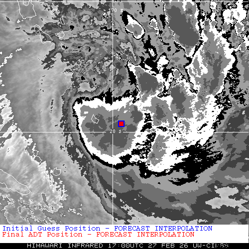
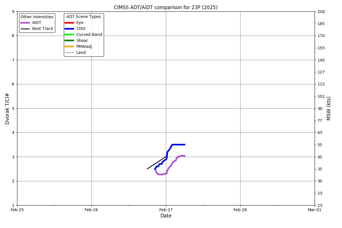
ADT
|
| Date |
Time |
Vmax |
MSLP |
| 27Feb2026 |
1330UTC |
63 kts |
982 hPa |
| Scene |
CI# |
FT# |
AdjT# |
RawT# |
Eye T |
Cloud T |
| UNIFRM |
3.9 |
3.9 |
3.9 |
3.9 |
-82.87C |
-80.66C |
|
|
|
|
AiDT
|
| Date |
Time |
Vmax |
|
| 27Feb2026 |
1330UTC |
52 kts |
|
|
|
|
|
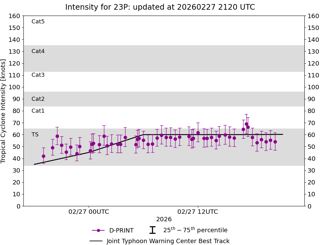
DPRINT
|
| Date |
Time |
Vmax |
MSLP |
| 27Feb2026 |
1330UTC |
58 kts |
984 hPa |
| Vmax 25% |
Vmax 75% |
|
|
| 50 kts |
66 kts |
|
|
|
|
|
|
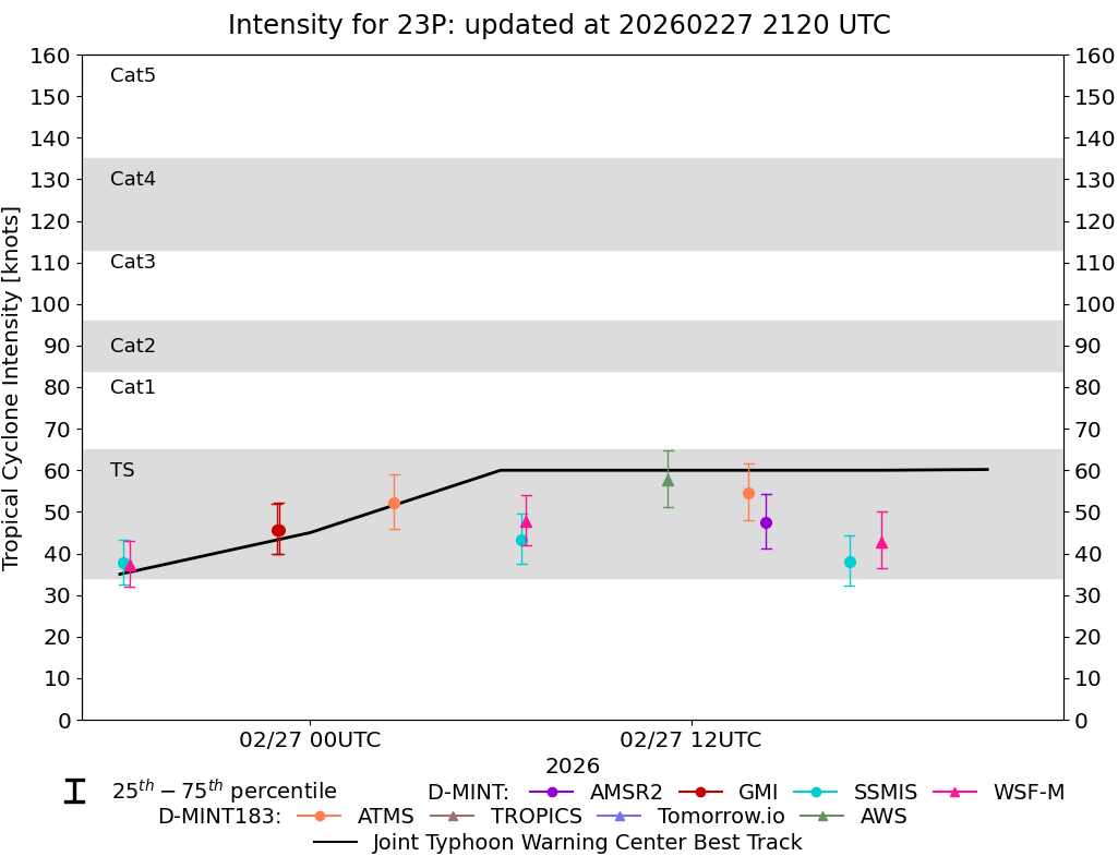
DMINT
|
| Date |
Time |
Vmax |
MSLP |
| 27Feb2026 |
1116UTC |
58 kts |
983 hPa |
| Vmax 25% |
Vmax 75% |
MW Instr. |
|
| 51 kts |
65 kts |
AWS |
|
|
|
|
|
MW Sounders
|
| Date |
Time |
Vmax |
MSLP |
| 27Feb2026 |
0641UTC |
45 kts |
986 hPa |
|
|
|
|
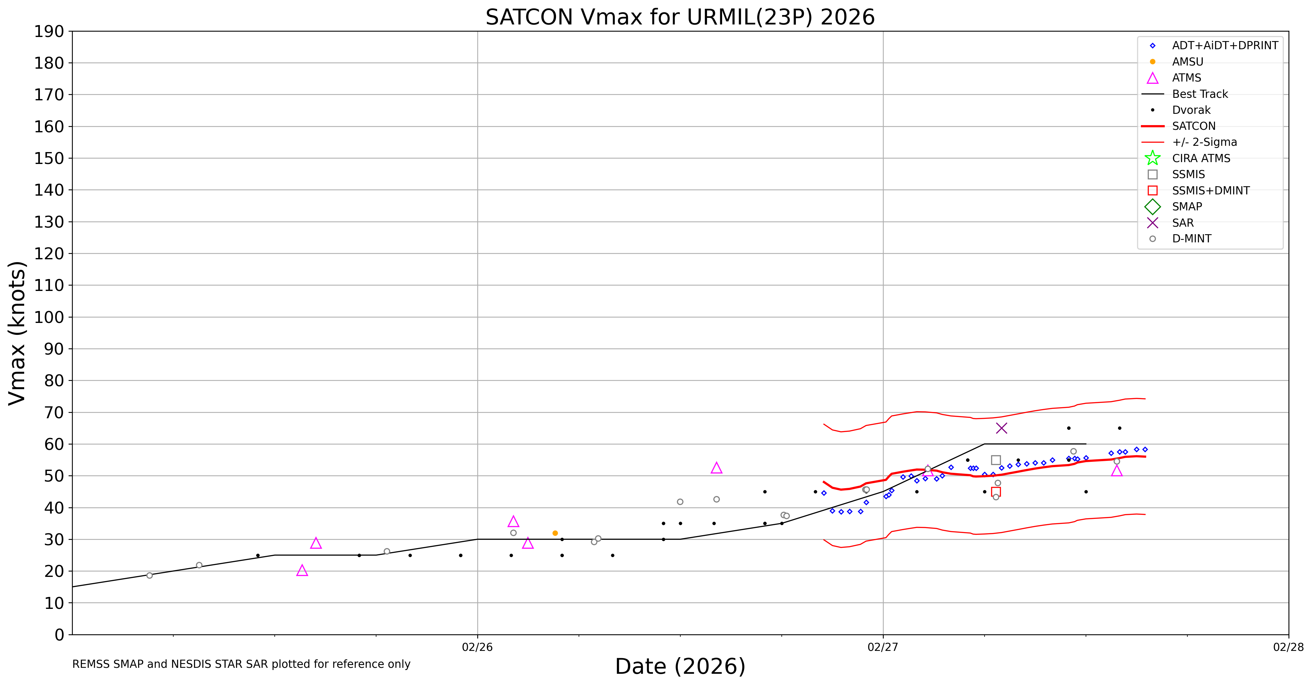
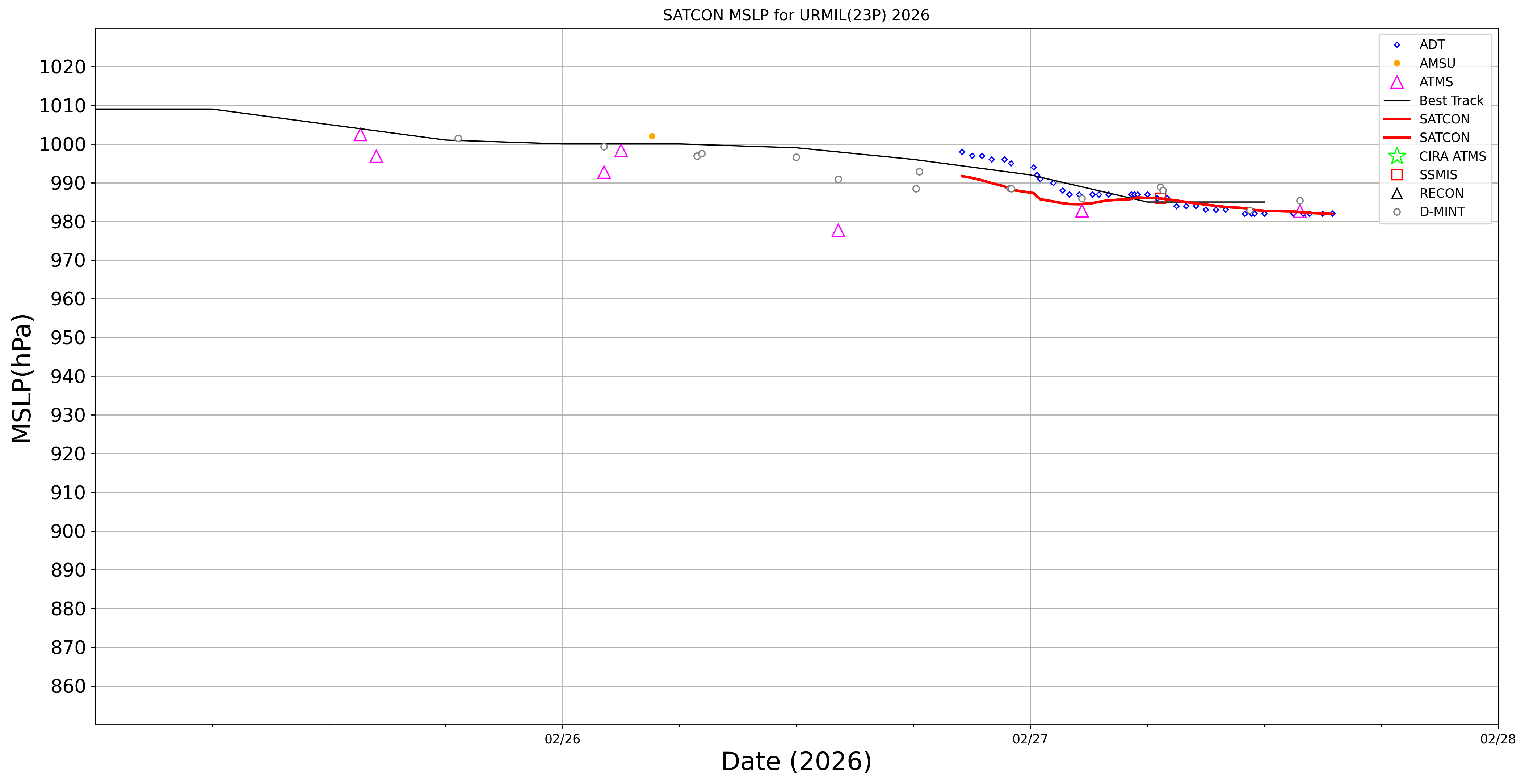
SATCON
|
| Date |
Time |
Vmax |
MSLP |
| 27Feb2026 |
0930UTC |
50 kts |
985 hPa |
| Consensus Members |
| 2 (ADT+Sounders) |
|
|
|