|
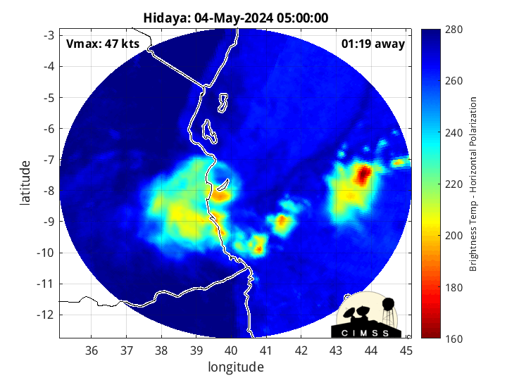
Current Intensity Estimates
|
ADT
|
| Date |
Time |
Vmax |
MSLP |
| 04May2024 |
1930UTC |
N/A kts |
N/A hPa |
| Scene |
CI# |
FT# |
AdjT# |
RawT# |
Eye T |
Cloud T |
| LAND |
N/A |
N/A |
N/A |
N/A |
N/AC |
N/AC |
|
|
|
|
AiDT
|
| Date |
Time |
Vmax |
|
| 04May2024 |
1230UTC |
36 kts |
|
|
|
|
|
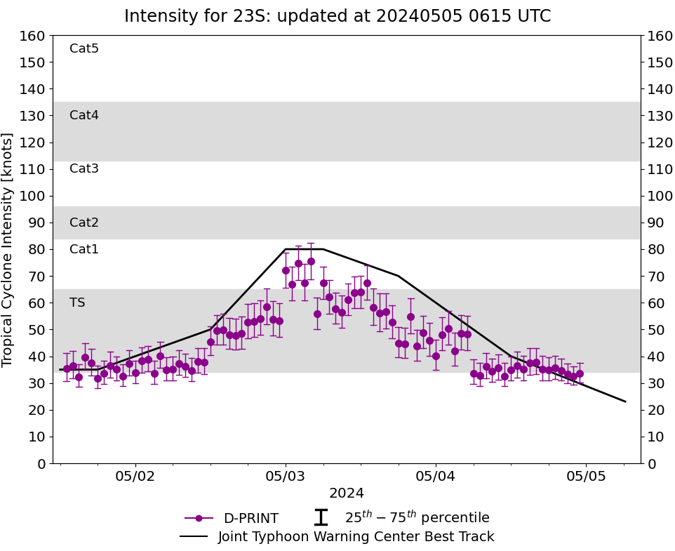
DPRINT
|
| Date |
Time |
Vmax |
MSLP |
| 04May2024 |
2000UTC |
35 kts |
997 hPa |
| Vmax 25% |
Vmax 75% |
|
|
| 31 kts |
39 kts |
|
|
|
|
|
|
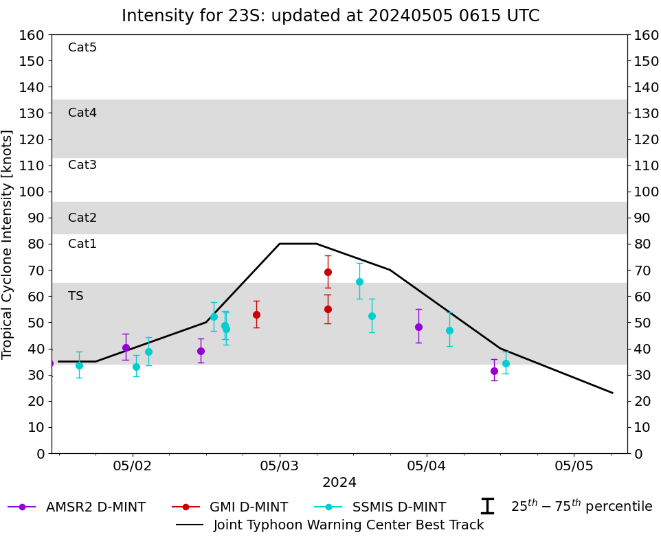
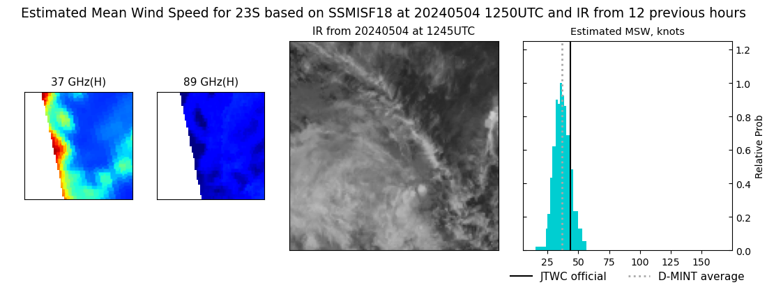
DMINT
|
| Date |
Time |
Vmax |
MSLP |
| 04May2024 |
1250UTC |
34 kts |
996 hPa |
| Vmax 25% |
Vmax 75% |
MW Instr. |
|
| 30 kts |
39 kts |
SSMISF18 |
|
|
|
|
|
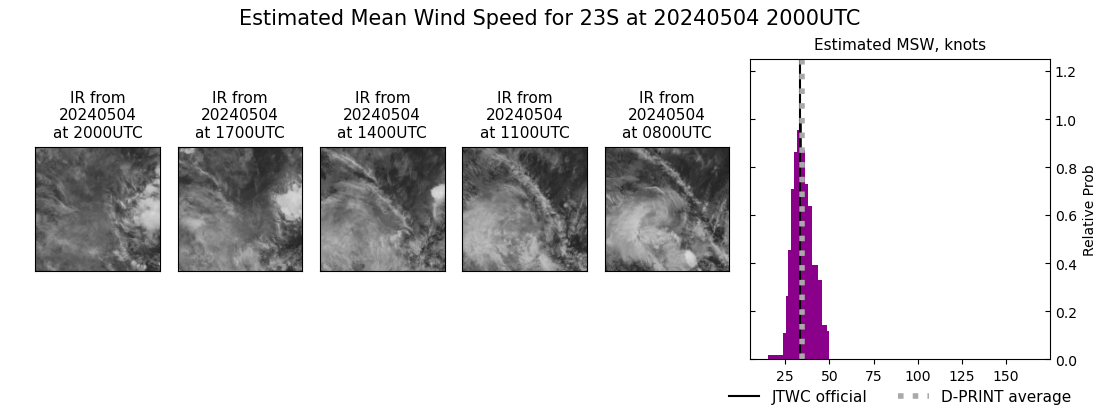
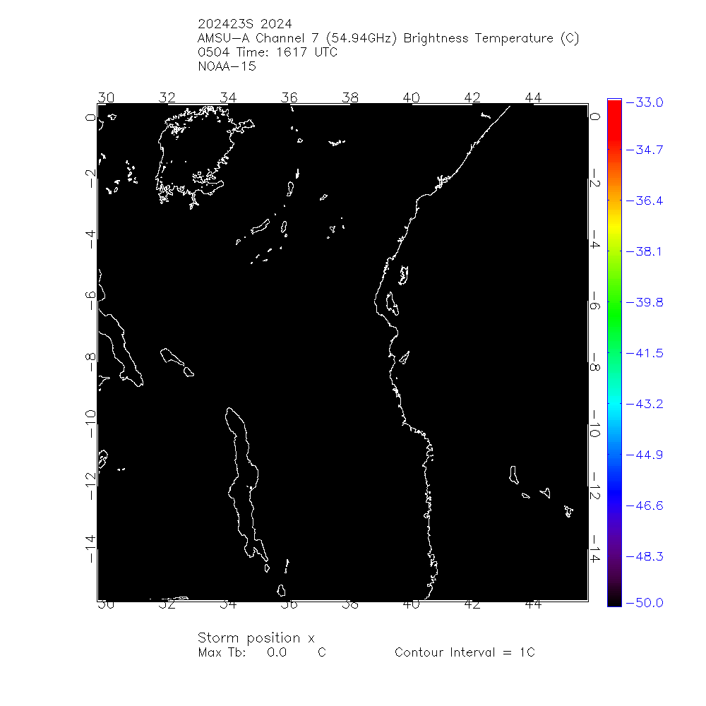
MW Sounders
|
| Date |
Time |
Vmax |
MSLP |
| 04May2024 |
1106UTC |
44 kts |
997 hPa |
|
|
|
|
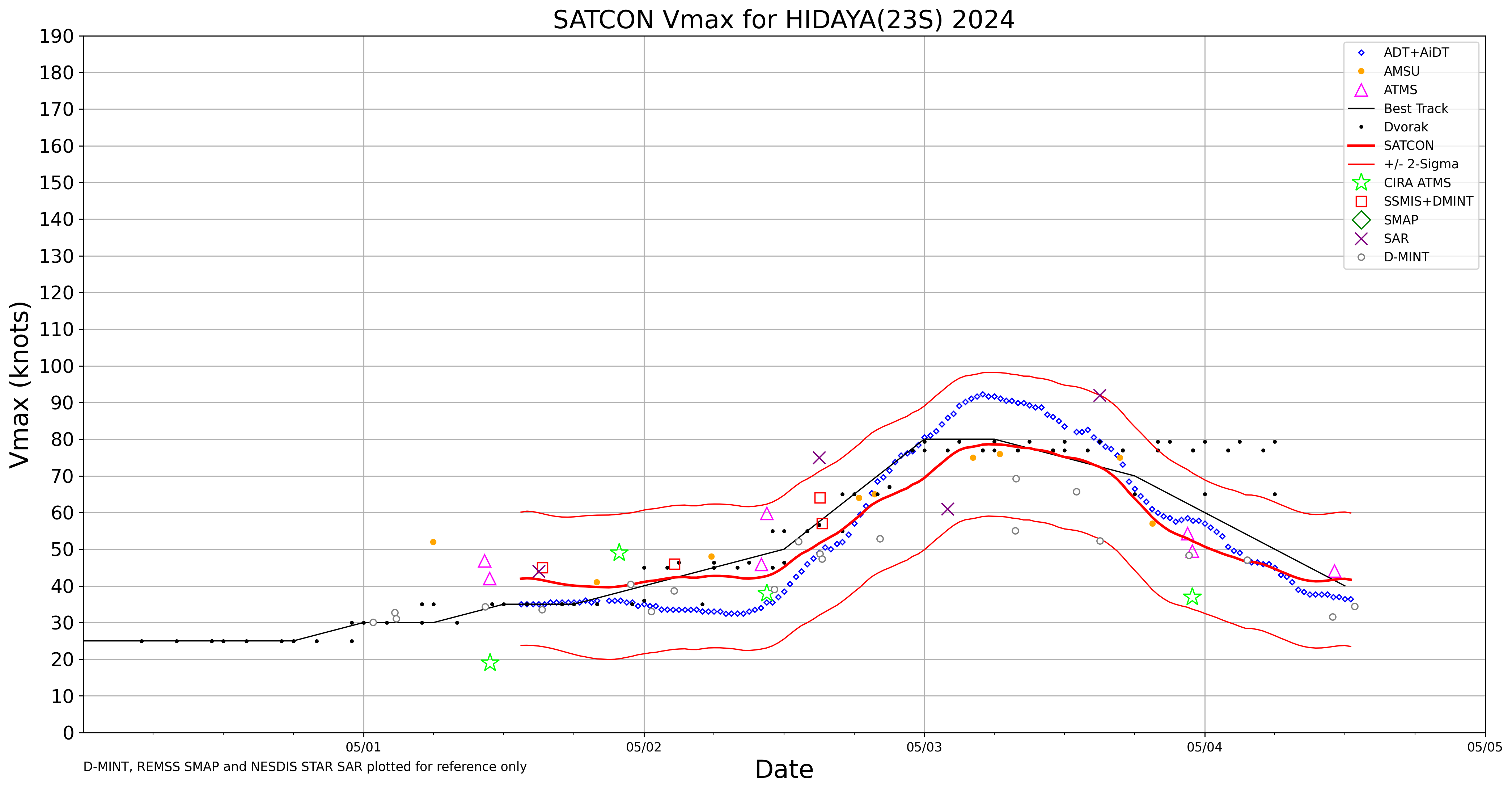
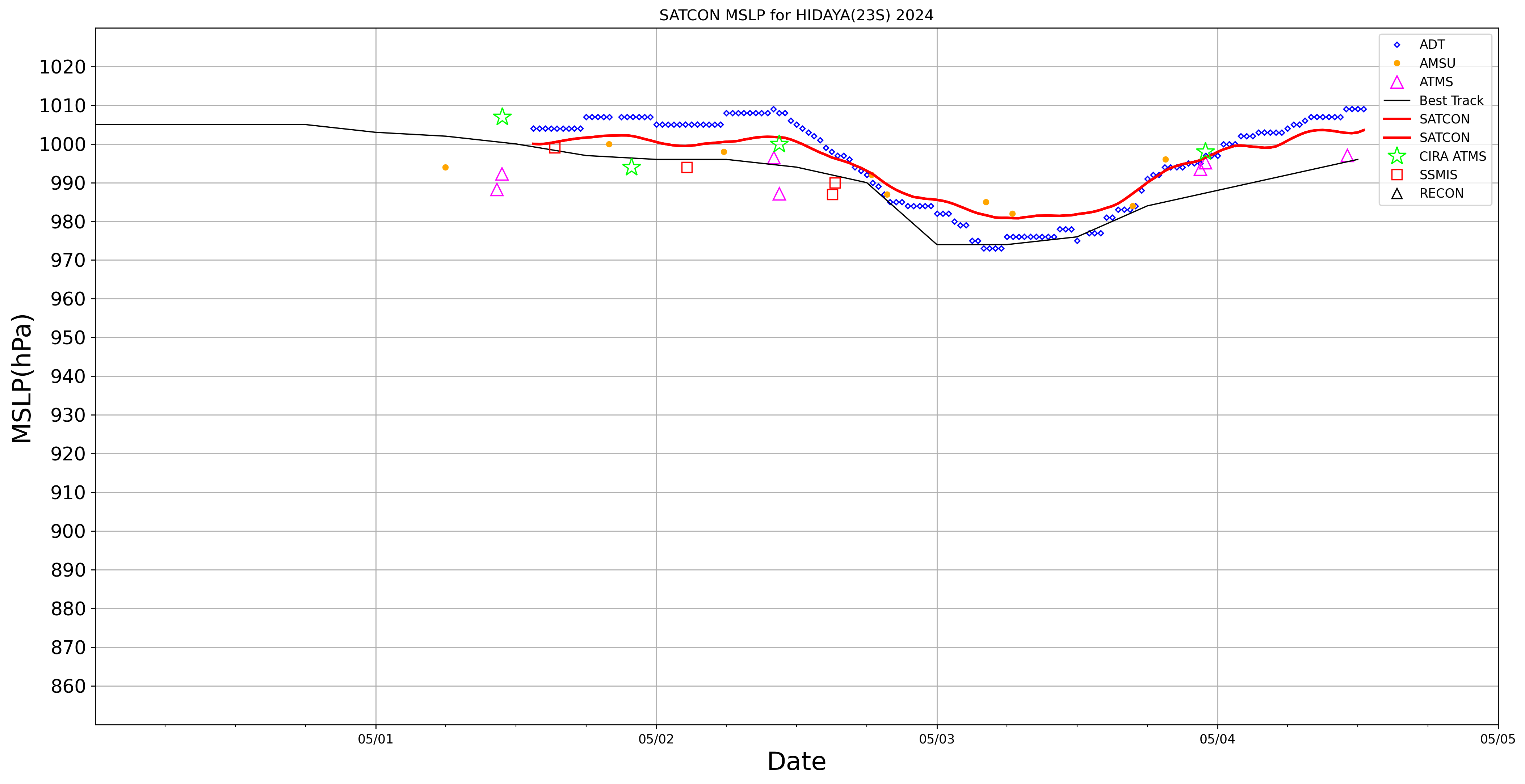
SATCON
|
| Date |
Time |
Vmax |
MSLP |
| 04May2024 |
1230UTC |
42 kts |
1003 hPa |
| Consensus Members |
| 2 (ADT+Sounders) |
|
|
|