|
Current Intensity Estimates
|
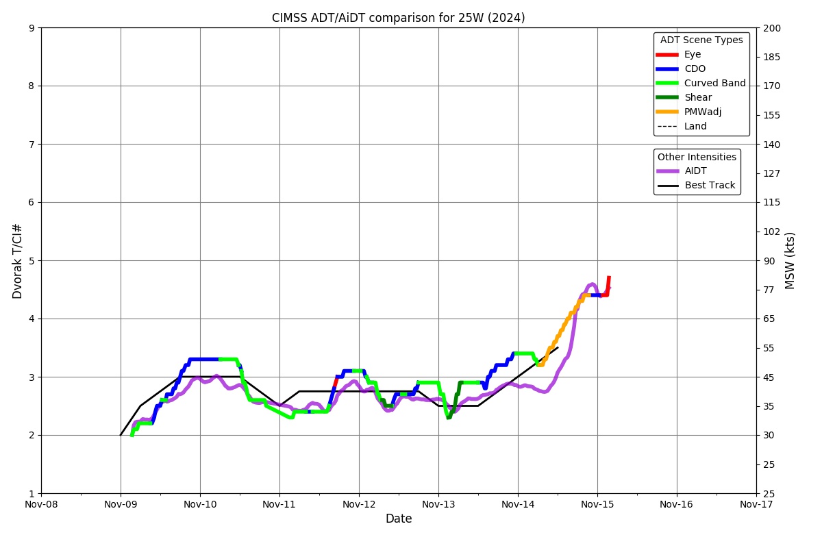
ADT
|
| Date |
Time |
Vmax |
MSLP |
| 20Nov2024 |
1100UTC |
25 kts |
1006 hPa |
| Scene |
CI# |
FT# |
AdjT# |
RawT# |
Eye T |
Cloud T |
| SHEAR |
1.5 |
1.5 |
1.5 |
1.5 |
13.28C |
9.92C |
|
|
|
|
AiDT
|
| Date |
Time |
Vmax |
|
| 20Nov2024 |
1100UTC |
26 kts |
|
|
|
|
|
DPRINT
|
| Date |
Time |
Vmax |
MSLP |
| 20Nov2024 |
1100UTC |
25 kts |
NaN hPa |
| Vmax 25% |
Vmax 75% |
|
|
| 23 kts |
27 kts |
|
|
|
|
|
|
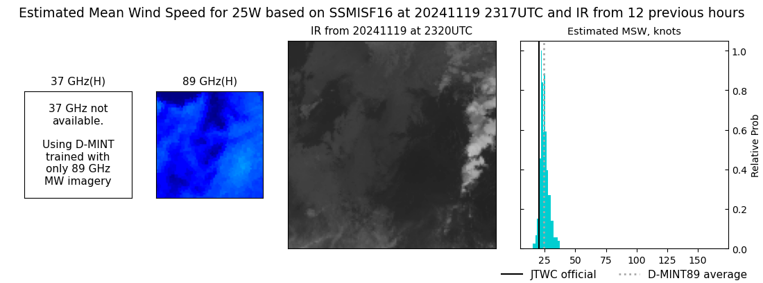
DMINT
|
| Date |
Time |
Vmax |
MSLP |
| 19Nov2024 |
2317UTC |
24 kts |
NaN hPa |
| Vmax 25% |
Vmax 75% |
MW Instr. |
|
| 22 kts |
27 kts |
SSMISF16 |
|
|
|
|
|
MW Sounders
|
| Date |
Time |
Vmax |
MSLP |
| 20Nov2024 |
0306UTC |
40 kts |
998 hPa |
|
|
|
|
SATCON
|
| Date |
Time |
Vmax |
MSLP |
| 20Nov2024 |
0530UTC |
34 kts |
1004 hPa |
| Consensus Members |
| 2 (ADT+Sounders) |
|
|
|