|
Current Intensity Estimates
|
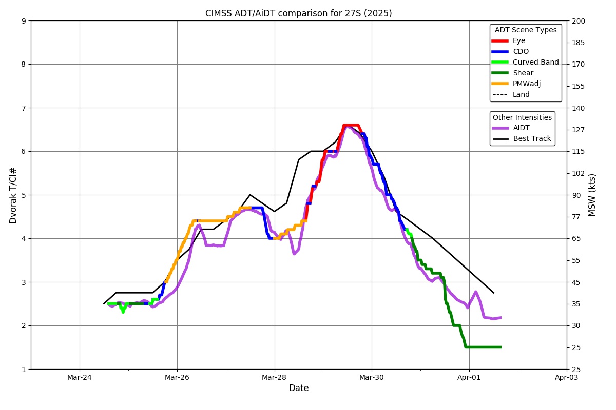
ADT
|
| Date |
Time |
Vmax |
MSLP |
| 30Mar2025 |
0445UTC |
102 kts |
955 hPa |
| Scene |
CI# |
FT# |
AdjT# |
RawT# |
Eye T |
Cloud T |
| UNIFRM |
5.5 |
4.9 |
4.8 |
4.5 |
-69.87C |
-65.69C |
|
|
|
|
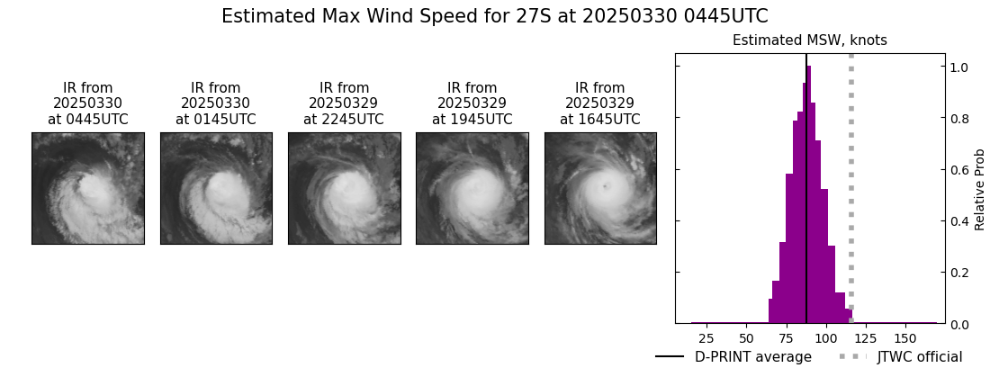
AiDT
|
| Date |
Time |
Vmax |
|
| 30Mar2025 |
0445UTC |
92 kts |
|
|
|
|
|
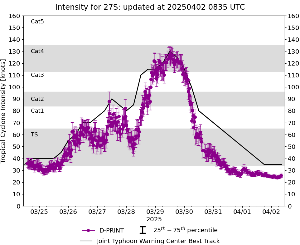
DPRINT
|
| Date |
Time |
Vmax |
MSLP |
| 30Mar2025 |
0445UTC |
88 kts |
963 hPa |
| Vmax 25% |
Vmax 75% |
|
|
| 81 kts |
95 kts |
|
|
|
|
|
|
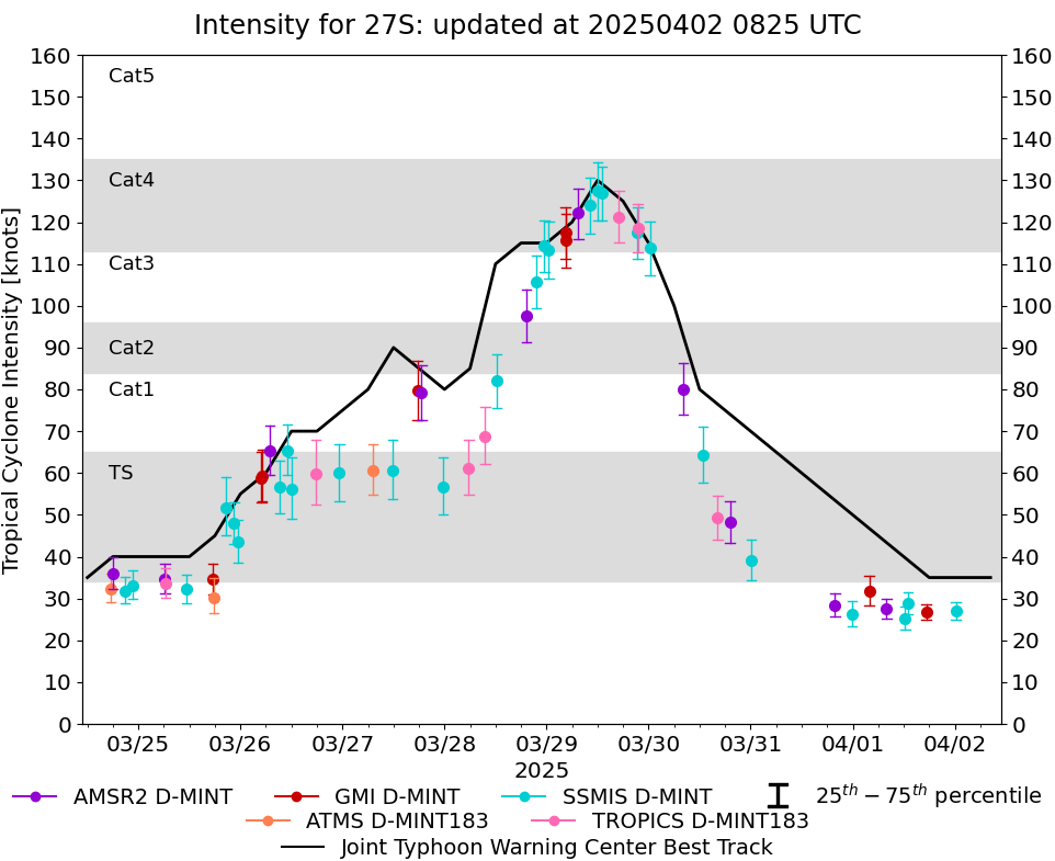
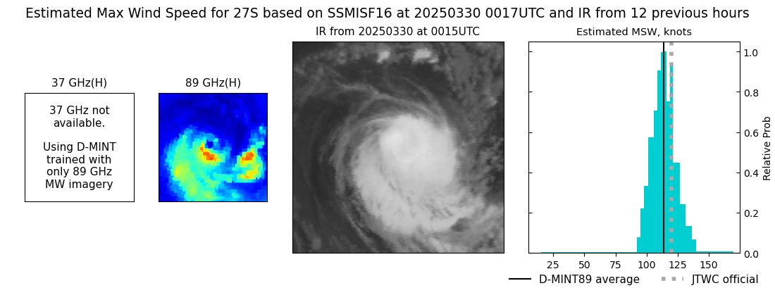
DMINT
|
| Date |
Time |
Vmax |
MSLP |
| 30Mar2025 |
0017UTC |
114 kts |
942 hPa |
| Vmax 25% |
Vmax 75% |
MW Instr. |
|
| 107 kts |
120 kts |
SSMISF16 |
|
|
|
|
|
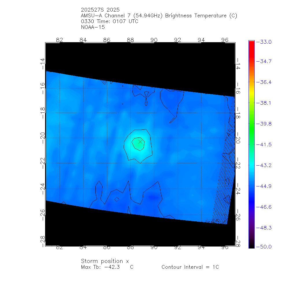
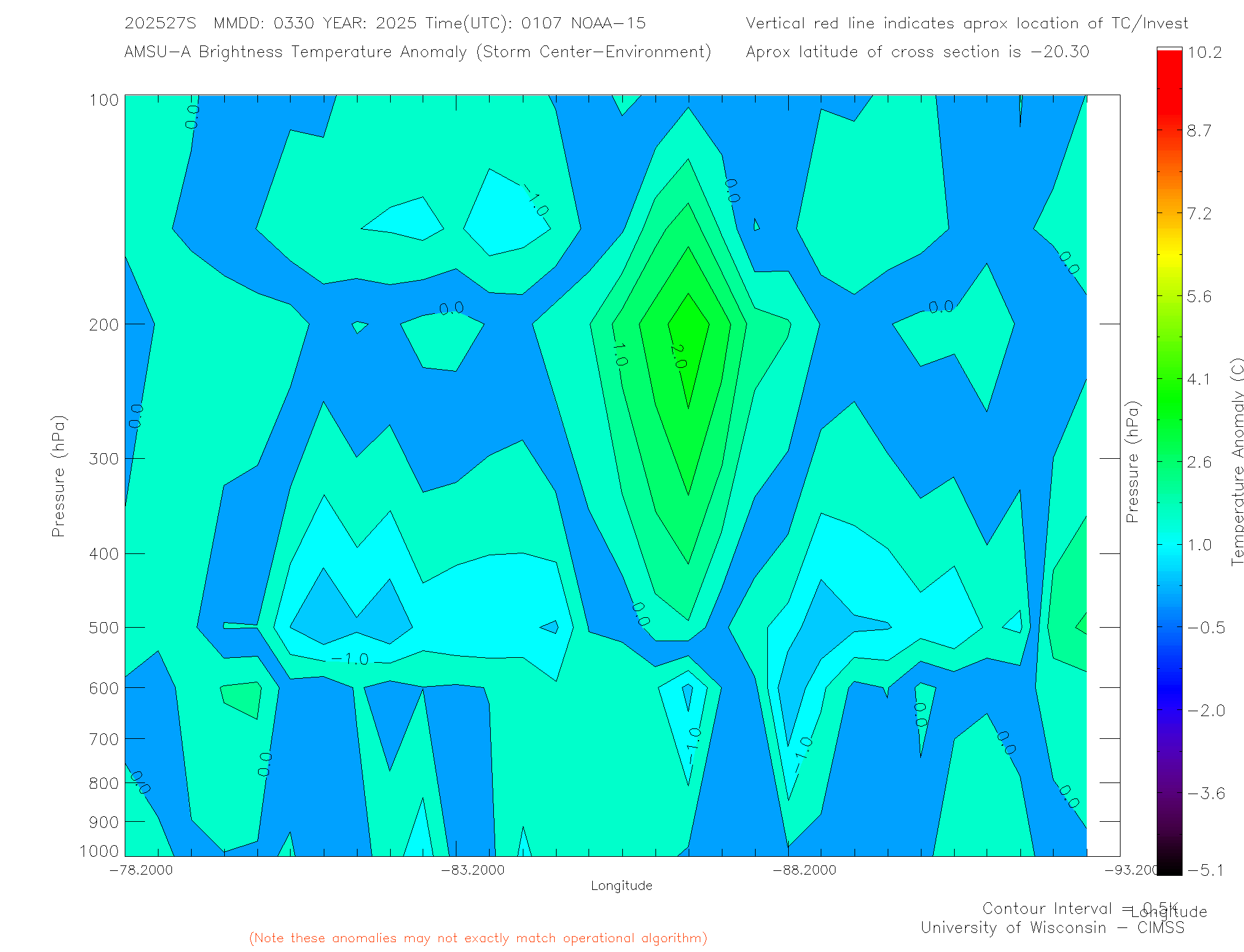
MW Sounders
|
| Date |
Time |
Vmax |
MSLP |
| 30Mar2025 |
0107UTC |
78 kts |
976 hPa |
|
|
|
|
SATCON
|
| Date |
Time |
Vmax |
MSLP |
| 30Mar2025 |
0345UTC |
92 kts |
959 hPa |
| Consensus Members |
| 3 (ADT+Sounders) |
|
|
|