|
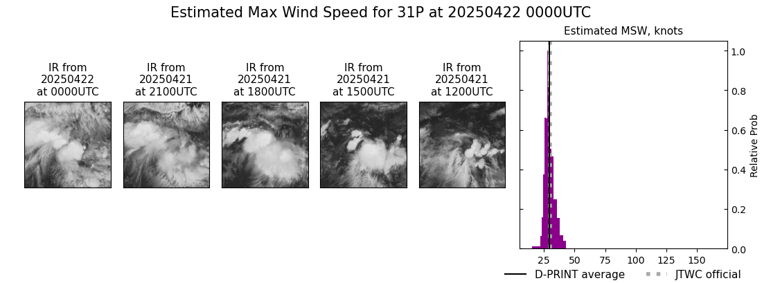
Current Intensity Estimates
|
ADT
|
| Date |
Time |
Vmax |
MSLP |
| 22Apr2025 |
0040UTC |
45 kts |
1002 hPa |
| Scene |
CI# |
FT# |
AdjT# |
RawT# |
Eye T |
Cloud T |
| CRVBND |
3.0 |
2.3 |
2.7 |
2.7 |
-53.51C |
-62.48C |
|
|
|
|
AiDT
|
| Date |
Time |
Vmax |
|
| 22Apr2025 |
0040UTC |
36 kts |
|
|
|
|
|
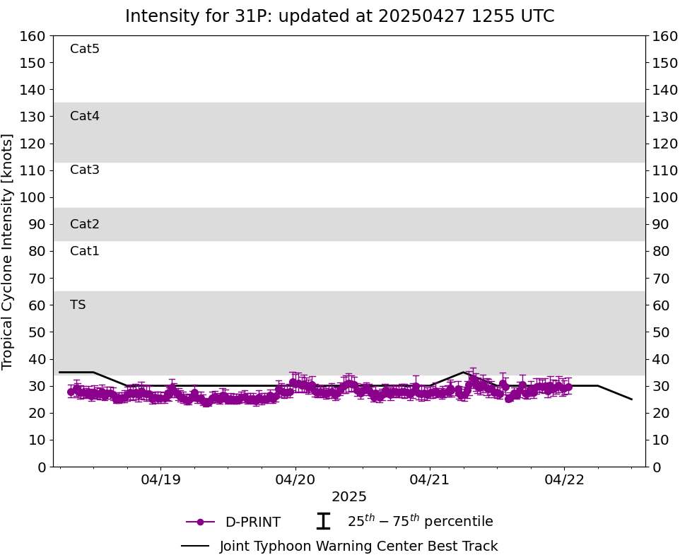
DPRINT
|
| Date |
Time |
Vmax |
MSLP |
| 22Apr2025 |
0000UTC |
29 kts |
1006 hPa |
| Vmax 25% |
Vmax 75% |
|
|
| 27 kts |
32 kts |
|
|
|
|
|
|
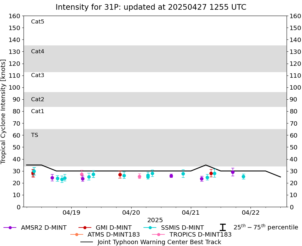
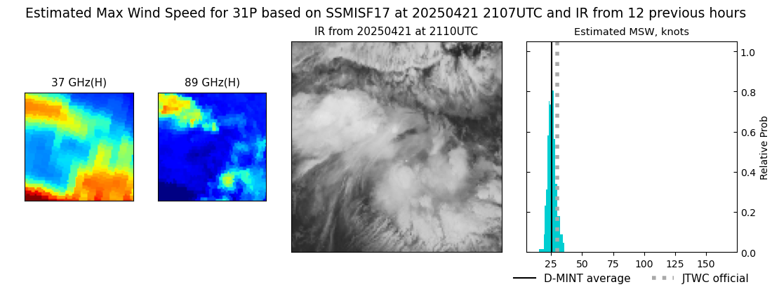
DMINT
|
| Date |
Time |
Vmax |
MSLP |
| 21Apr2025 |
2107UTC |
25 kts |
1003 hPa |
| Vmax 25% |
Vmax 75% |
MW Instr. |
|
| 23 kts |
28 kts |
SSMISF17 |
|
|
|
|
|
MW Sounders
|
| Date |
Time |
Vmax |
MSLP |
| 21Apr2025 |
1553UTC |
38 kts |
1006 hPa |
|
|
|
|
SATCON
|
| Date |
Time |
Vmax |
MSLP |
| 21Apr2025 |
1800UTC |
38 kts |
1006 hPa |
| Consensus Members |
| 2 (ADT+Sounders) |
|
|
|