|
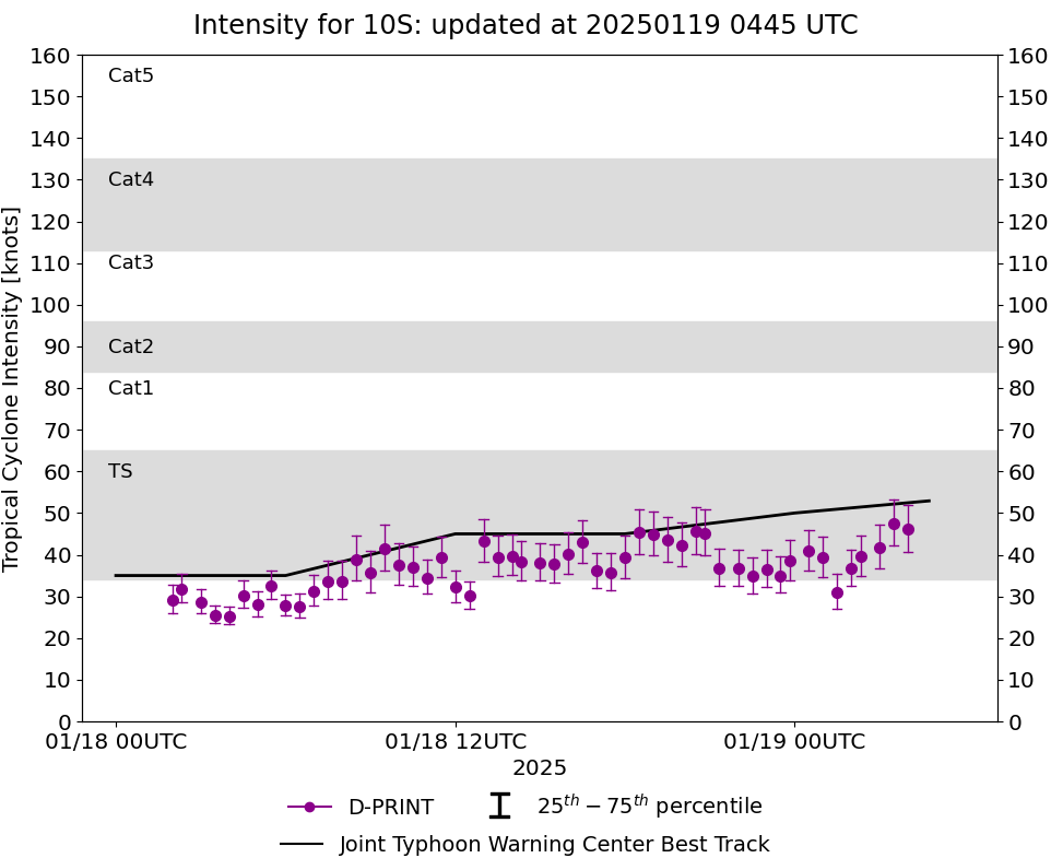
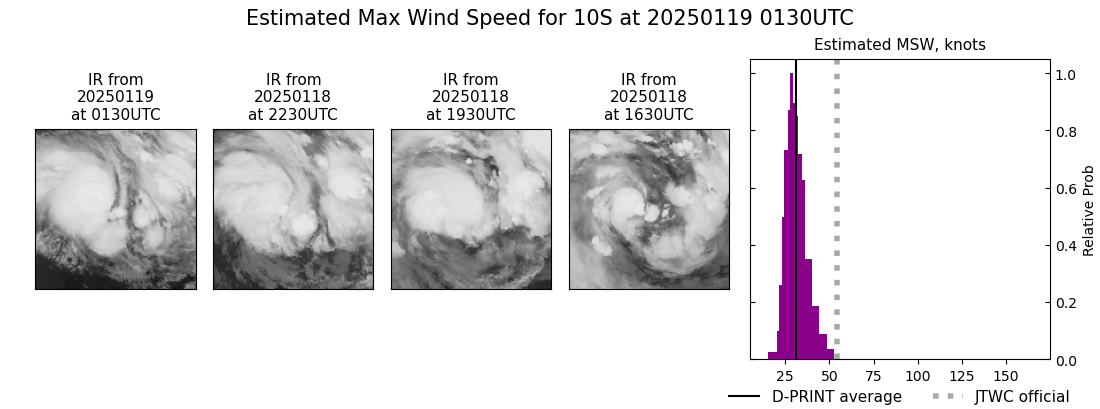
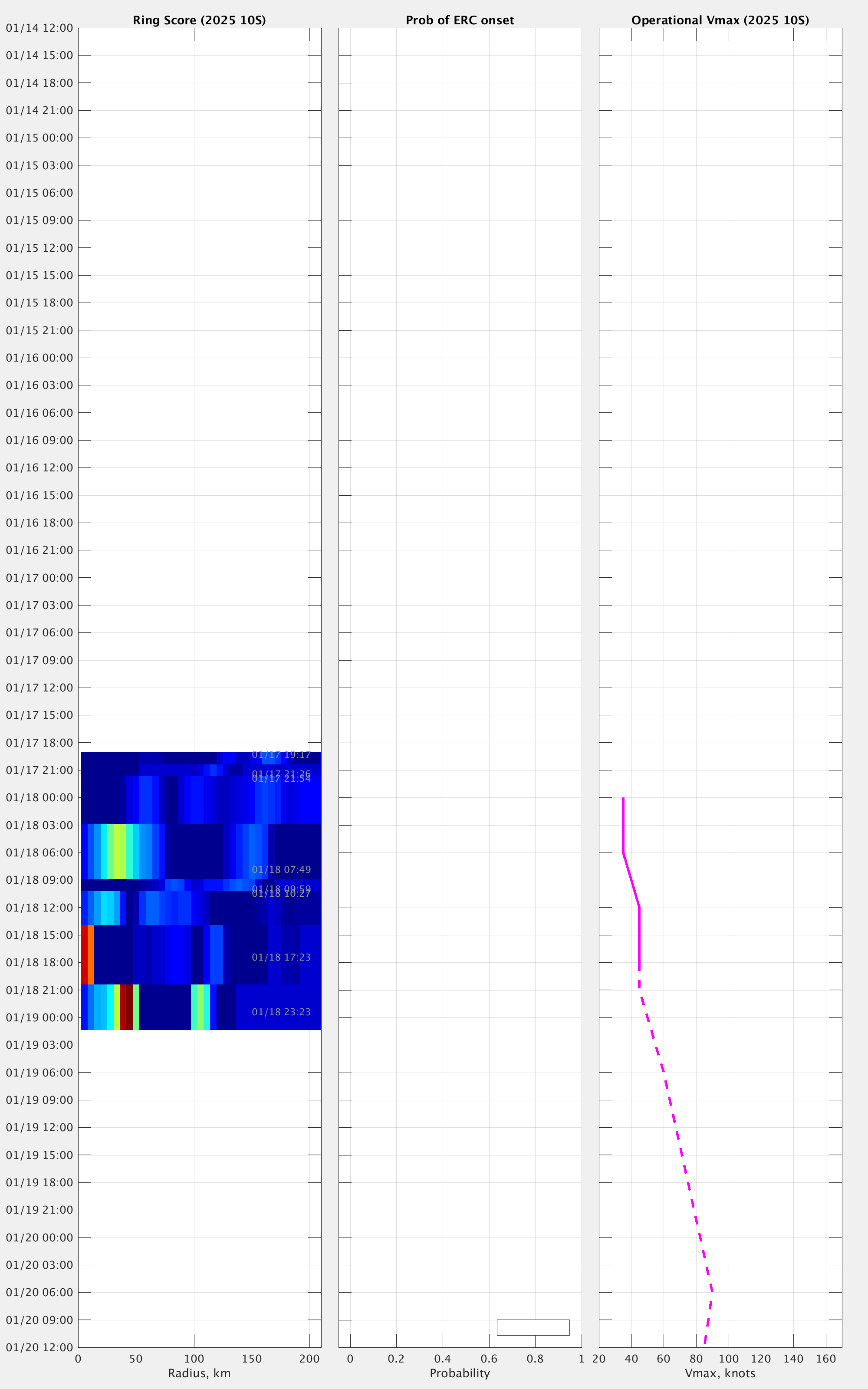
Current Intensity Estimates
|
ADT
|
| Date |
Time |
Vmax |
MSLP |
| 19Jan2025 |
0130UTC |
43 kts |
995 hPa |
| Scene |
CI# |
FT# |
AdjT# |
RawT# |
Eye T |
Cloud T |
| CRVBND |
2.9 |
2.9 |
3.4 |
3.4 |
-16.63C |
-68.31C |
|
|
|
|
AiDT
|
| Date |
Time |
Vmax |
|
| 19Jan2025 |
0130UTC |
38 kts |
|
|
|
|
|
DPRINT
|
| Date |
Time |
Vmax |
MSLP |
| 19Jan2025 |
0130UTC |
31 kts |
995 hPa |
| Vmax 25% |
Vmax 75% |
|
|
| 27 kts |
35 kts |
|
|
|
|
|
|
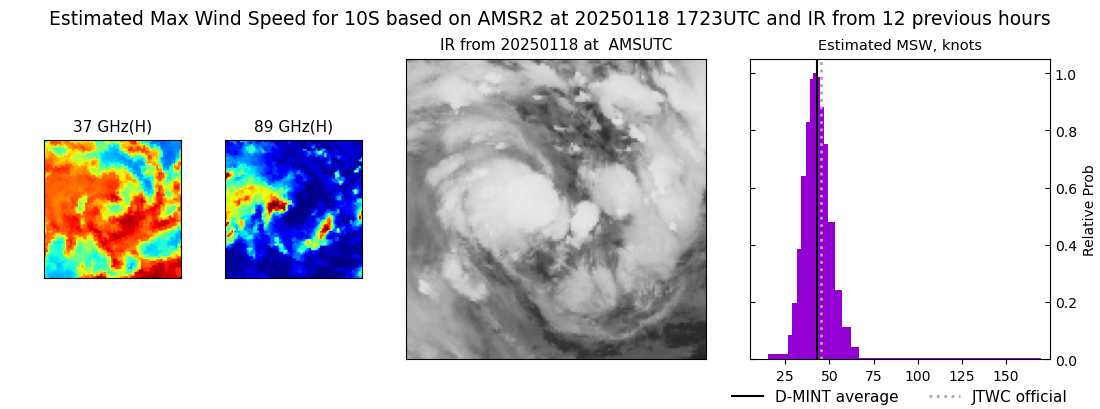
DMINT
|
| Date |
Time |
Vmax |
MSLP |
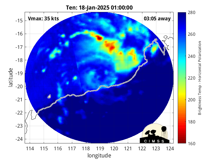
| 18Jan2025 |
1723UTC |
43 kts |
990 hPa |
| Vmax 25% |
Vmax 75% |
MW Instr. |
|
| 38 kts |
48 kts |
AMSR2 |
|
|
|
|
|
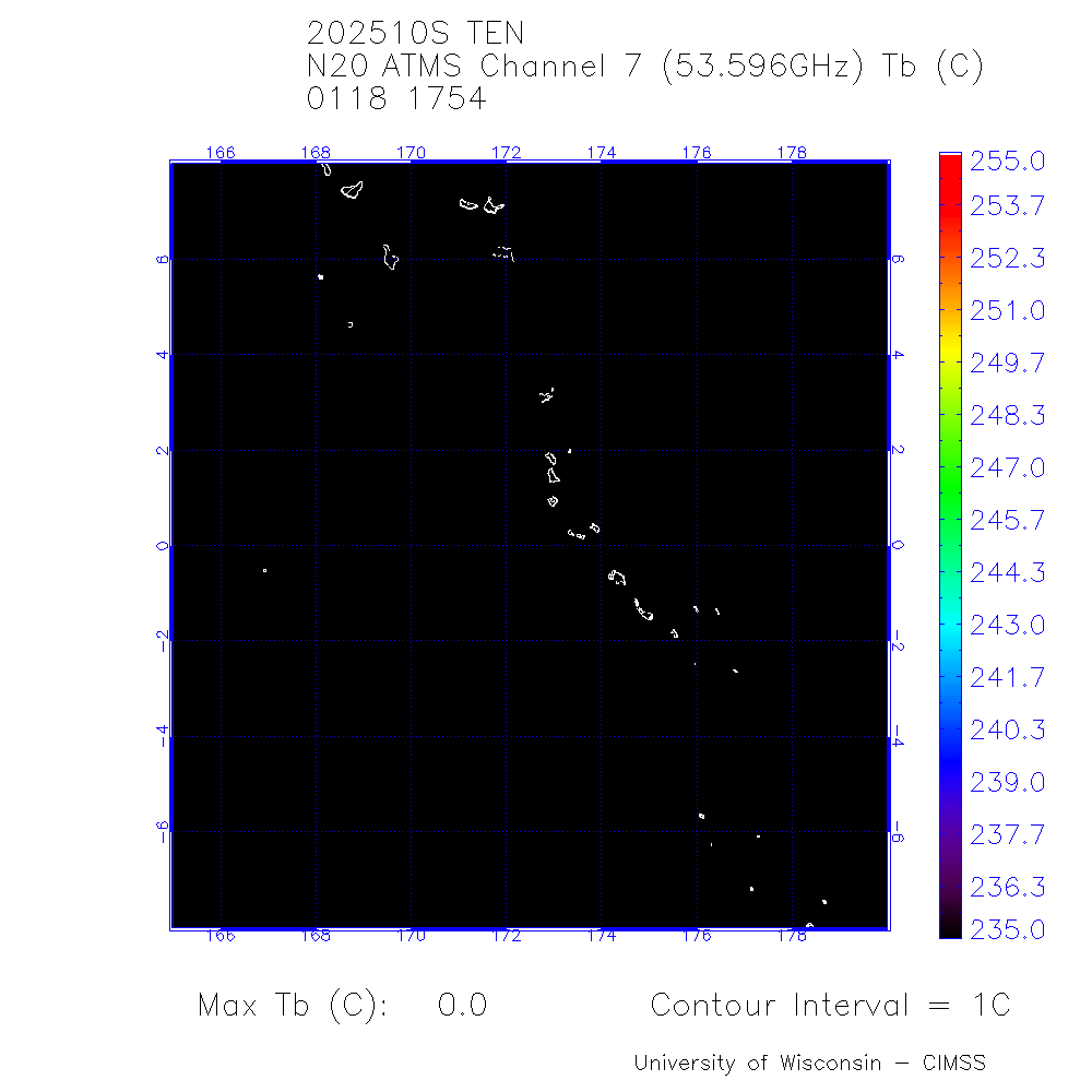
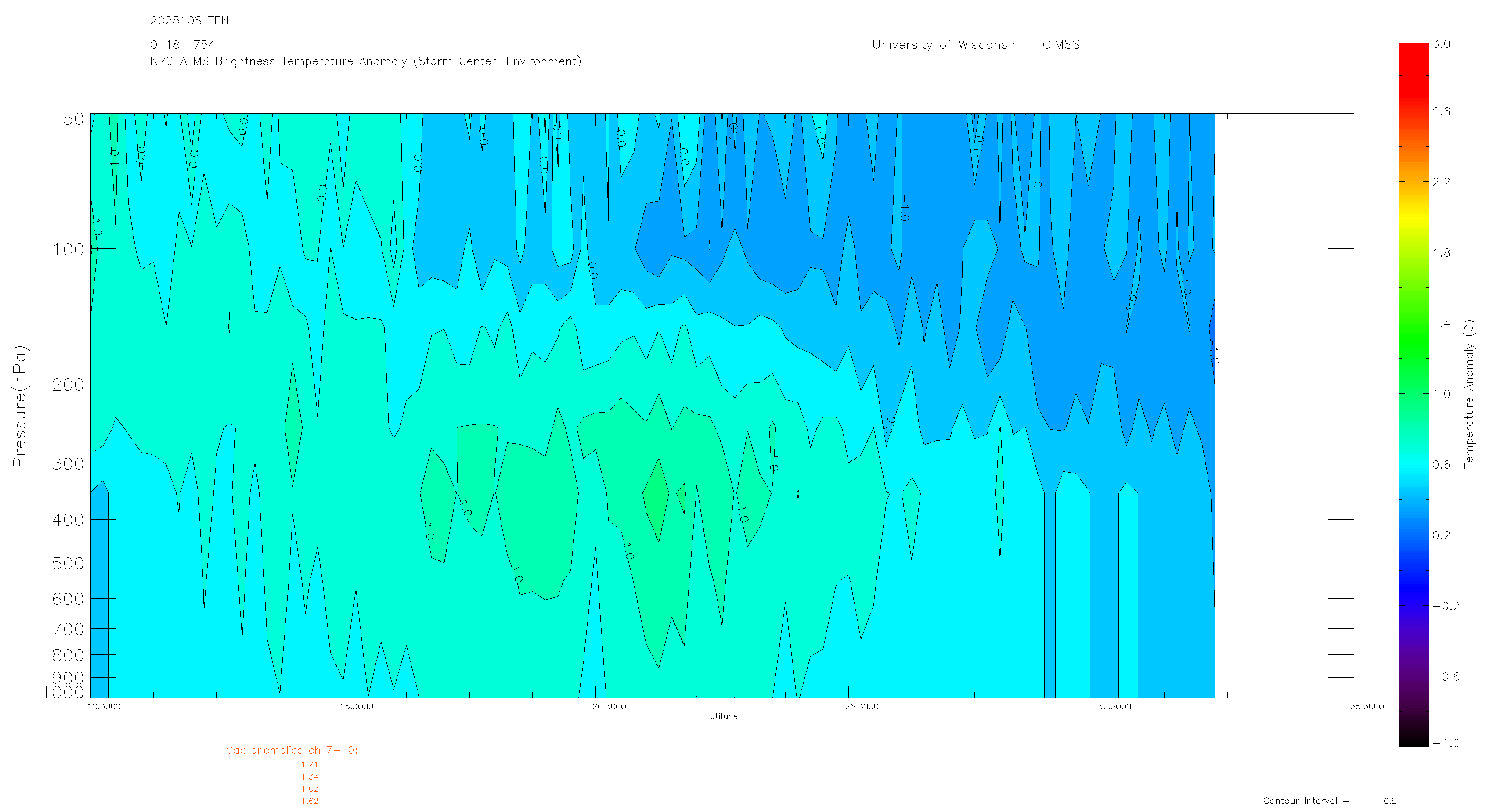
MW Sounders
|
| Date |
Time |
Vmax |
MSLP |
| 18Jan2025 |
1754UTC |
40 kts |
982 hPa |
|
|
|
|
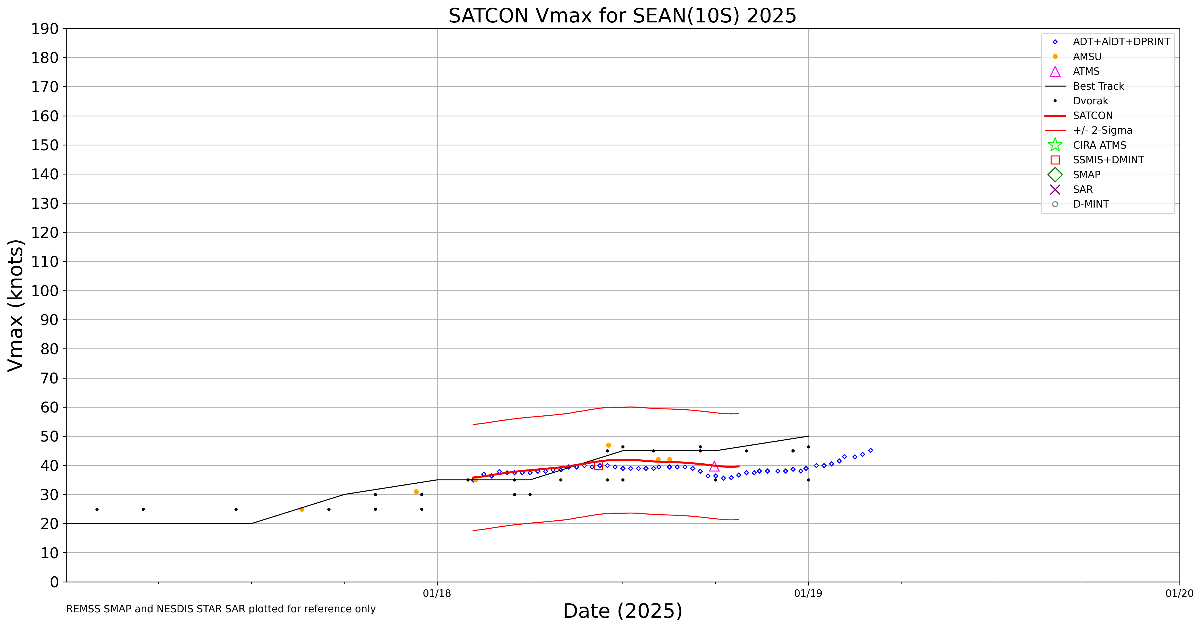
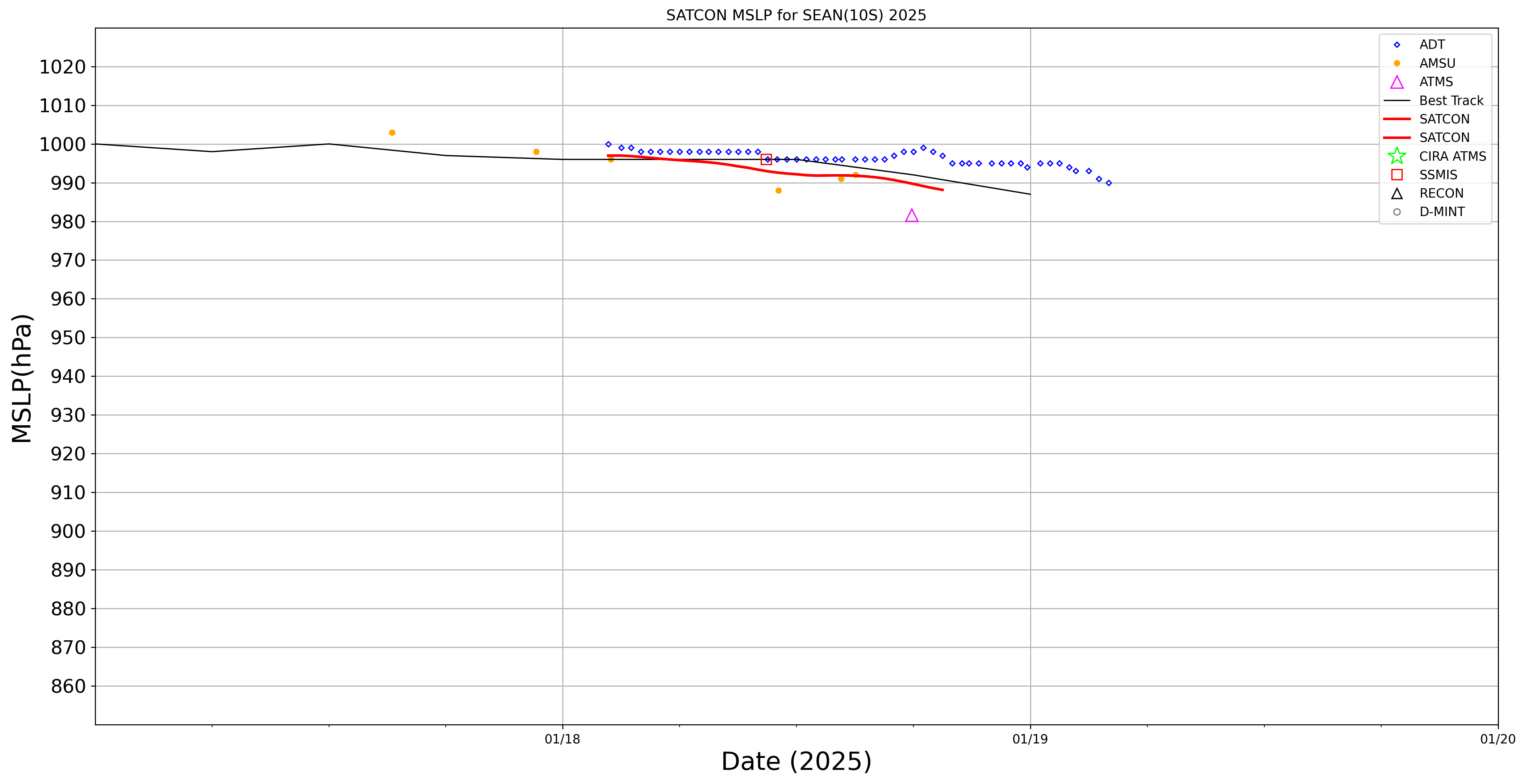
SATCON
|
| Date |
Time |
Vmax |
MSLP |
| 18Jan2025 |
1930UTC |
40 kts |
988 hPa |
| Consensus Members |
| 2 (ADT+Sounders) |
|
|
|