|
Current Intensity Estimates
|
ADT
|
| Date |
Time |
Vmax |
MSLP |
| 21Jan2026 |
1030UTC |
35 kts |
994 hPa |
| Scene |
CI# |
FT# |
AdjT# |
RawT# |
Eye T |
Cloud T |
| CRVBND |
2.5 |
2.3 |
2.2 |
2.2 |
-26.91C |
-36.09C |
|
|
|
|
AiDT
|
| Date |
Time |
Vmax |
|
| 21Jan2026 |
1030UTC |
40 kts |
|
|
|
|
|
DPRINT
|
| Date |
Time |
Vmax |
MSLP |
| 21Jan2026 |
1100UTC |
28 kts |
994 hPa |
| Vmax 25% |
Vmax 75% |
|
|
| 25 kts |
32 kts |
|
|
|
|
|
|
DMINT
|
| Date |
Time |
Vmax |
MSLP |
| 21Jan2026 |
1006UTC |
35 kts |
993 hPa |
| Vmax 25% |
Vmax 75% |
MW Instr. |
|
| 30 kts |
41 kts |
ATMS-N21 |
|
|
|
| Date |
Time |
Vmax |
MSLP |
| 21Jan2026 |
0942UTC |
37 kts |
988 hPa |
| Vmax 25% |
Vmax 75% |
MW Instr. |
|
| 33 kts |
41 kts |
AMSR2 |
|
|
|
|
|
|
MW Sounders
|
| Date |
Time |
Vmax |
MSLP |
| 21Jan2026 |
1006UTC |
52 kts |
987 hPa |
|
|
|
|
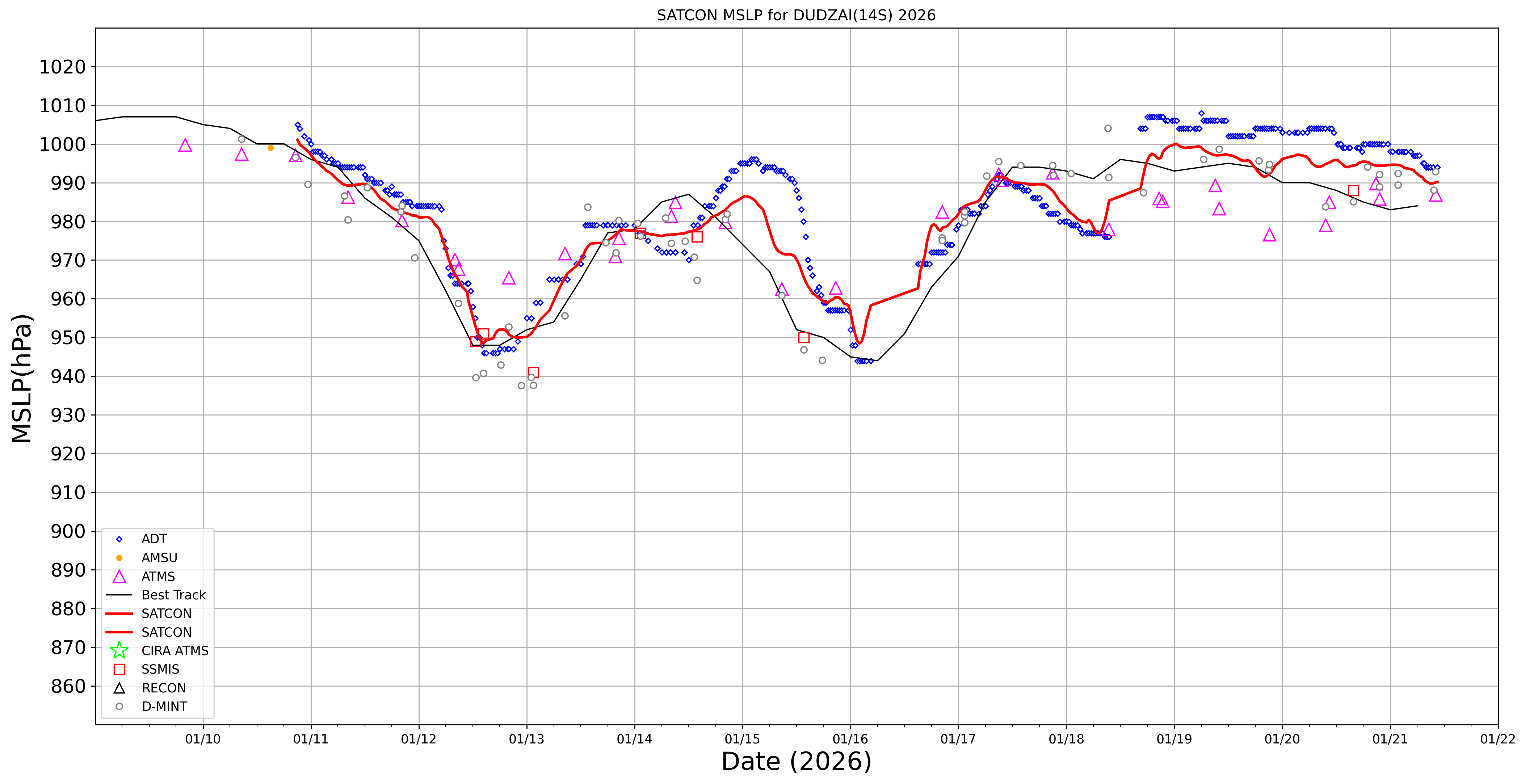
SATCON
|
| Date |
Time |
Vmax |
MSLP |
| 21Jan2026 |
1030UTC |
46 kts |
990 hPa |
| Consensus Members |
| 2 (ADT+Sounders) |
|
|
|